
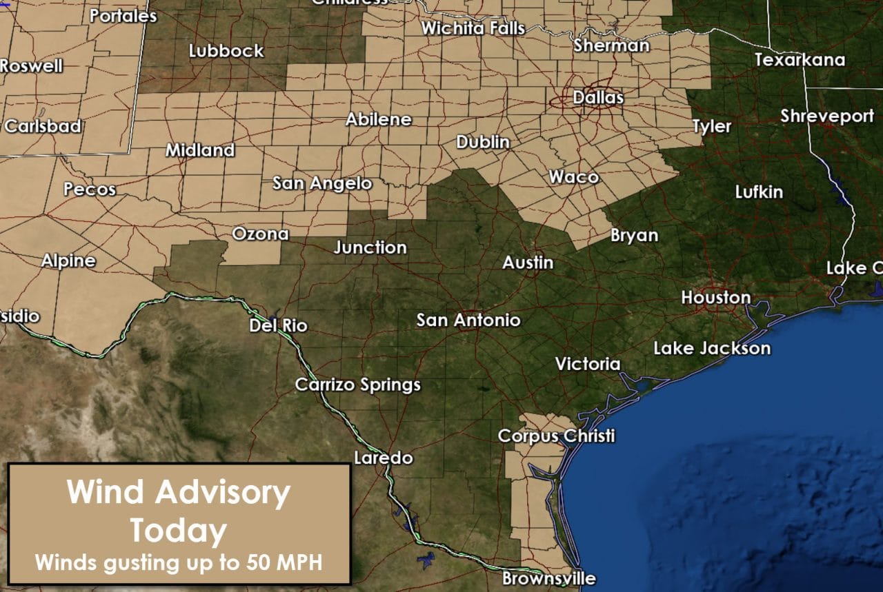
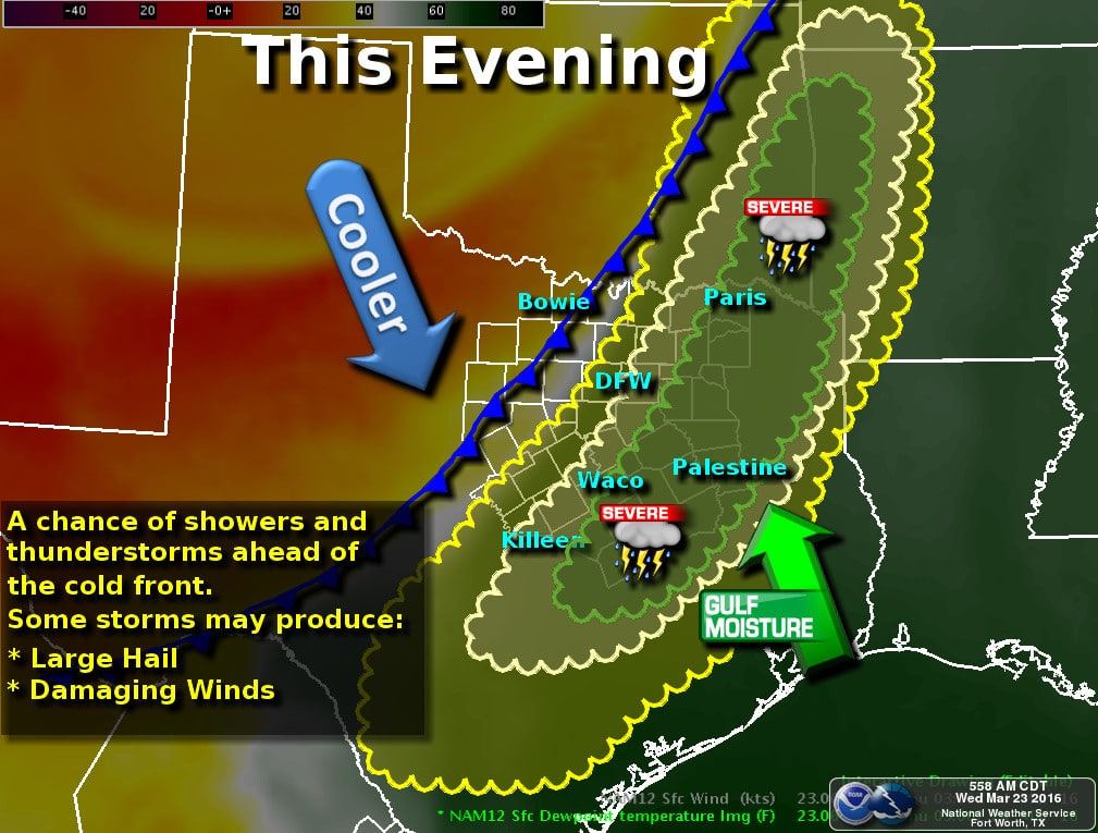
A classic early spring storm system will bring high-impact weather to Texas today and tonight. The most pressing concern is the possibility of a wildfire outbreak along and west of Highway 281 this afternoon and tonight. A dryline will surge east to near I-35 by late afternoon. Conditions west of the dryline will consist of southwest/west winds near 40-50 MPH. Relative humidity values will drop to between 3 and 20 percent. The weather pattern is similiar to past events that have produced large/significant wildfire events in our state. Red Flag Warnings, High Wind Warnings, and Wind Advisories are in effect today. Winds east of the dryline will be out of the south with gusts up to 45 MPH. Winds west of the dryline will be out of the southwest/west up to 55-60 MPH. A cold front will move south today and tonight. Winds behind the cold front will become northwesterly with gusts up to 50+ MPH. That wind shift will be hazardous for firefighters working any fires this afternoon and evening. Red Flag Conditions could continue well into the evening hours.
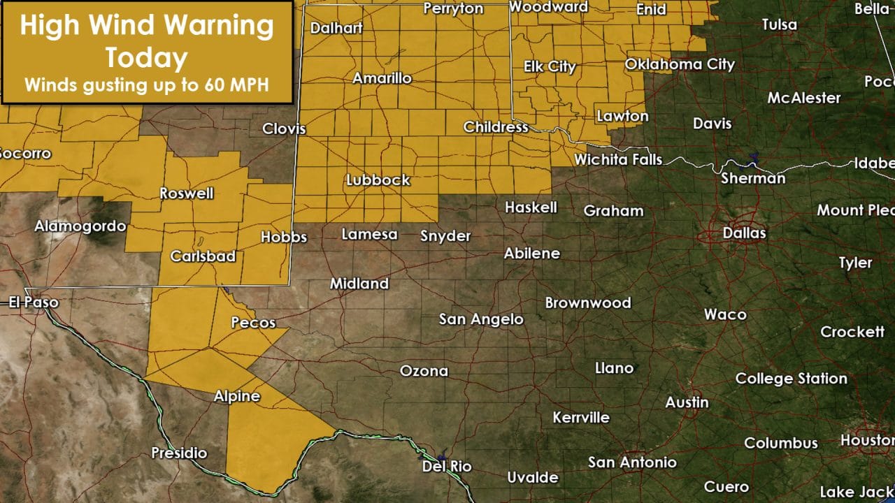
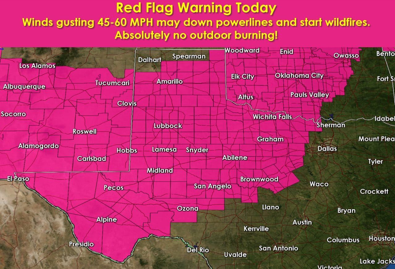
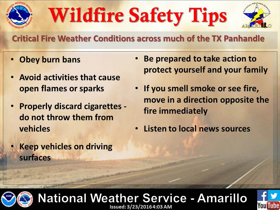
We understand that there have been many fire-danger days this winter. That’s all a part of living in Texas. However today’s danger is extreme and significantly higher than many other ‘critical’ days this winter. Understand that today’s weather pattern has historically produced major wildfire outbreaks in parts of the state in the past. The strong winds could down power lines and cause wildfires – thus increasing the possibility of problems. A wildfire in northwest Oklahoma that started up around 7 PM last night has burned 30 miles north and is now in Kansas. We could see fires like that today. Some fires that develop will not be containable until weather conditions settle down late tonight. That means if a fire develops you need to be ready to evacuate in a hurry. I would not be surprised if we had a few fires burn 5-10 miles today. Firefighters will not be able to initiate a direct attack on the fire’s head since spotting and crowning will be likely. If you see smoke/fire heading your way be ready to evacuate quickly. The strong winds will also create blowing dust across the Texas Panhandle, South Plains, Rolling Plains, Permian Basin, and Far West Texas. Travel will be difficult due to the strong winds. Critical to extremely critical fire conditions will continue well into the evening hours.
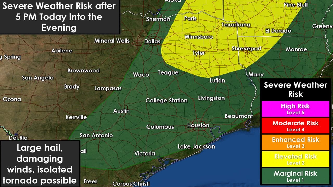
South winds ahead (east) of the dryline will gust up to 45 MPH today. In fact there are several wind gusts already near 40 MPH this morning. Those strong winds will continue into the evening hours. A strong cap is expected to prevent thunderstorm development for much of the afternoon. As upper level forcing increases this evening its possible that line of thunderstorms will develop just east of I-35 from the Red River Valley south into Northeast Texas. Those storms – should they develop – could produce large hail and damaging wind gusts. A brief tornado is possible, but the overall tornado threat will be very low. The likelihood of thunderstorms decreases with southward extend due to a stronger cap. We’ll be watching things closely and will post updates as needed. I do believe the fire/wind problems will be the most dangerous today – but obviously storm chances will need to be watched as well.


0 Comments