
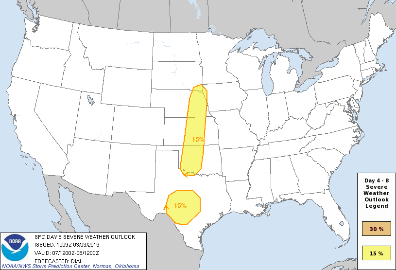
The forecast for the state as a whole is expected to remain dry through Saturday. On Sunday, we’ll see the approach of back to back upper level systems which will bring rain and thunderstorm chances back to parts of the state through at least the middle of next week. While this is still a ways out, forecast confidence is beginning to increase with a chance of seeing significant rainfall amounts primarily east of the I-35 corridor and the possibility of several rounds of strong to severe storms Sunday through Monday and again Tuesday through Thursday. Here are the two culprits. The first upper level disturbance is currently forecasted to move across the region beginning Sunday sparking a chance for showers out ahead of it. As better lift arrives early Monday, chances for rain and possibly a few storms will be on the increase across parts of western Oklahoma and southwest Texas. The Storm Prediction center has already placed a Day 5 Outlook for Monday across these regions. Moisture return is still questionable early on, and atmospheric capping may keep a lid on more robust storm development Sunday, less so on Monday. Still too early to get specific about severe weather threats, but we’ll have much better data over the weekend as this system arrives on the west coast and is sampled by the weather balloon network. 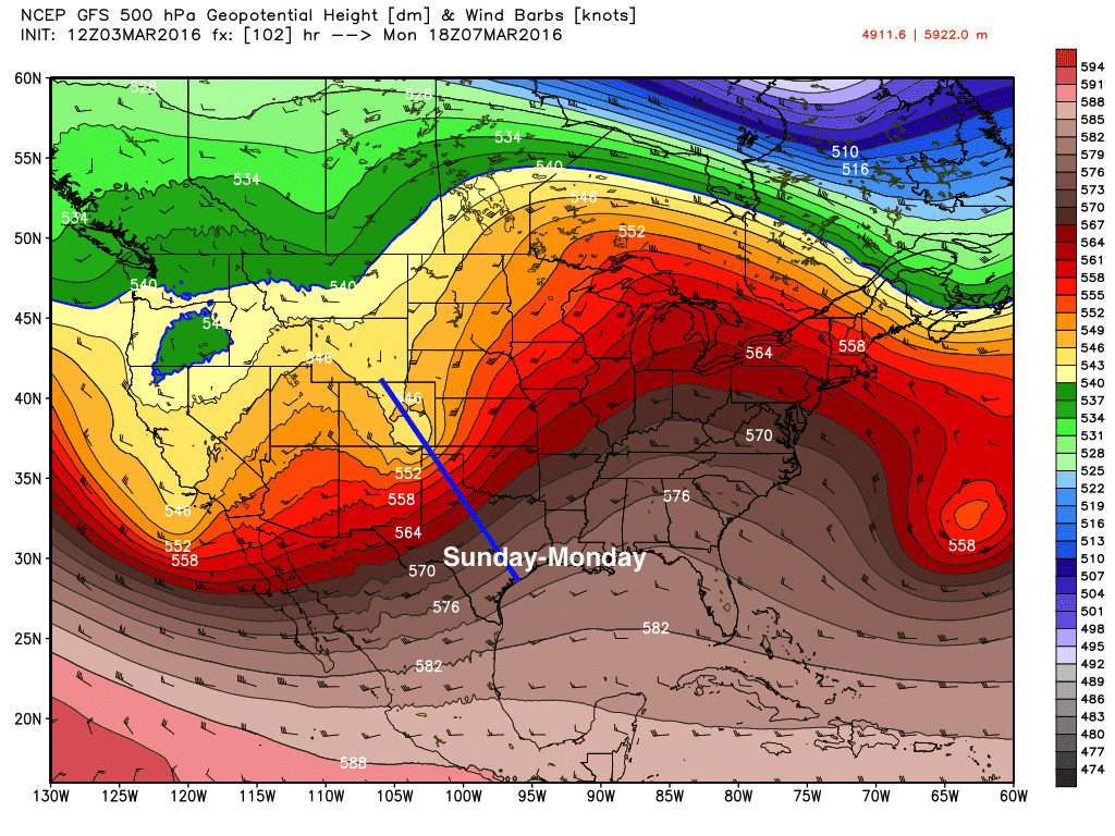
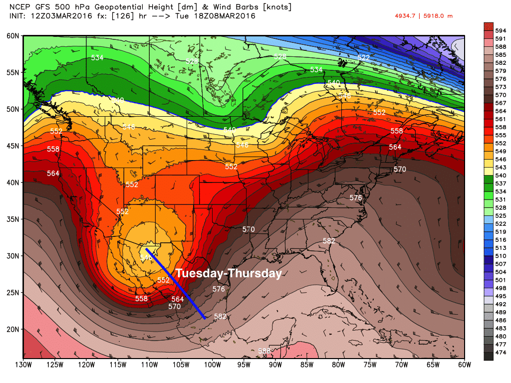
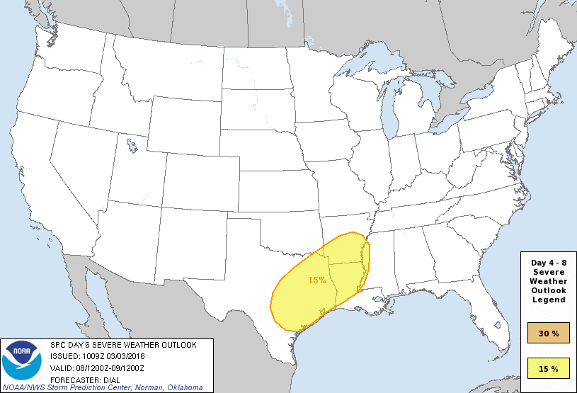
As we get into Tuesday, a stronger and deeper upper level system arrives dropping down across the desert southwest and into northern Mexico. This will likely get cut off from the main jetstream flow across the central US, which is problematic for forecasting as the models have difficulty with the track and speed of these types of systems. At any rate, the forecast confidence for periods of heavy rain and possible flooding along with the threat for some strong to severe storms is increasing That’s something we haven’t talked about in a long time. The Storm Prediction Center has issued a Day 6 Outlook for Tuesday which currently encompasses the entirety of east and southeast Texas and parts of central Texas and the central coastal region. Again, we must stress that this is still a ways off and could change, but it’s something that we will be monitoring over the next several days, so be sure to check back for additional updates.
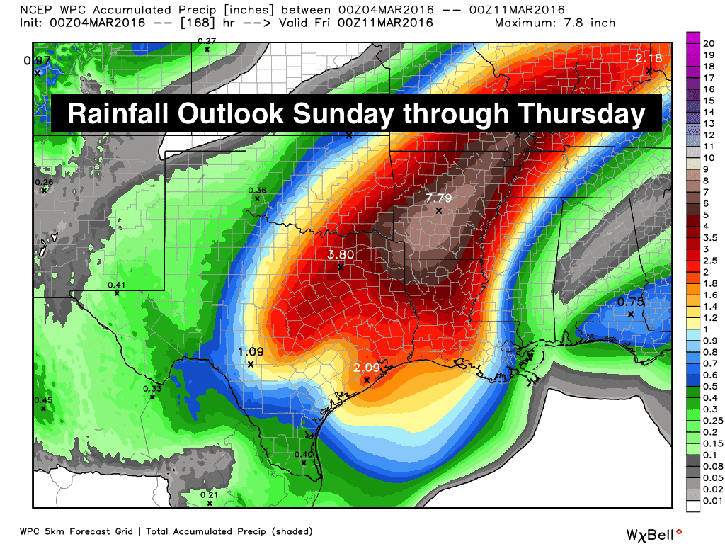
Here’s the current rainfall forecast for the period beginning Sunday and taking us through next Thursday.


0 Comments