
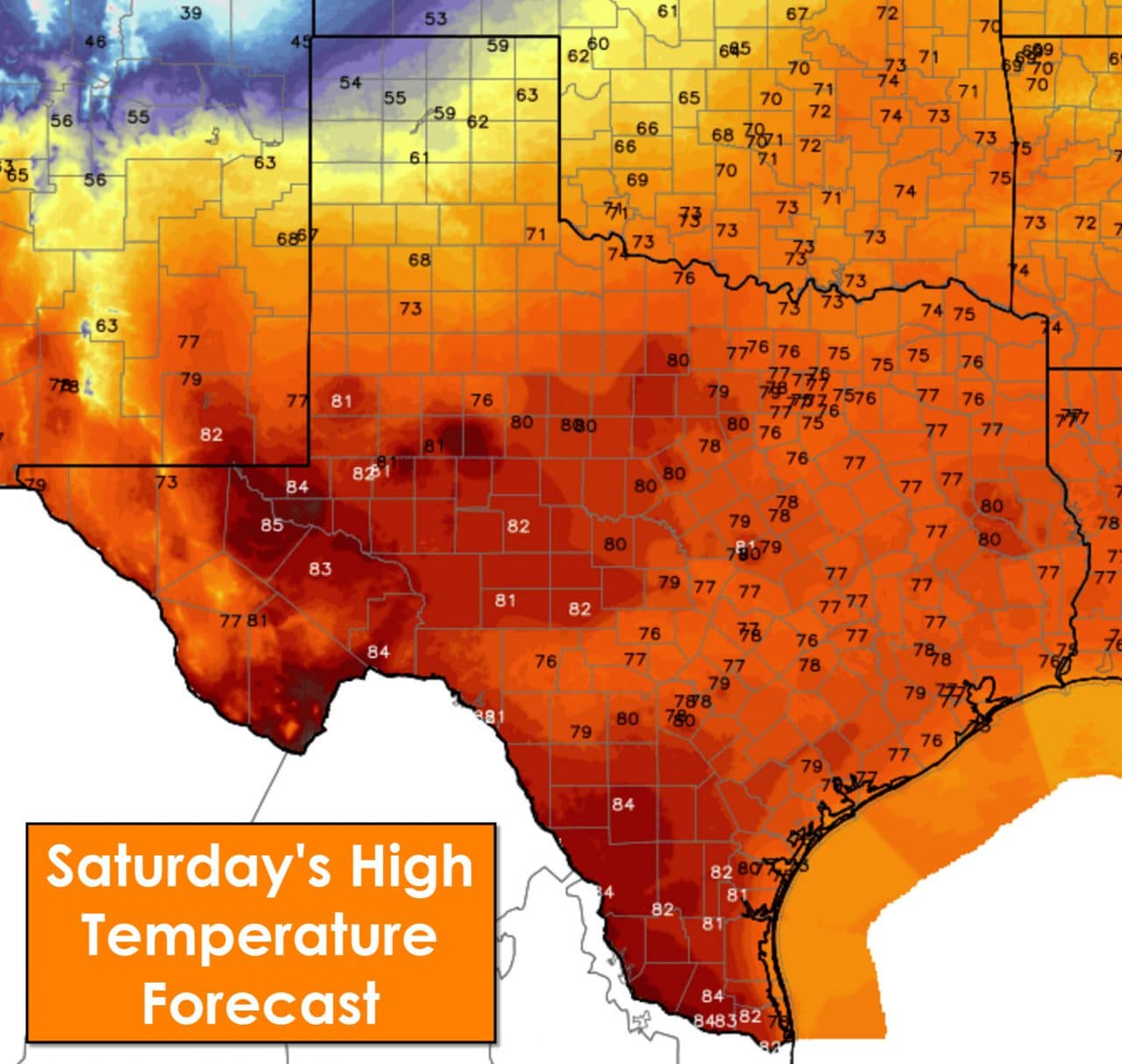
The primary forecast focus will be an approaching cold front tonight and on Sunday. Until that front arrives temperatures will be above average. High temperatures for this afternoon will be in the 70s to lower 80s outside of the Panhandle. Cold air advection in the Panhandle with the cold front will cause a stark temperature difference. Amarillo should top out around 60 degrees today before the cold front comes sweeping down the plains. Texline and Dalhart won’t get out of the 40s to lower 50s today. Once the front rolls through temperatures will start dropping off. The front should be pushing through the South/Rolling Plains by late afternoon. It will not have an impact other regions until tonight or later on Sunday.
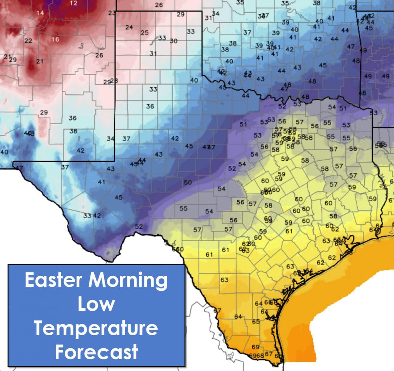
Temperatures tonight will range from the lower 20s around Texline and Salhart to the middle 30s in Lubbock and Shamrock. Temperatures will fall into the 40s by Sunday morning in the Permian Basin, Big Country, into Northwest Texas. Temperatures east/south of the cold front will not get below 55-60 degrees tonight. Widespread cloud cover will be in place along with fog. It’ll be a dreary Easter morning until the cold front passes a given location. Patchy showers are also possible. Once the cold front moves through the fog will lift with mostly cloudy skies remaining.
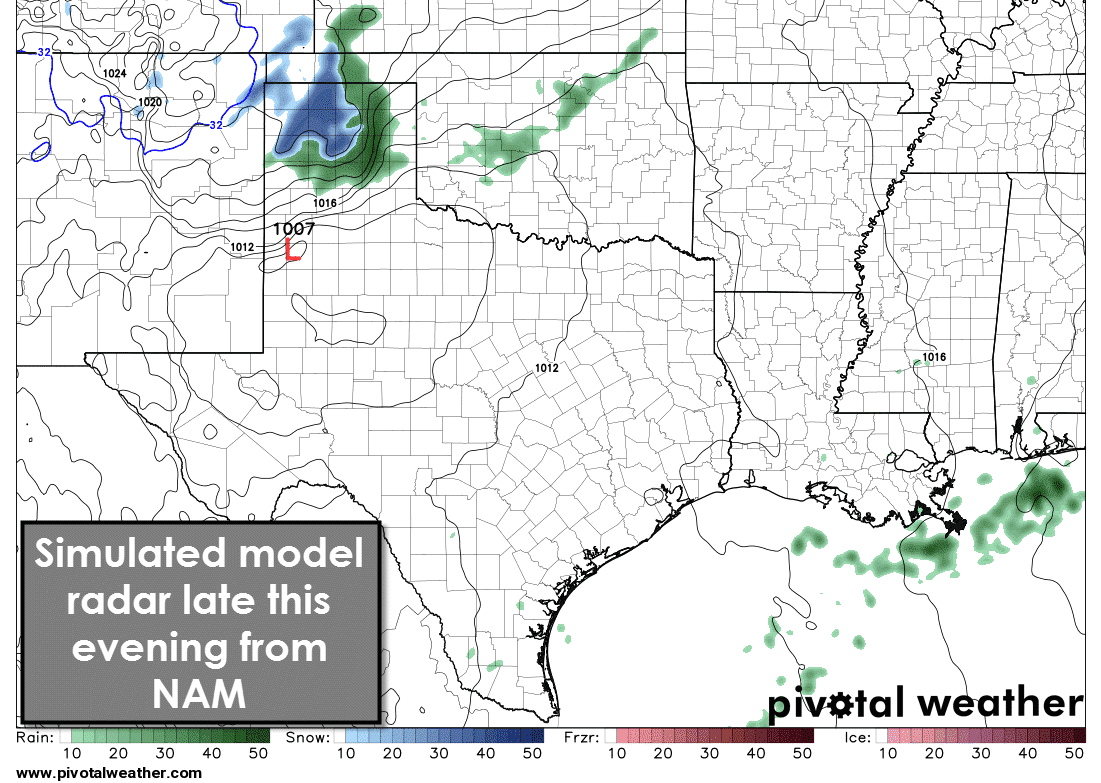
By early this evening scattered showers and thunderstorms are possible across the Texas Panhandle. Those thunderstorms will move into Oklahoma after 11 PM. As temperatures fall in the northwestern half of the Texas Panhandle a changeover to snow is possible. Some snow accumulations of 1 to 3 inches are possible northwest of a Vega-Dumas-Stratford line. Some travel difficulties may develop tonight before snow melts by morning. A rain/snow mix is possible across the western half of the Panhandle tonight but accumulations should be minor east of the Vega-Dumas-Stratford line. Scattered showers and perhaps a thunderstorm are possible across Northwest Texas, West Texas, the Big Country, and North Texas tonight and on Sunday morning. Small hail is possible in Northwest Texas late tonight with a stronger storm. Widespread severe weather is unlikely.

Temperatures on Sunday will be cooler north of the cold front – but nothing close to past cold snaps we’ve seen in winters past. High temperatures will top out in the upper 50s to lower 60s across the Texas Panhandle through the Red River Valley. 60s to mid 70s are forecast across the Permian Basin, Big Country, Concho Valley, North Texas, East Texas, Hill Country, and Central Texas. The front won’t make it far south of Interstate 10. Temperatures south of Interstate 10 will top out in the 80s for Easter.


0 Comments