
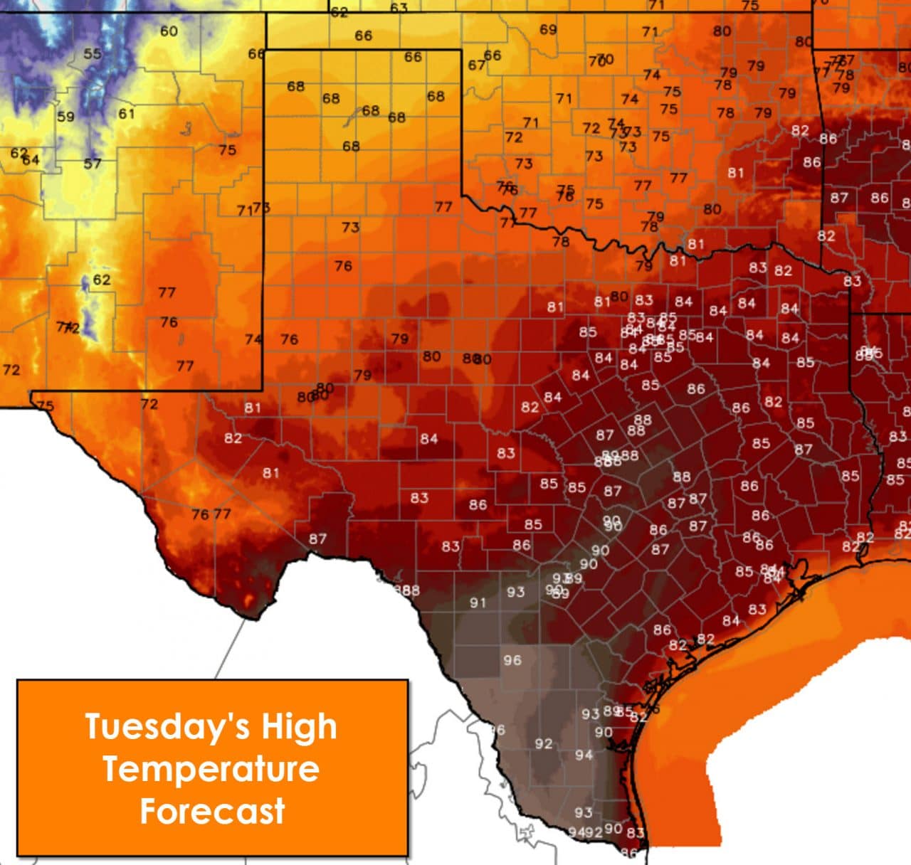
Another seasonably hot day is in store for Texas but a cool front will ensure a drop in temperatures by Wednesday. For today that cool front will start moving south through the state. The big change you’ll notice as the front passes your location is much drier air and northwest winds. Temperatures won’t necessarily become noticeably cooler behind the front but the wildfire threat will significantly increase. Temperatures this afternoon will be lower compared to Monday across the Texas Panhandle, West Texas, and Northwest Texas thanks to that cool front. We’re not talking about much of a drop though since temperatures will still be above-average. By the time you get along and south of Interstate 20 temperatures will top out in the 80s this afternoon. Central Texas, South-Central Texas, and South Texas will top out in the upper 80s to middle 90s again today. San Antonio and Austin both look to top out around 90 degrees. Skies will be sunny statewide today.
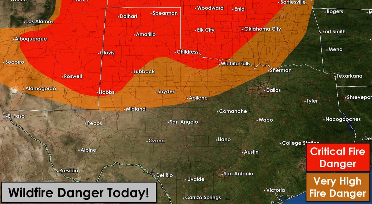
As previously stated we’re anticipating a busy fire day across the Texas Panhandle, West Texas, and Northwest Texas today. A cool front will bring much drier conditions by the early afternoon hours. Relative humidity values by peak-heating will drop to between 5 and 25 percent. Northwest winds will become sustained between 15 and 25 MPH. Wind gusts up to 35 MPH are possible. Very warm temperatures over the past few days have caused surface fuels to quickly dry. Conditions will be favorable for rapid fire spread this afternoon.
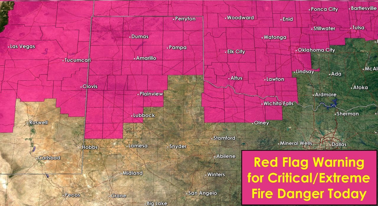
A Red Flag Warning is in effect today for the Texas Panhandle, South Plains, into Northwest Texas. Even those not under a RFW would be very careful when using equipment that may cause a spark. Notify your local emergency officials immediately if you spot a grass fire.
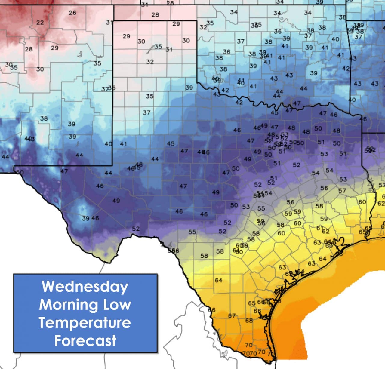
Temperatures will be cold tonight in the Texas Panhandle with upper 20s to lower 30s. 40s to low 50s will be common south into the Big Country, Concho Valley, Hill Country, North Texas, Northeast Texas, into Central Texas. Temperatures south of those regions will be warmer with the cool front stalling out. Upper 50s to upper 60s along with increasing clouds and fog tonight across South-Central Texas, Southeast Texas, the Coastal Plains, Coastal Bend, South Texas, and the Rio Grande Valley.
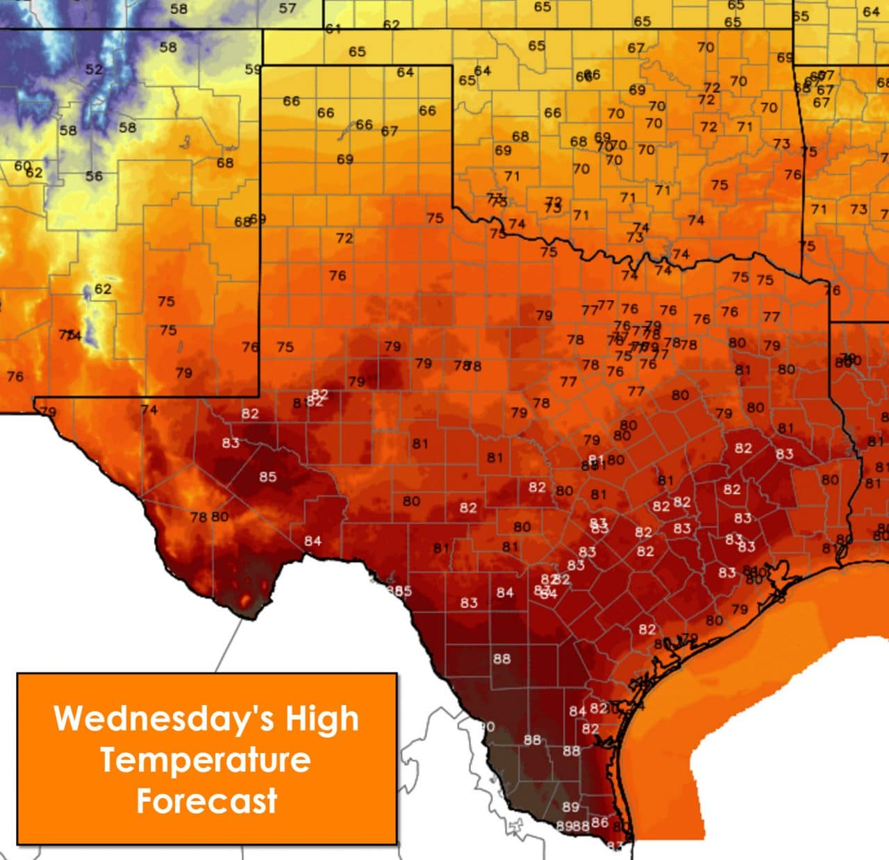
The stalled cool front will begin moving north on Wednesday as a warm front. Winds will start coming back around from the south. Fog is expected south of that front in the morning along with clouds. Isolated showers will be possible on Wednesday along the coast and in Southeast Texas. Rain chances will increase slightly by Wednesday Night across East Texas into South-Central Texas. Any rain that falls will be light and is not expected to cause any new flooding issues. Rain and storm chances look to increase on Thursday and Friday. At this time we expect rain totals to remain under one inch across North Texas, East Texas, and Southeast Texas.


0 Comments