
I’ve seen plenty of crazy weather having lived in Texas for well over 40 years, but a new record high of 100 degrees in McAllen today, then snow in the forecast for parts of west Texas on Friday, pretty much takes 1st prize for nutty! And on April Fools day, too. What a coincidence! At any rate, a strong cold front will arrive tomorrow bringing gusty north winds behind it. Just a reminder from Old Man Winter that he’s not quite done with us yet. In addition to the cold front, a strong upper level low will move through southern New Mexico and southwest Texas on Friday which will provide lift to generate a wintry mix of wet snow and rain during the day on Friday. Thankfully, snowfall threats will only impact parts of the southern Texas panhandle and the northern Permian Basin region and nowhere else. Quick accumulations of 1-2 inches can be expected during the day on Friday. Impacts to roadways are expected to be minimal except in areas where slush on the roadway can accumulate. A Winter Weather Advisory has been issued for the following counties in effect between 7am and 6pm CDT on Friday: Andrews, Crosby, Garza, Hockley, Lubbock, Lynn, Terry, Yoakum and the Guadalupe Mountains Region. This includes the cities of Lubbock, Levelland, Brownfield, Tahoka, Post, Lamesa, Seminole, Andrews and Pine Springs in the Guadalupe Mountains National Park area. 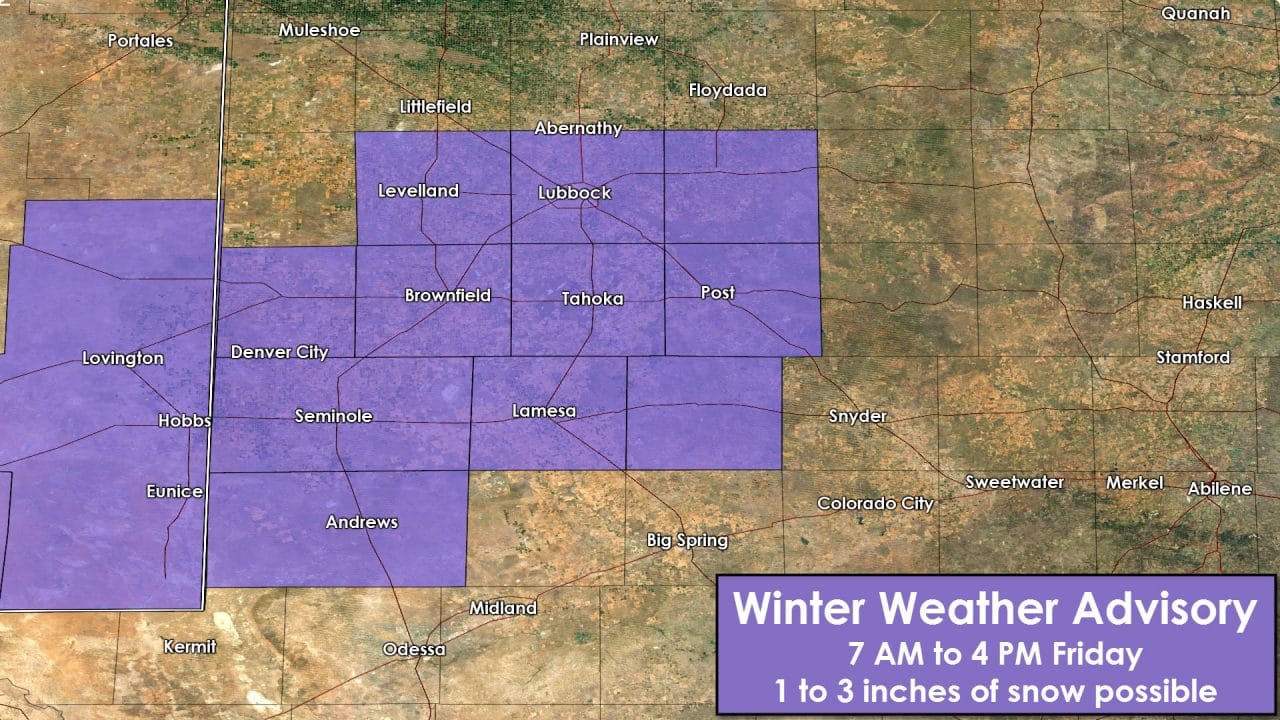
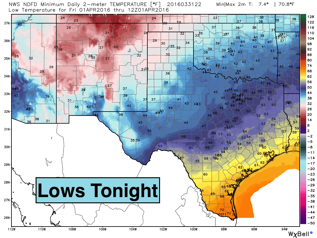
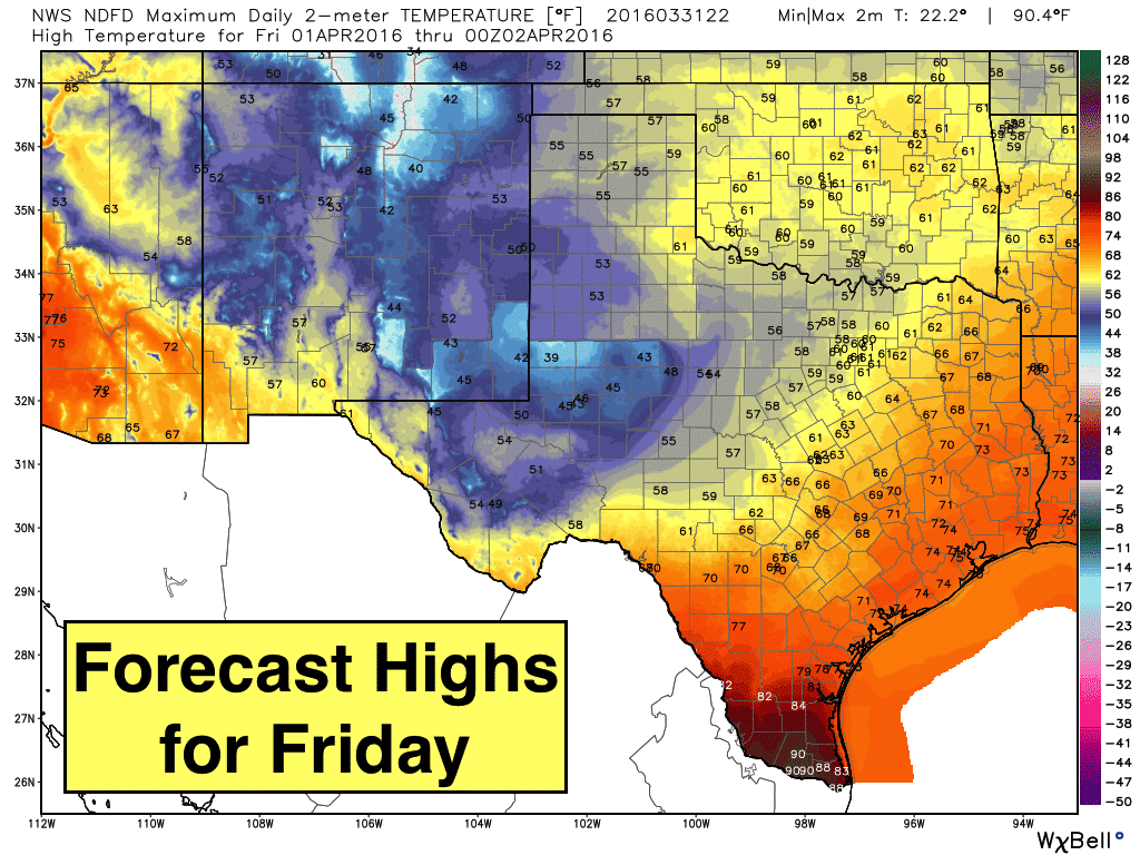
The cold front will arrive across the northern half of the state during the early morning to mid-day time frame. By late afternoon and into the evening hours, the front will push through the southern half of the state…including the Rio Grande Valley region. This will be a nice respite from the well above normal temperatures experienced today, and again tomorrow ahead of the front. But as quickly as Old Man Winter arrives on Friday, his visit will be short and he’ll be leaving by Saturday as we see high pressure begin to settle in and temperatures quickly recover back to normal by Saturday, and above normal by early next week.
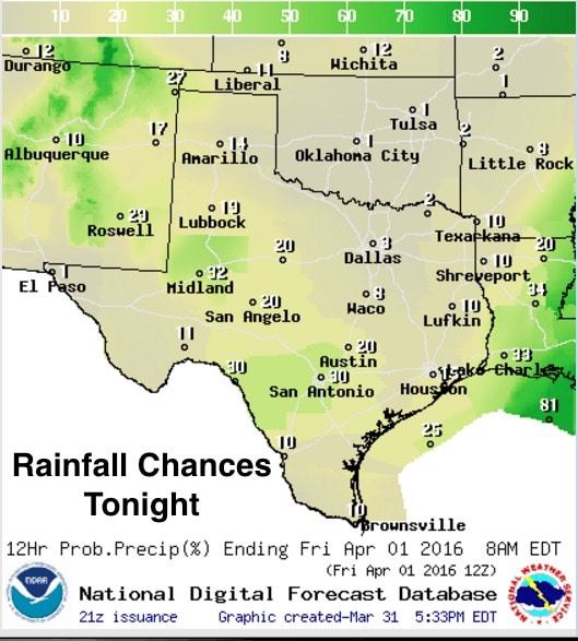
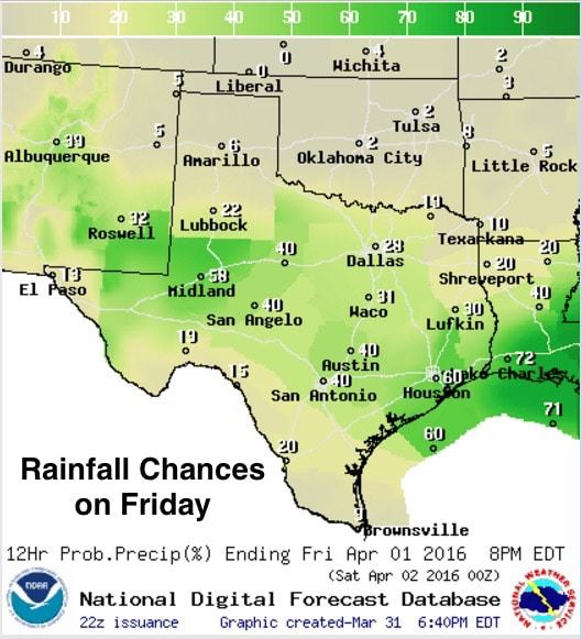
We will also have a chance for showers and a few thunderstorms overnight into early tomorrow morning across parts of southwest and south central Texas. Lift from the approaching upper level low will begin to generate scattered showers overnight along the Rio Grande and Edwards Plateau region which will expand east during the day tomorrow. A few of the storms could become marginally severe with gusty winds and small hail ahead of the cold front across south central/southeast Texas, but at this time, the atmosphere does not look to become unstable enough to support much in the way of severe storms. After this, it looks like we remain dry through most of the next work week before our next rainmaker arrives.


0 Comments