
With several areas of convection underway we’ll focus on each one separately. As a whole the strongest storms will be capable of producing golfball size hail and localized wind gusts up to 60 MPH. Localized minor flooding is also possible where storms set up over urban areas.
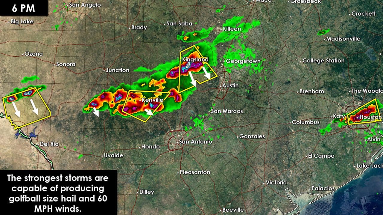
- A stationary severe thunderstorm is located right over the Houston metro in Harris county. Heavy rain and hail are occuring from Bellaire over downtown Houston to Sheldon. This storm is nearly stationary and is hardly moving. Frequent cloud to ground lightning, quarter size hail, and very heavy rain is occuring. Flash flooding may become an issue in a localized area due to the stationary storm.
- A severe thunderstorm is located over Round Mountain. This storm is moving south/southeast at 30 MPH. Hail up to the size of golfballs and wind gusts to 60 MPH are possible. Johnson City and Dripping Springs may be impacted by this storm over the next 30 minutes. Very frequent cloud to ground lightning is also occuring. Current indications are this storm will remain west of the Austin metro. Additional thunderstorms are underway from near Blanco west to Comfort and to northeast of Leakey. These storms are also capable of producing hail. These storms are slowly moving southeast and may impact parts of the San Antonio metro later.
- Two supercell thunderstorms have developed 50 miles northwest of Del Rio. These storms are moving south/southeast at 15 MPH. Hail up to the size of golfballs is possible. Eventually these storms may impact Highway 90 near Comstock.


0 Comments