
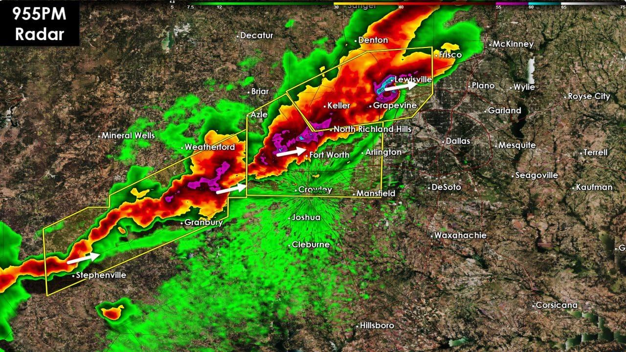
Shortly before 10 PM we were monitoring a broken line of severe thunderstorms in North Texas. These storms extend from near Howe to Lewisville, Fort Worth, Granbury, and Stephenville. The line itself is broken up with individual storms moving northeast at 40 MPH. The line itself is making slower progress to the east around 15-20 MPH. Prolific lightning is being produced which is putting on quite a show. Stronger cores in the line are capable of producing quarter size hail. Localized wind gusts of 45 to 55 MPH are also possible. The tornado threat is low – but not zero. We continue to watch the cell approaching Lewisville as it does maintain a decent looking structure. Outflow cut off the circulation about 25 minutes ago but we’ll have to watch it closely. Storms so far have struggled to develop in the Concho Valley. That isn’t a surprise since upper level forcing is weaker with southward extent. We’ll be watching for any development closely since that would bring the threat of storms to Central Texas later this evening.


0 Comments