
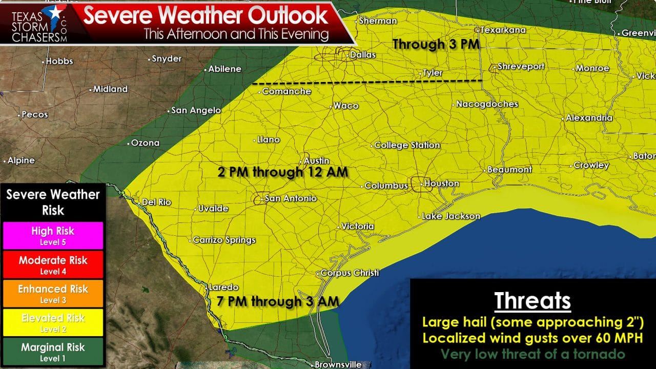
The threat of a few severe thunderstorms will continue across Northeast Texas through early afternoon. At the time of this writing a complex of strong storms extends from north of Sherman to north of Clarksville. These storms are moving east/southeast around 30 MPH. Some storms are capable of producing hail up to the size of quarters. Most storms are not severe but may produce small hail and localized gusty winds. These storms should gradually move east out of the state by mid-afternoon. A cold front will continue to move south through the Big Country, Concho Valley, into southern sections of North Texas by this afternoon. Temperatures north of the front will drop off into the 50s. South of the front temperatures will top out in the 70s and 80s with dewpoint temperatures in the 60s. It is locations south of this front where we will be watching for new thunderstorm development by the mid-afternoon hours.

North American Model – Simulated model radar around 7 PM this evening. NOT A FORECAST
The most probable locations for thunderstorm development will be in the Hill Country, Central Texas, with isolated development as far east as the Brazos Valley. These initial storms will likely be cellular with movement to the east/southeast. The strongest of these storms could be severe with a threat of large hail and localized damaging wind gusts. The atmosphere will be strongly unstable although wind shear values will be more marginal. The good news is low-level wind shear will be very weak. That will keep the tornado threat very low. I can’t rule out a brief tornado this afternoon but more than likely it won’t become a big issue. What will be likely today is the potential for large hail. With the atmosphere becoming strongly unstable and upper-level winds booking it the strongest storms could produce very large hail. The Storm Prediction Center is highlighting the potential for hail up to the size of tennis-balls this afternoon with the strongest storms. Not all storms will produce that kind of hail – but it is something to be aware of.
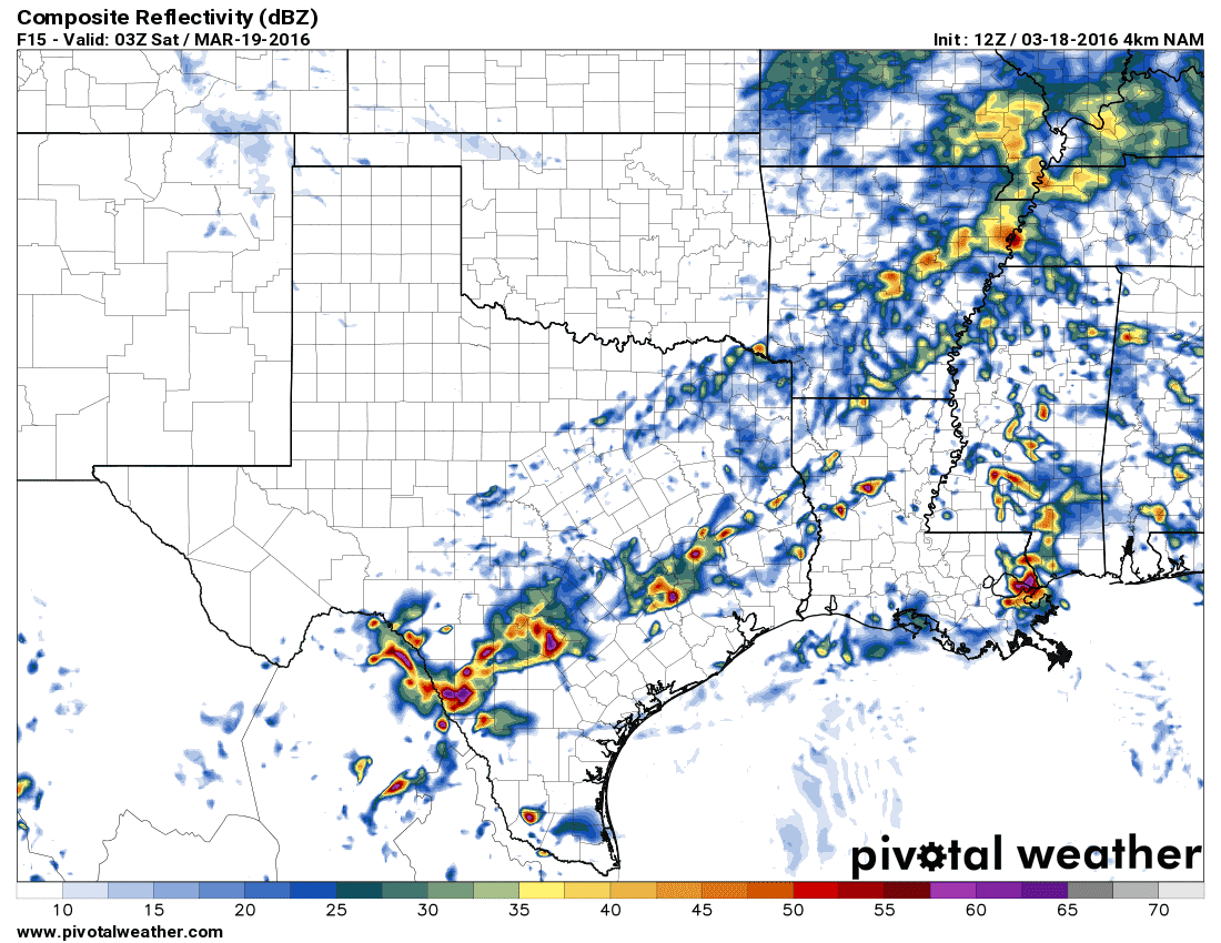
North American Model – Simulated model radar around 10 PM this evening. NOT A FORECAST
By early to mid evening a couple clusters of storms may be moving south/southeast across South-Central Texas and Southeast Texas. I do believe the most potent activity will be across South-Central Texas and moving south into Deep South Texas. We’ll also have to watch for any severe storms that move in from the higher elevations of Mexico. Those kind of storms have historically been monster hail producers in the past. Storms could continue into the overnight hours across Deep South Texas. If we get a cluster of storms to organize than the potential for damaging winds would also exist. We’ll watch trends to see how things play out.


0 Comments