
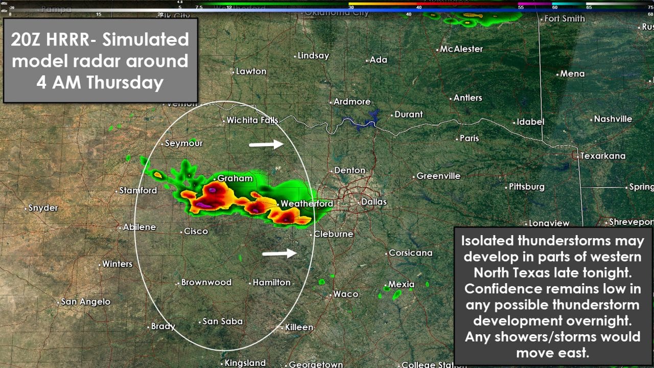
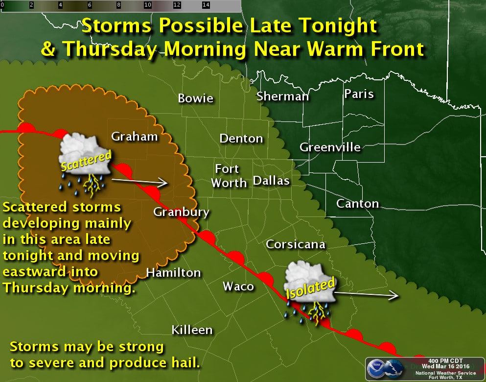
A conditional risk for a few thunderstorms will exist late tonight in parts of North Texas. A warm front will move north tonight. Moisture levels, measured by the dewpoint, will increase along and south of the warm front. Clouds and even some fog are expected south of the warm front tonight. The front should be in the Big Country into North-Central Texas tonight. At the same time a possible weak area of lift may develop over western North Texas. Confidence in the location/strength of lift is low since it’ll be localized. Short-term high resolution weather models are indicating a couple storms developing around 3 AM. They indicate those storms may develop anywhere from the Red River all the way south into the eastern Big Country. Thunderstorm development won’t be widespread or cover a large area. The few storms that may develop will likely be cellular in nature and elevated. An elevated thunderstorm will normally have no tornado risk and generally not produce destructive wind gusts. What elevated storms can do is produce hail, dangerous cloud to ground lightning, and heavy rain. The atmosphere will be unstable enough to support a hail threat with the stronger storm cores. If storms do develop they’ll move east towards Interstate 35. We’ll have to see if/where the initial storms develop to project the downstream target areas near Interstate 35. It certainly is possible a couple storms may move into the D/FW Metroplex after 3-4 AM. Some storms may produce hail up to the size of nickels or quarters. Most activity will not produce hail that large – or at all. We’ll have an update later this evening once additional data arrives. Its entirely possible we don’t have to deal with more than a few showers tonight.


0 Comments