

A cluster of strong to severe thunderstorms is moving east/southeast into Lamar and Red River counties. These thunderstorms have a history of producing penny-size hail. They are capable of producing hail up to the size of quarters. Brief wind gusts up to 60 MPH are also possible. This cluster of storms is moving southeast at 30 MPH. As it progresses southeast over the next two hours it could bring pockets of wind and hail to Red River, Bowie, and Cass counties. Eventually this cluster will move into Arkansas/Louisiana. Isolated thunderstorms are occuring further west along the Red River all the way back to Interstate 35. An isolated shower or two are also popping up in Denton and Collin Counties. All that activity is moving east/southeast at 30 MPH. An isolated severe storm is possible with hail up to the size of quarters.
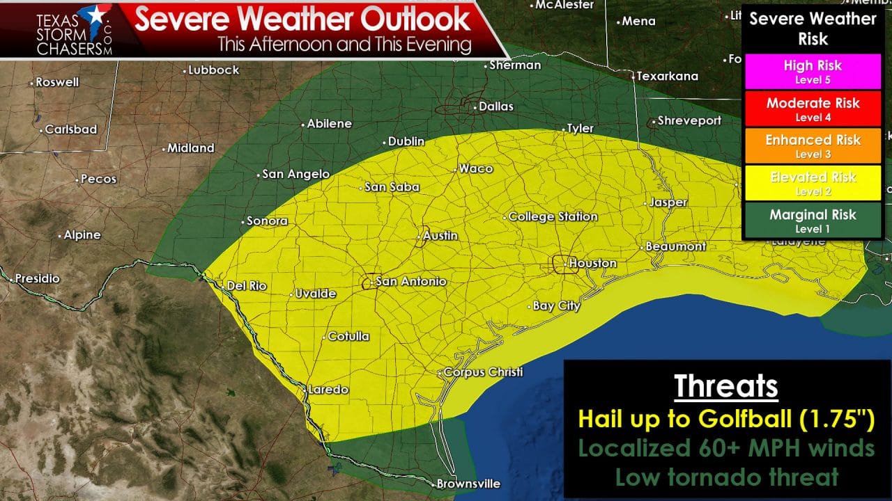
Additional severe thunderstorms are expected later this afternoon in the Hill Country and South-Central Texas. We’ll have a new update on that possibility around noon. Hail would be the primary threat along with localized gusty winds.


0 Comments