
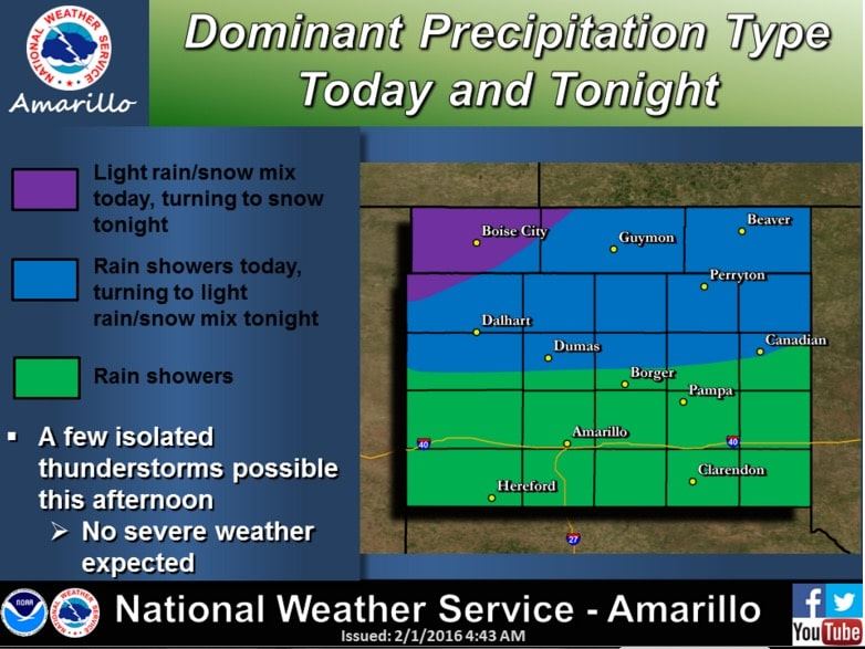
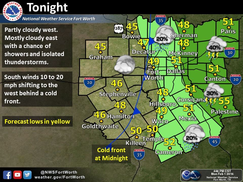
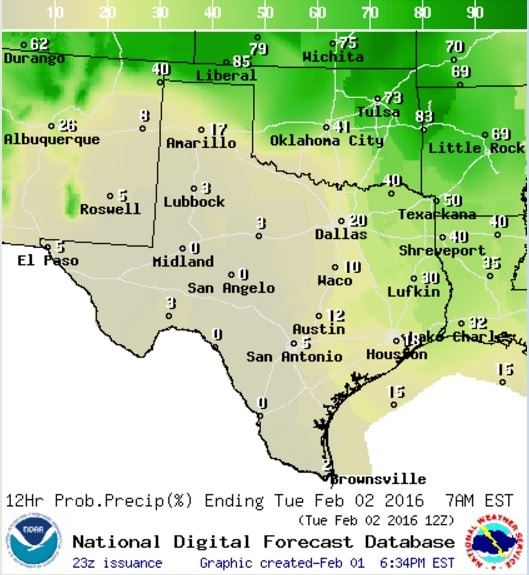
There’s actually quite a bit to talk about, so we’ll break the blog up into topics with the first item being snow/rain chances for the panhandles tonight and the chance for a few showers and storms along the cold front later tonight from around Dallas eastward. Light rain is showing up across the central and eastern panhandle and far northwest Texas and is expected to continue over the next several hours before moving into western and southwestern Oklahoma. As the upper level low we’ve been talking about for the past couple of days begins to lift off to the northeast overnight, there is a chance for light wintry precipitation across the OK and northern Texas panhandles through early tomorrow morning as a secondary (Canadian) cold front arrives behind the current Pacific front. Rain/snow amounts are expected to be very light across the northern panhandle tonight and into tomorrow with no significant travel impacts expected except for the far western corner of the OK Panhandle. For the eastern half of the state, we expect to see a small line of showers develop along the leading edge of the Pacific front as it heads closer to the I-35 corridor and interacts with better moisture. Best timing for the line to begin developing would be between 9pm and Midnight near the I-35 corridor, then continue east overnight into Tuesday morning as scattered showers. Storms that have recently developed just west of Wichita Falls will continue heading northeast this evening will continue heading northeast into Oklahoma with gusty winds and some small hail possible. No severe weather is expected otherwise, but don’t be too surprised if you hear a clap or two of thunder before sunrise tomorrow.
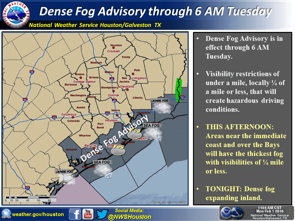
Next topic for discussion will be the chance for dense fog tomorrow along the upper coast and inland counties across southeast Texas by tomorrow morning. The NWS office in Houston/Galveston has issued a Dense Fog Advisory for the coastal counties between Matagorda Bay and Sabine in effect through 6am tomorrow. This should clear out from west to east early tomorrow as the cold front arrives, but until then, it will be pretty soupy with decreasing visibilities for those right along the coast. Check driving conditions before you leave for work or school tomorrow and allow extra time for your commute if it’s looking like pea soup outside when you leave.
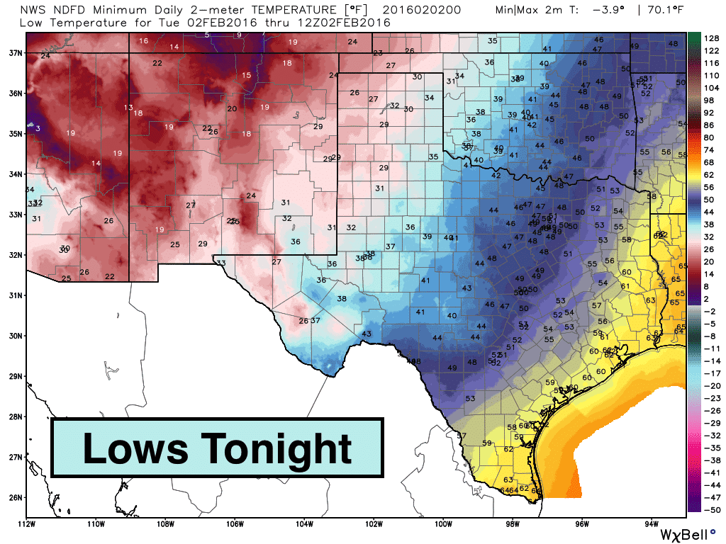
As for the cold fronts…yes, there’s actually two fronts…a north/south oriented Pacific front which was the driving force behind the wall of dust which traversed west central Texas earlier this afternoon. This front will continue its eastward progression overnight into tomorrow, but will not have too much of an impact on temperatures for us tonight. Its greatest impact will be the gusty west winds it brings with it. Gusts this afternoon across west Texas have reached greater than 50mph across a large swath of the region…with some locations exceeding 60mph. Thankfully, these gusty winds will temper a bit overnight and not be quite that strong as the front passes through central Texas and into east Texas buy tomorrow morning. It will be the Canadian front that arrives tomorrow, after the Pacific front, which will have the greatest impact on surface temps for the next couple of days. Lows tonight will drop down into the mid to upper 20s across the western panhandle and portions of far west Texas. For the eastern panhandle, eastern Trans Pecos and Permian Basin region, we’ll be looking at lows just above freezing overnight. For north central down into central and southwest Texas, lows tonight will drop into the mid to the 40s. Ahead of the front overnight, we’ll see some balmy 60 degree readings.
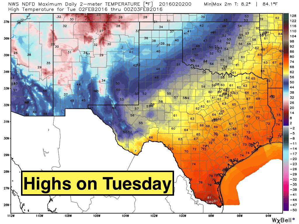
Highs tomorrow, chilly across the northern half of the state, but still quite warm across the southern half with highs once again reaching the 70s and even some low 80s across deep south Texas before the cooler and drier Canadian air has a chance to filter south. After that, a surface high builds in across the state and remains in place for several days keeping us cool and a bit below seasonal averages through the rest of the work week. Looks like we remain quite dry as well with our next chance for rain not showing up until the weekend. More on that in our forecast blogs tomorrow!


0 Comments