
As David mentioned in his morning blog, the chance for meaningful precipitation ahead of the strong front arriving overnight into tomorrow is looking pretty dismal. While instability levels build to moderate levels just ahead of the surging cold front, a strong capping inversion (a layer of warmer air in the mid-levels of the atmosphere) will act as a lid and keep robust storm development in check. The best rain and storm chances will likely miss the Dallas/Ft. Worth metro area entirely, with the best chances for seeing a couple of strong to severe storms located across northeast Texas during the morning hours and across far eastern Texas during the afternoon hours. If a couple of strong storms can manage to develop, gusty winds and quarter size hail would be the main threats. 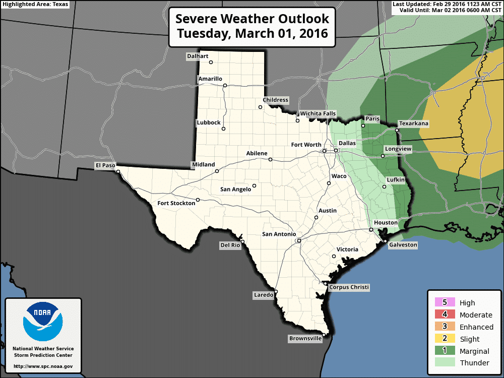
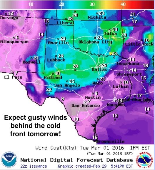
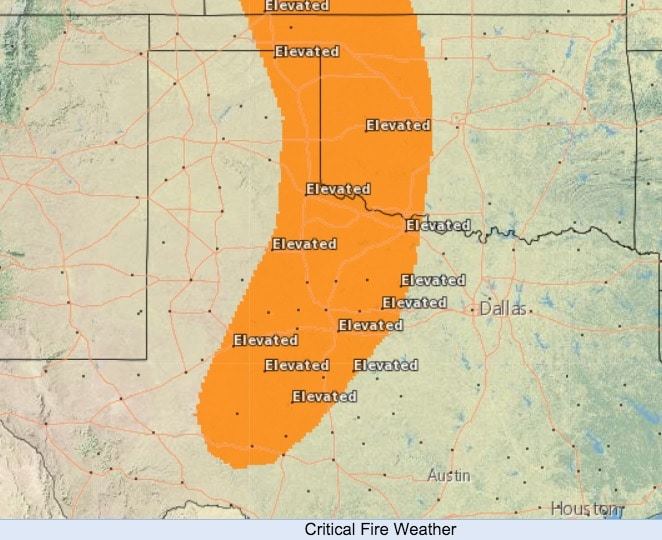
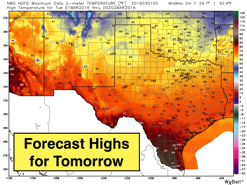
Conditions behind the front tomorrow will be quite windy with gusts exceeding 30mph at time across the panhandle and northern Texas. These gusty winds combined with humidity values dropping down between 20%-25% will lead to Elevated Fire Weather conditions tomorrow afternoon across portions of the eastern Texas panhandle, western north Texas and west central Texas. Much of this area has received less than an inch of rain since January 1st, so it goes without saying that any vegetation that catches fire will spread very quickly.
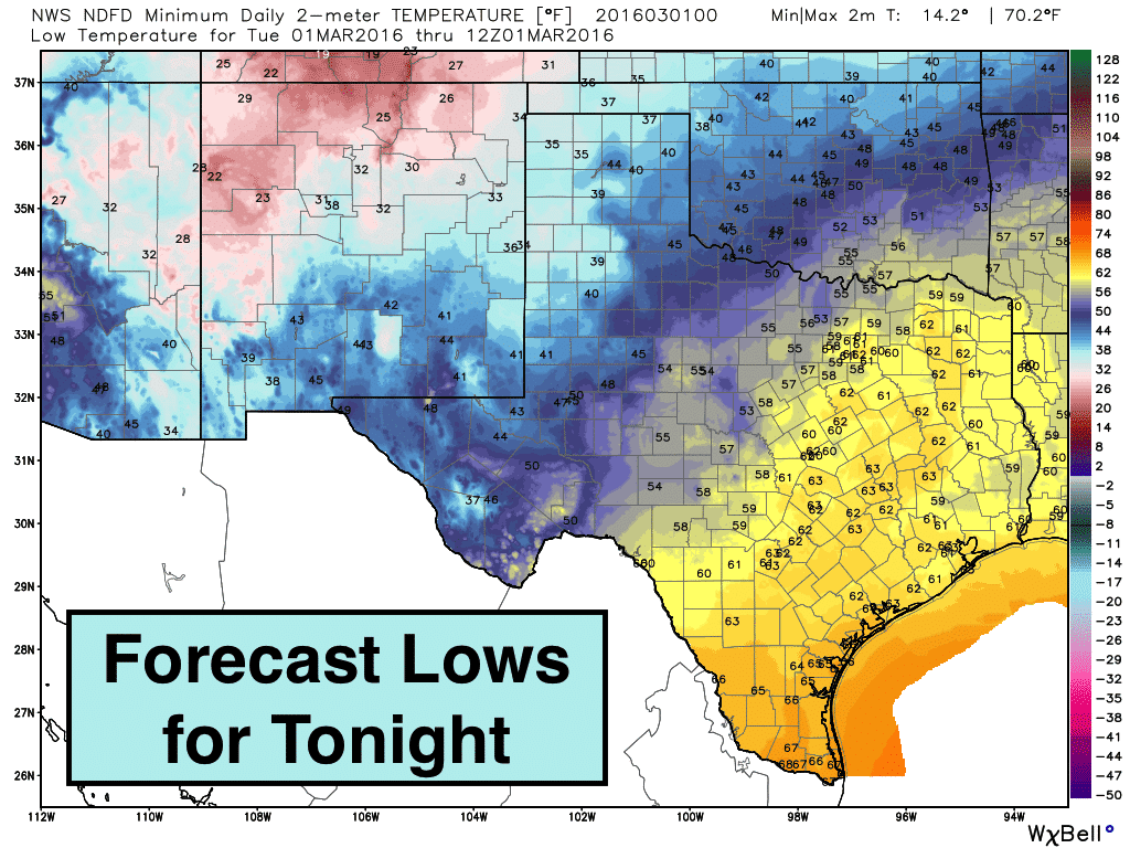
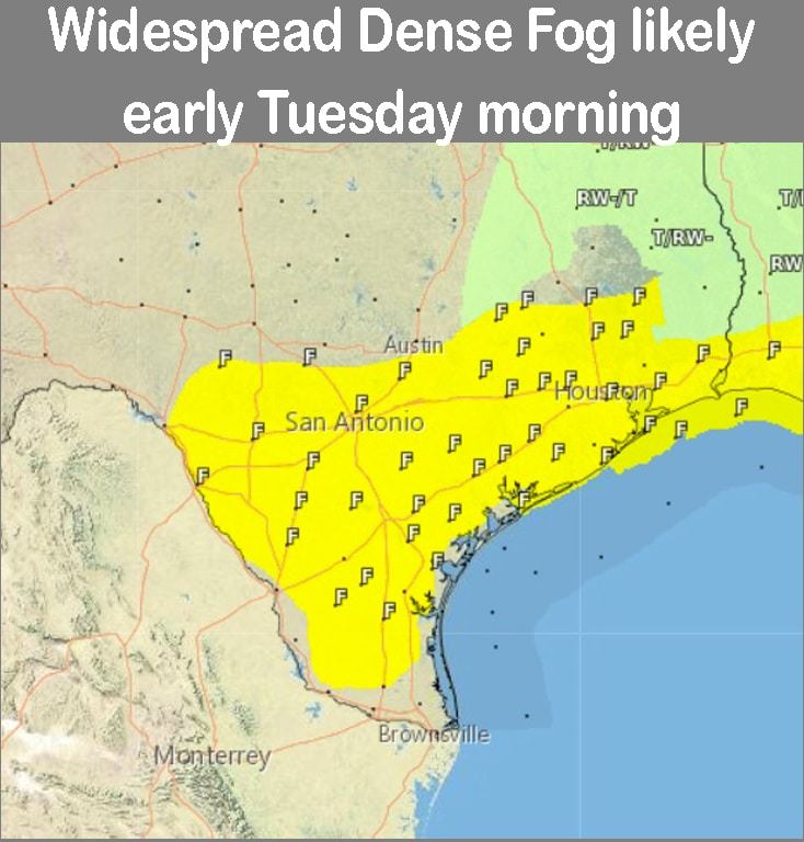
Lows tonight will drop down into the 30s across the panhandle and 40s across parts of west and northwest Texas. Further east and south, we’ll be seeing overnight lows stay quite mild and in the upper 50s to low 60s. Deep south Texas will see lows only drop down to the upper 60s to low 70s. Widespread dense fog will be possible again tomorrow morning across nearly all of south Texas and the coastal plains.
Highs tomorrow will be seasonal behind the front climbing only to the low 60s across much of the panhandle and the mid 60s across far north Texas. Temps will remain above average ahead of the front across central and south Texas. Much drier air will be pulled in behind the front which will likely be positioned across central Texas by this time tomorrow evening. Frontal passage is not expected along the coast until after midnight tomorrow.


0 Comments