
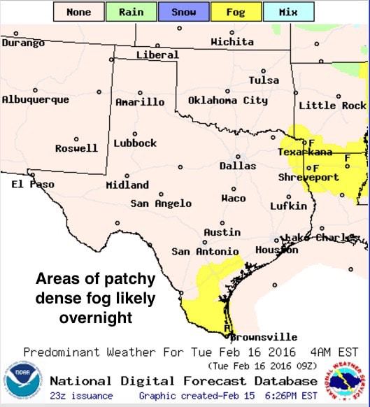
Showers and thunderstorms this morning across northeast Texas dumped a bit more rain than anticipated across the region. In fact, Texarkana broke the record for rainfall today with 2.06 inches which beats out the old record of 2.05 inches set back in 2001. Numerous locations across northeast Texas picked up a quick 1-2 inches with some locally higher amounts mixed in. For the rest of this work week…the forecast remains dry with daytime highs creeping upwards each day, with the warmest temps expected on Thursday and Friday as high pressure briefly builds in over the state. For tonight, lows will be, close to, but still above seasonal averages for this time of the year. Fog will be likely across parts of south Texas under clear skies with light winds by early tomorrow morning. Moisture from this morning’s rainfall across northeast Texas will also help to generate some patchy fog by morning across far northeast Texas as well.
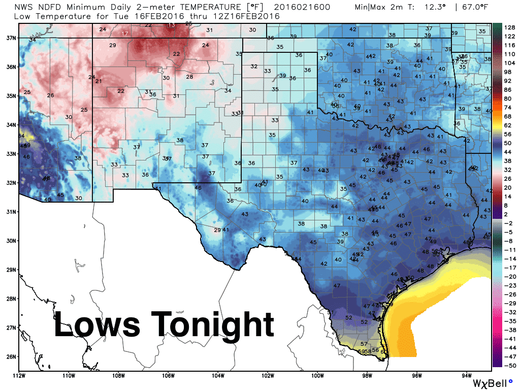
While you’re sleeping…or not sleeping…tonight, a weakish surface high will move off to the east which will shift winds back around from the south by early tomorrow morning. A weak cold front will pay north Texas a visit on Tuesday but will likely stall out somewhere south of the I-20 corridor by tomorrow afternoon. This front will not have much of an impact on our daily highs but will reinforce the dry air already in place. Highs tomorrow are still expected to range a good 10 to 15 degrees above seasonal averages once again.
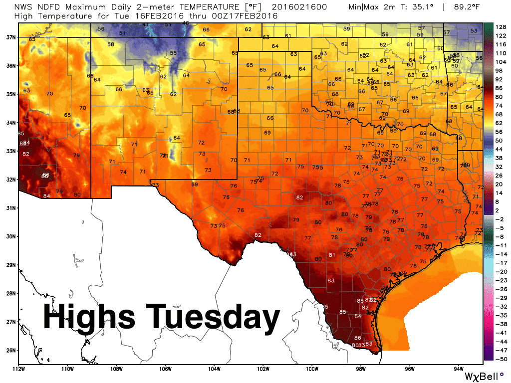
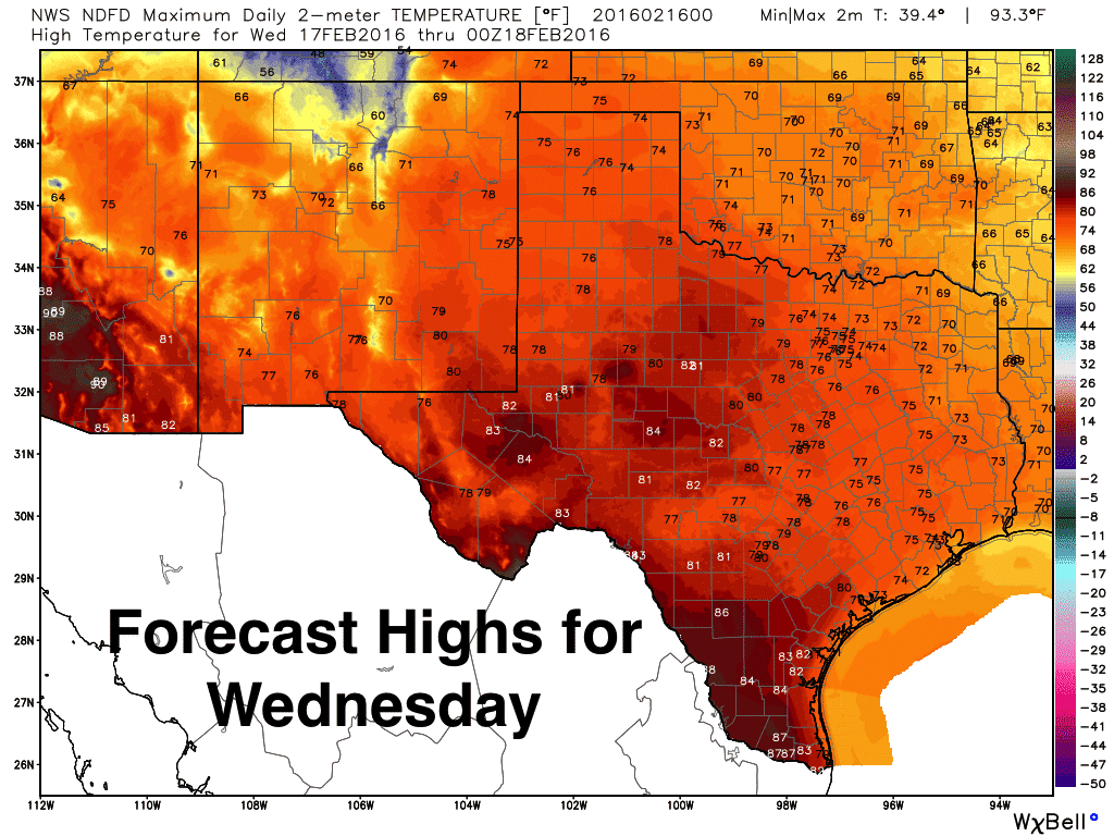
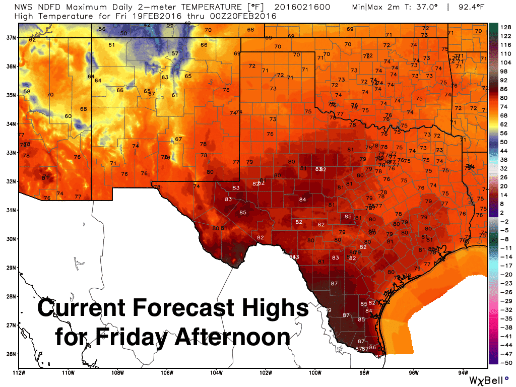
And the warming doesn’t stop on Tuesday! By Thursday and Friday, we’ll be seeing widespread highs in the low to mid 80s across the western half of the state which will end up being 20 to 30 degrees above normal for this time of the year. Further east….expect mid 70s both Thursday and Friday where slightly higher moisture will keep temps slightly cooler.

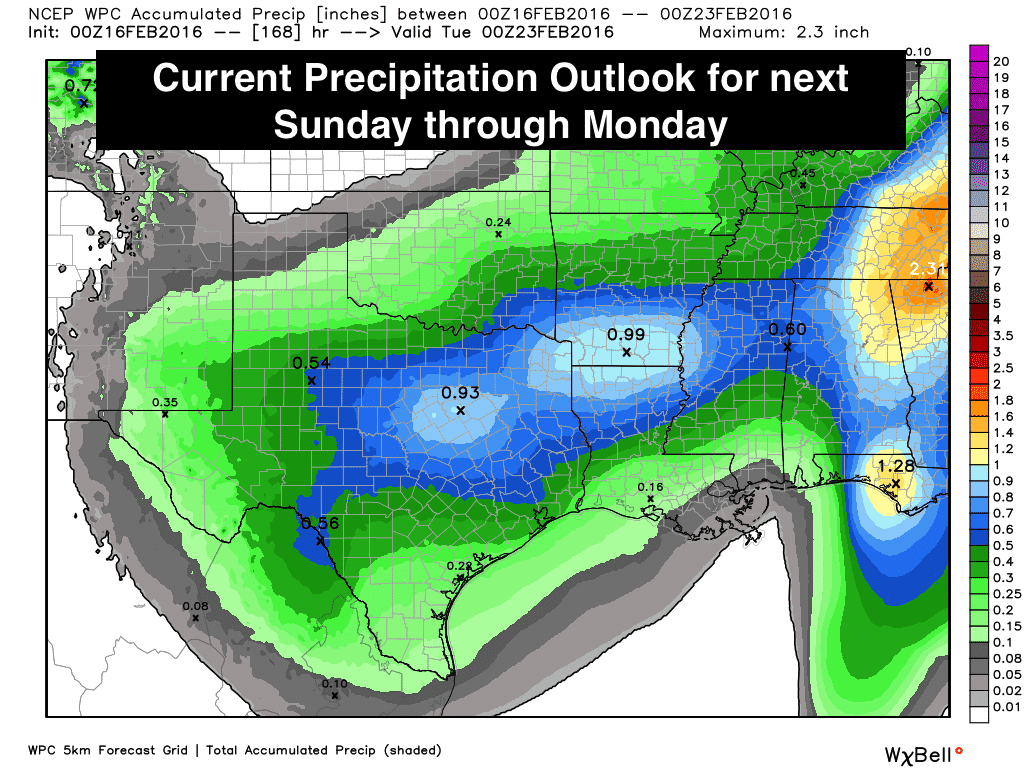
As we mentioned in our Sunday blog, it looks like we may be in for a pattern shift next week which is likely to bring much more widespread rain chances and a much stronger cold front Sunday into Monday. The Weather Prediction Center’s Precipitation Outlook certainly gives us more hope than we’ve seen since in quite some time. Still not the quantities we’d like to see, but something is better than nothing and we’ll take what we can get. We should also add that this will all fall as rain with temperatures expected to remain above freezing the whole time. As this is still a week away, we can expect to see changes to the currently forecasted amounts and locations, so be sure to check back with us as we’ll be keeping a close eye on this!


0 Comments