
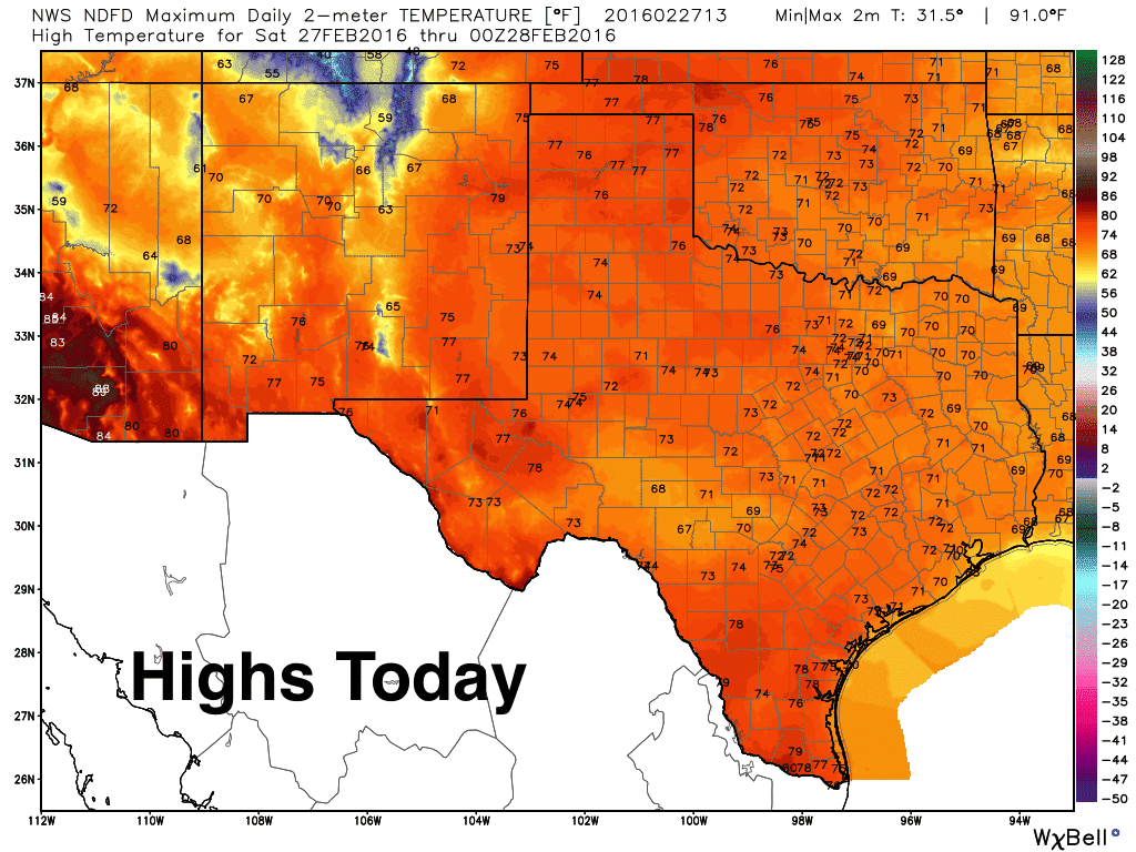
Good morning and happy Saturday! The overall forecast for this weekend looks wonderful with pleasant temperatures during day and temperatures not getting terribly cold overnight. Skies will be mostly sunny today with highs in the mid 70s across the panhandle and west Texas, upper 60s to low 70s for north, central and east Texas, and mid to upper 70s across south Texas. Humidity values will be on the increase with south winds today, but not enough to make it feel too muggy just yet.
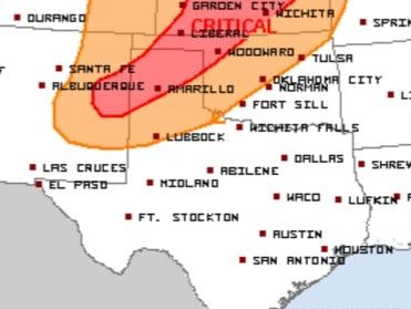
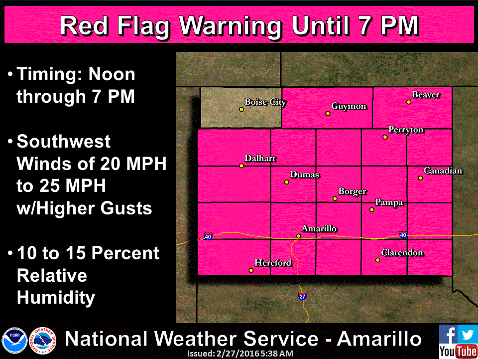
The only weather concerns to mention today will be the Critical Fire Weather Outlook across the panhandle region. Low humidity values and gusty winds in excess of 30mph across the region this afternoon will be conducive to the rapid spread of grass fires, so please…no outdoor burning and be careful with anything that could cause a spark or flame. A Red Flag Warning is in place until 7pm this evening, after which winds should drop below 20mph for the overnight hours.
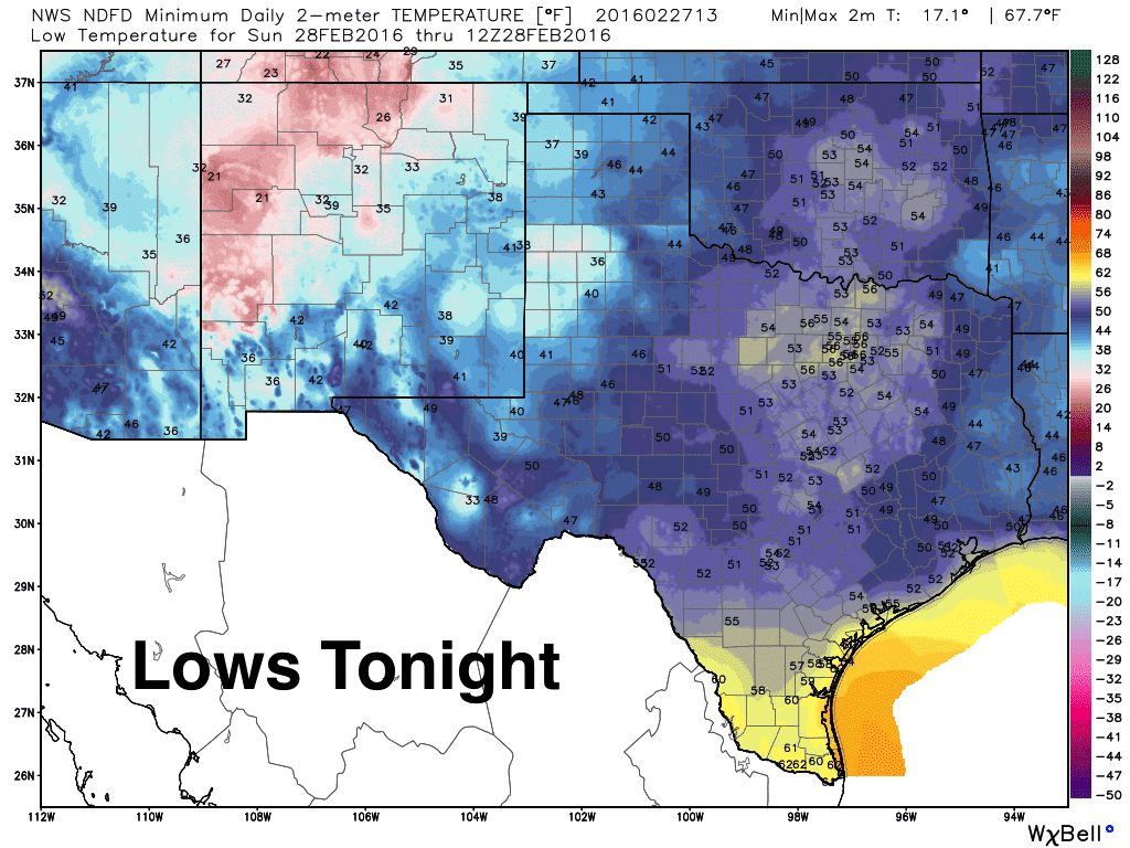
Lows tonight will be cool, but above where they typically are this time of the year. The warmest areas overnight will be across deep south Texas where lows will dip only into the low 60s. The panhandle and east Texas will be the coolest ranging from the mid 30s to low 40s. For the rest of the state, we’ll be looking at upper 40s to low 50s…which is really not bad late February.
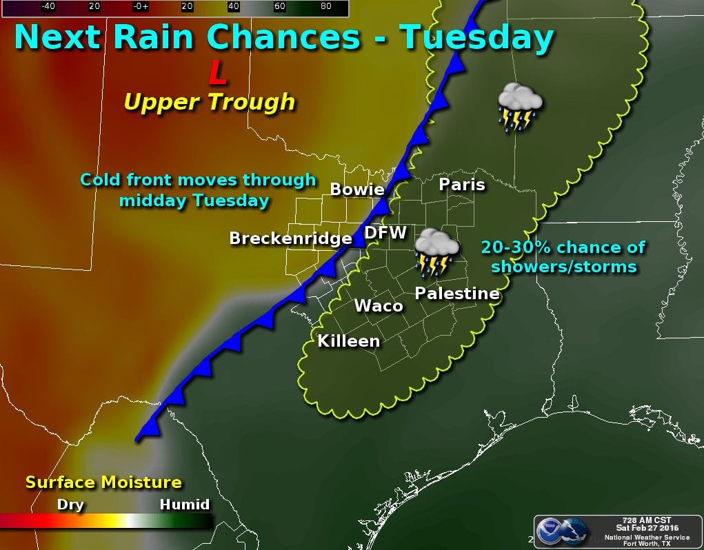
As we’ve been mentioning a few days now, rain chances will return to the state late Monday into Tuesday as a powerful upper level system moves across the southern plains dragging a cold front along with it. The best lift from the upper low will be too far north of Texas to provide much in the way of severe weather, but that chances is not completely zero either. We will have a chance at seeing a few strong storms by early Tuesday as the front begins to push through north Texas. During the afternoon hours when we see peak daytime heating, chances for strong to severe storms will likely increase across parts of east Texas and along the southeast and central Texas coastal regions as the cold front dives south and interacts with richer gulf moisture. We’ll keep an eye on that over the next few days and have update out as we get closer to Tuesday. Once this clears out, it looks like we’ll remain fairly dry through the first week of March, then rain chances return by the 2nd week.


0 Comments