
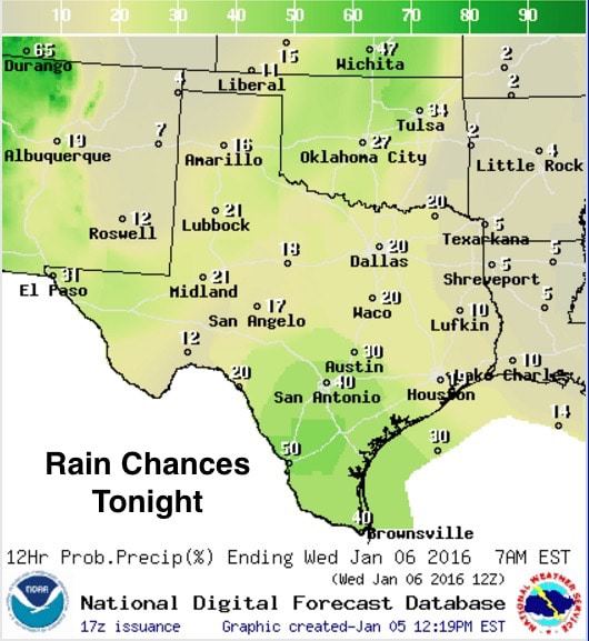
Snow accumulations across the panhandle today ended up being pretty light with most areas seeing between 1/4 and 1 inch with minimal travel impacts. Overnight, a mix of snow and rain will be likely across far western Texas from the northwestern Permian Basin region all the way down into the Marfa Plateau. No significant accumulations are expected and travel impacts will be minimal. Further east across the eastern Permian Basin and Big Country/Concho Valley…and north across the panhandle/south plains…rain chances will be minimal but patchy fog and drizzle will be likely tonight. Temps are not expected to dip below 32 for much of the area except across the western panhandle and mountain regions of far west Texas, so for the most part, we’re expecting most of the precipitation to fall as rain or a mix of rain and snow with no significant issues.
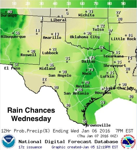
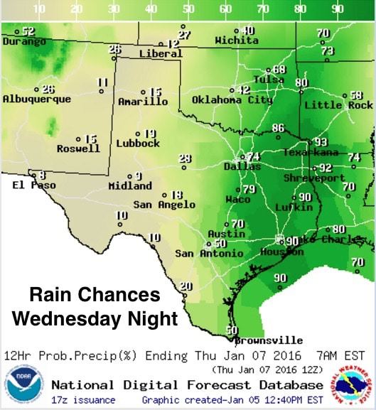
For tomorrow, rain chances will be on the increase for the eastern half of the state, with the highest chances of rainfall exceeding 1/4 to 1/2 inch along the I-35 corridor. Flooding is not expected to be a major issue tomorrow due to the relatively weak nature of the upper level disturbance which will generate this rainfall. Overnight Wednesday into early Thursday, rain chances will shift east of the I-35/I-45 corridor and we’ll see better chances for seeing more widespread and heavier rainfall which could lead to some localized flooding issues. Rainfall amounts will be highest along the coast between Corpus Christi and Houston where some folks could pick up a quick 1.5 to nearly 2 inches. Further north, rainfall is not expected to exceed 1 inch for most areas. Severe weather is not expected, but we can’t rule out a rumble or two of thunder closer to the coast during the day tomorrow.
Lows tonight will be a few degrees warmer than we’ve seen in recent days due to the blanketing effect of increasing cloud cover and increasing moisture. The coldest temps will be across the western panhandle where we could see temps range from the upper 20s to right about freezing. Elsewhere…temps will range from the 40s across north and central Texas, with upper 40s to low 50s as you get closer to the coast.

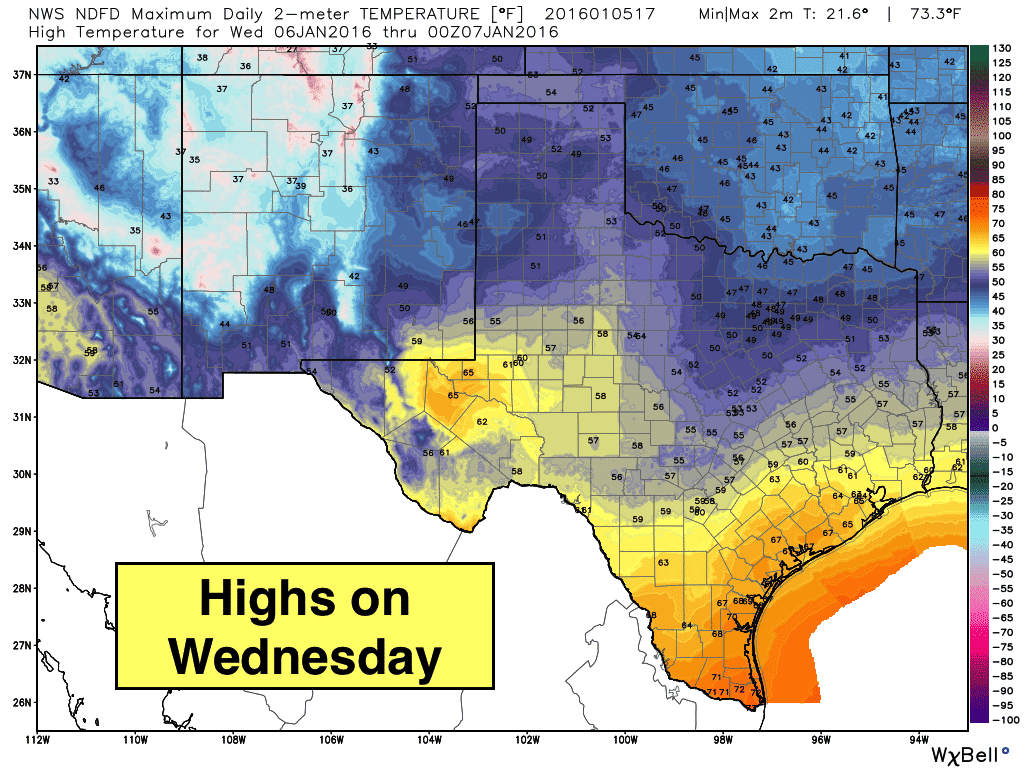
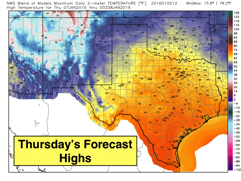
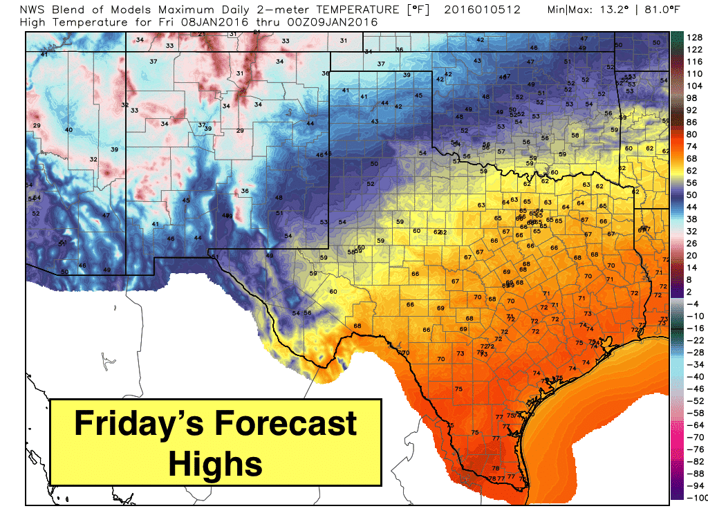
We’ll see a nice warmup tomorrow across the Trans Pecos region, south and southeast Texas with highs expected to reach the low to mid 60s. Deep south Texas will see very pleasant highs in the low 70s by tomorrow afternoon. We won’t see much in the way of sunshine, but at least it will be a tad warmer! This warming trend will stick with us until we get into the weekend when our next strong cold front is expected to arrive, so enjoy the brief warm-up while it lasts!
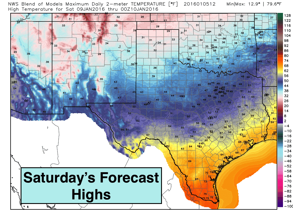
A note about winter weather chances this coming weekend: We’ve seen a bunch of snowfall graphics floating around on the interwebs this week showing the chance for snow across the northern half of the state this weekend. You may have also seen them if you follow other sources for weather information across Texas. While a light amount of snow is a possibility across the panhandle this coming weekend, there are no clear signals at this time for any significant chance of seeing winter weather elsewhere across north Texas, and this includes the DFW metroplex. As it stands now, it looks like most of the precip expected with our next upper level disturbance will have moved out of the area before the temperatures drop to freezing behind the next front. We will continue to keep an eye on this and let you know if there’s any further developments!


0 Comments