
After a few days of quiet and pleasant weather to start the work week, the chance for some light snow, some drizzle/showers and a few thunderstorms returns to the forecast. A weak cold front will arrive tonight bringing a chance for light rain at first across the panhandle sometime after 10pm, then transitioning to a light snow before daybreak on Thursday. Accumulations will be light and generally less than 1/2 inch with no major travel impacts expected. A surface low will be drifting east across north Texas overnight as well which will bring a chance for patchy areas of dense fog and drizzle out ahead of the front early on, then scattered showers with maybe a few rumbles of thunder mixed in beyond daybreak tomorrow.
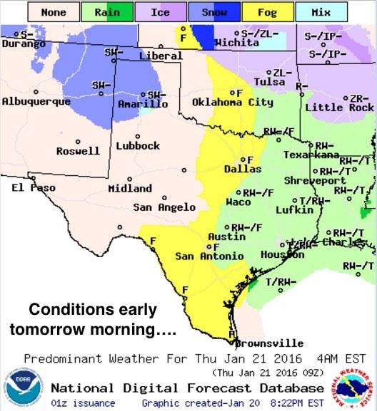
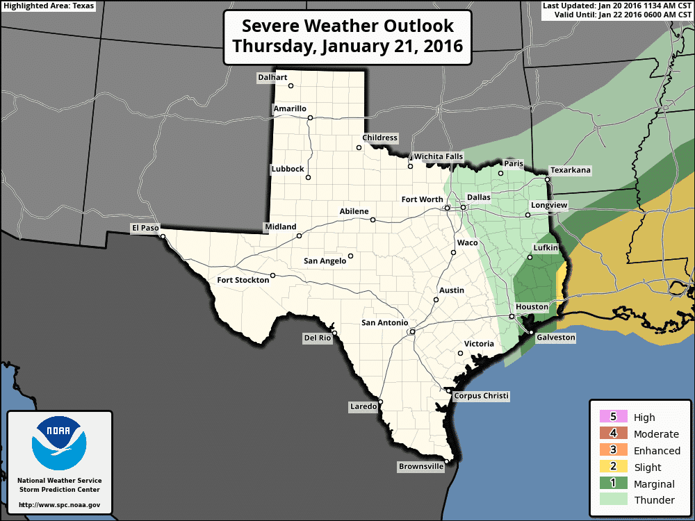
Rain chances will continue across the eastern half of the state tomorrow afternoon as the front continues to move south reaching the upper coast by early evening. Winds behind the front will gust into the 30 to 40mph range tomorrow across the panhandle by early afternoon which may require a Wind Advisory. We’ll update you on that if one is issued during the early morning update. The main hazard tomorrow afternoon will be the marginal chance for seeing a few strong to severe storms to develop across southeast Texas. The timing right now looks to be between 11am and 4pm tomorrow afternoon. North/Northeast Texas also has a chance at seeing a few strong storms as well, but being that this will happen behind the front, the threat for any severe weather is greatly diminished. David published a blog with specifics earlier this evening. In case you missed it, check it out here: https://texasstormchasers.com/2016/01/20/42525/
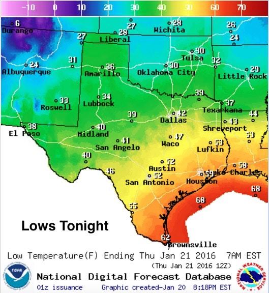
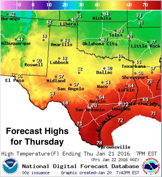
Lows tonight will drop into the 30s across the panhandle and far western Texas, with mainly 40s across central and southwest Texas, and we’ll see much warmer lows in the 50s to low 60s for the coastal plains and deep south Texas. Highs behind the front tomorrow will struggle to get out of the 40s, plus we’ll have the strong north winds to contend with which will make it feel much colder. Ahead of the front, quite warm and humid with highs in the 70s. In looking ahead…Friday through Sunday, conditions are expected to remain dry with pleasant temperatures returning, especially across the western half of the state. All in all, it looks like we’ll have a very nice weekend ahead…perfect for making outdoor plans!


0 Comments