
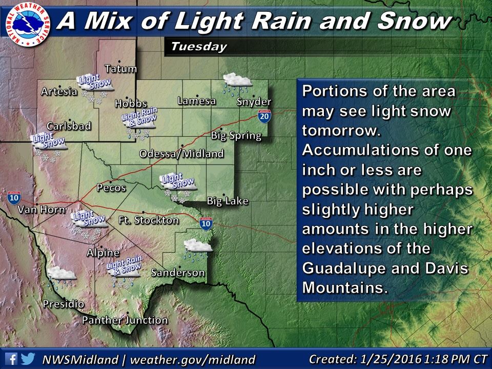
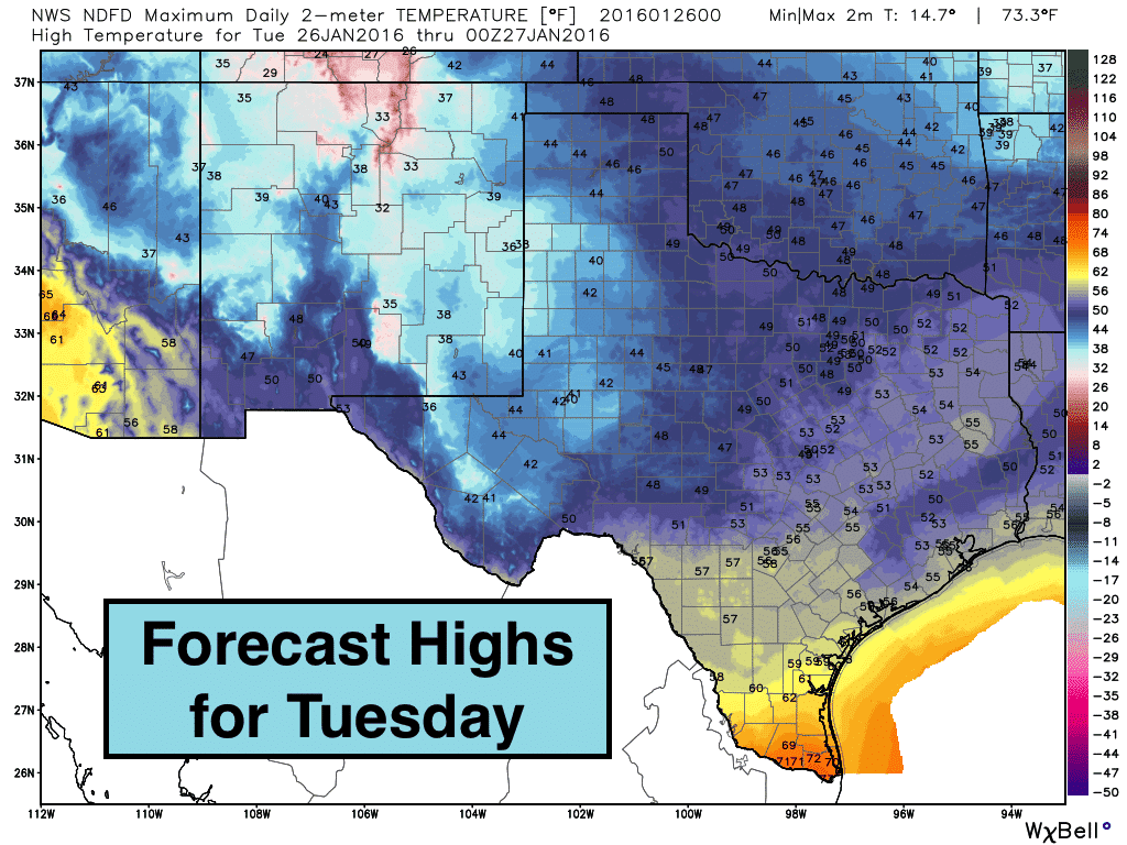
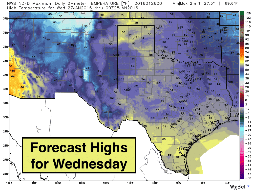
The overall forecast this week is shaping up to be mostly dry and cooler than average to start with, but warming to well above average once again by the coming weekend. A weak upper level disturbance will arrive tonight as a cold front pushes south through central Texas. The front will not bring exceptionally cold air with it, but it will knock us down a few degrees below average for the next couple of days. Precip chances will be on the low side…with a few snow flurries/light snow across parts of west Texas and the western panhandle tonight through Tuesday. 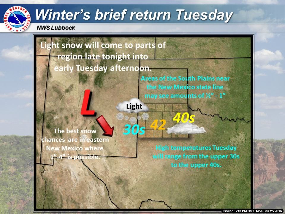
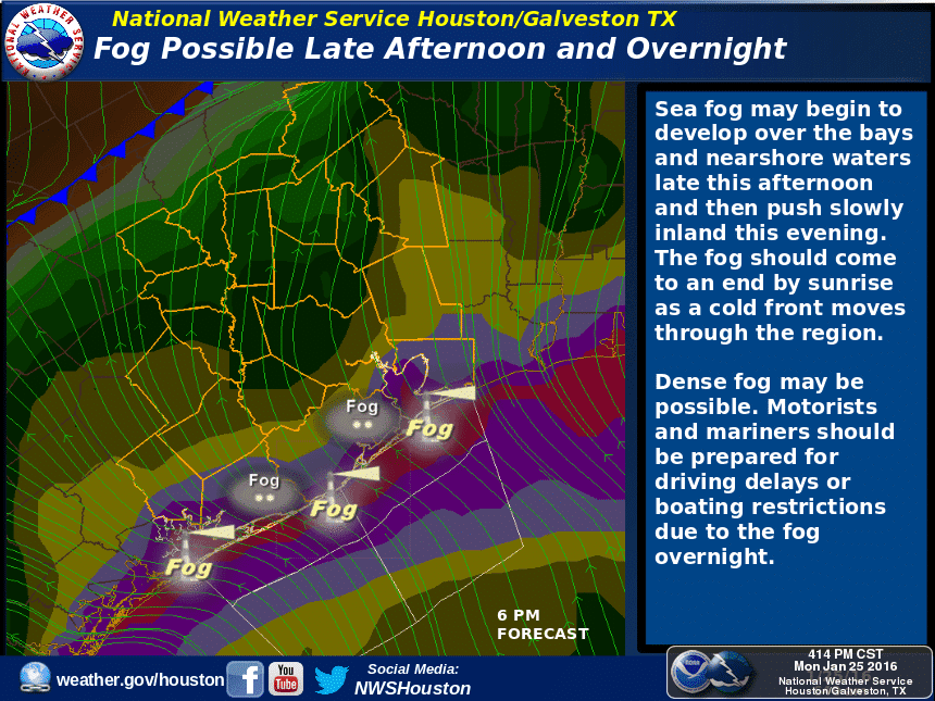
Further south along the coast, fog…dense at times…will be possible until the cold front clears the coast by tomorrow morning. On and off light rain and showers will also continue through Tuesday night before completely clearing out by early Wednesday. After that, we’ll see dry conditions for the remainder of the work week and through the weekend! Other parts of the state..namely central, north and eastern Texas, are expected to remain free of any winter weather or much rainfall.
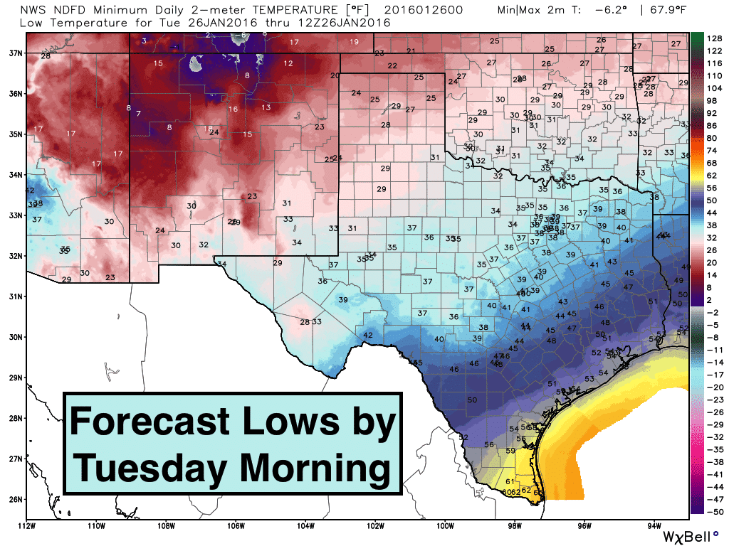
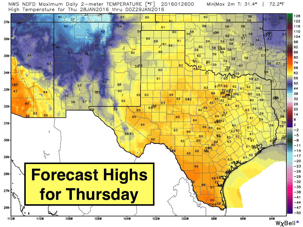
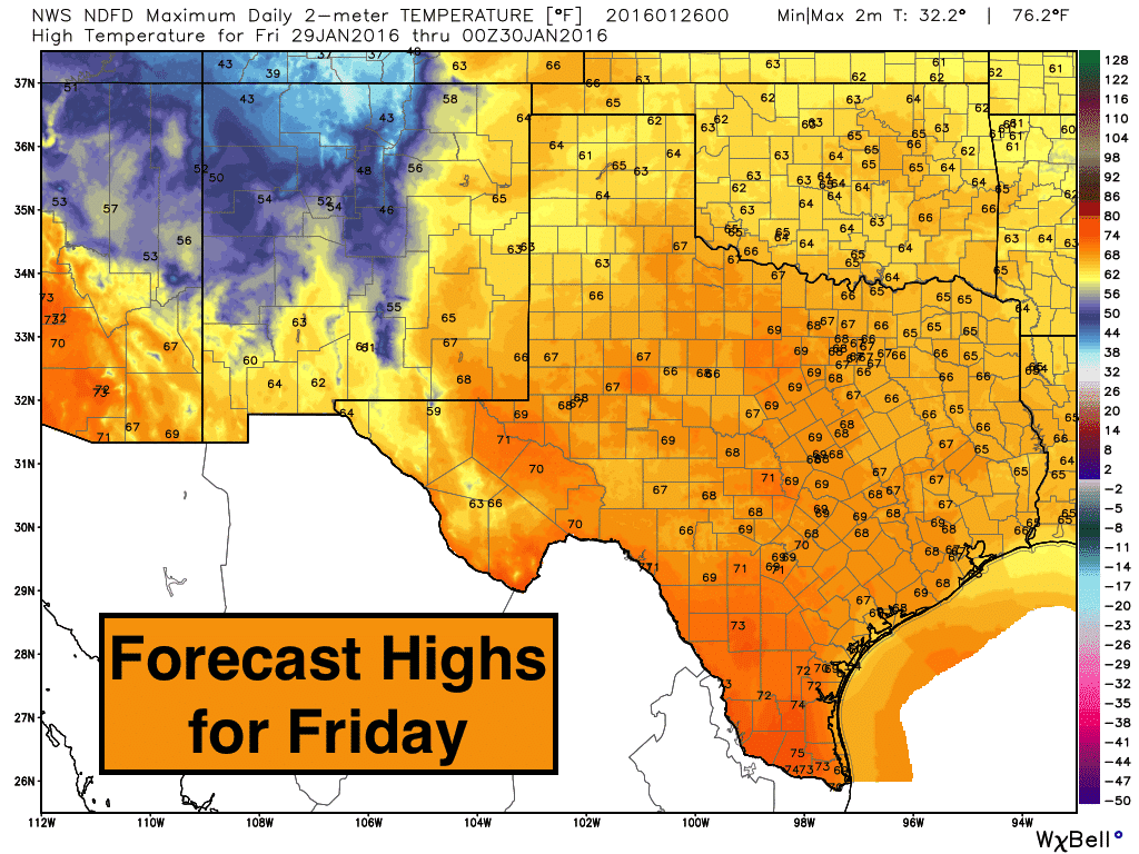
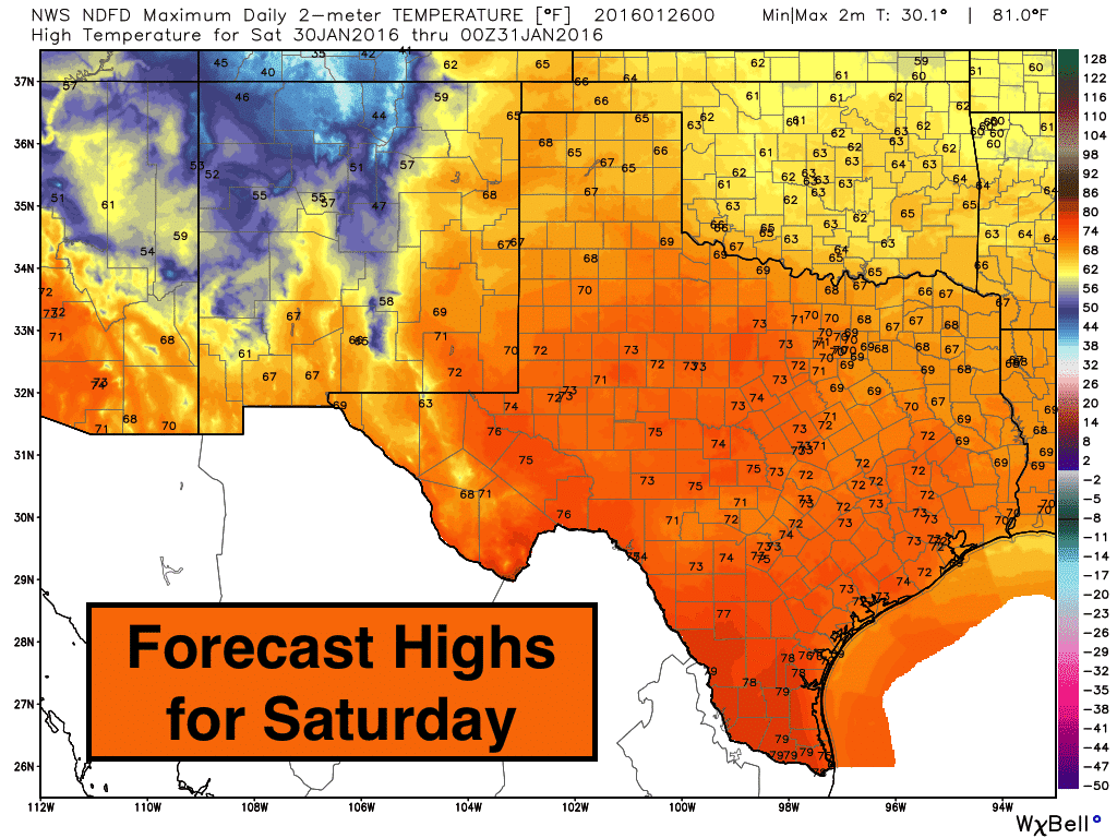
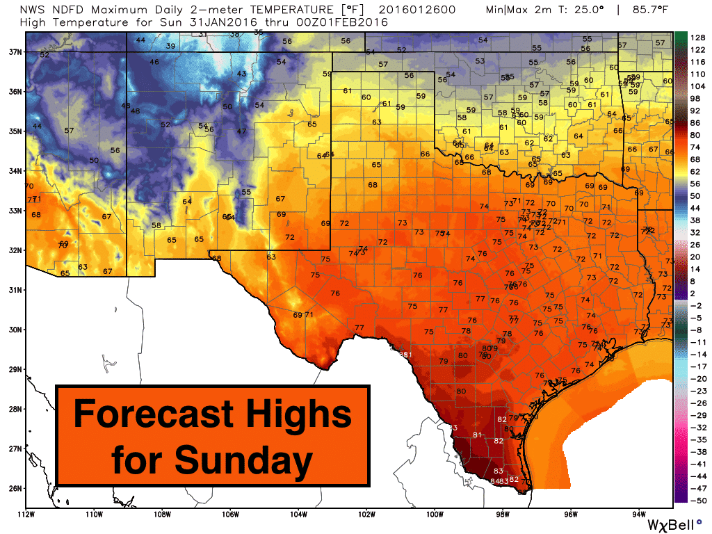
As mentioned above, temps will start off on the chilly side for the first part of the work week, but we’ll see a gradual warming trend through next weekend. By Saturday and Sunday, we’ll be seeing highs well above seasonal averages. Definitely a treat for late January! Here’s a look at tonight’s lows, and the daily forecasted highs for Tuesday through next Sunday! Beyond next weekend, it looks like we may see a return of rain chances, but the overall pattern is expected to remain on the dry side with above average temperatures into the first week of February.


0 Comments