
There has been chatter for a few days now regarding the possibility of snow overnight Friday into Saturday across parts of Texas. The storm system that would be responsible for the chance of snow is finally coming onshore today. That will allow the storm system to be sampled by the Upper Air Network. Data will then be ingested by weather models hopefully giving us a better idea of what’s coming up. This morning’s 12Z weather model guidance suite does seem to have a better grasp on what we can expect tomorrow night. I’ve included a few graphics from the 4 kilometer North American Model (NAM) 12Z run. These graphics are right off the model and should not be taken as a literal forecast.
Simulated Radar at 3 AM Saturday
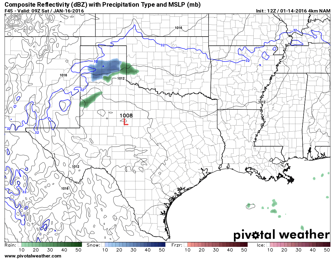
Simulated Radar at 9 AM Saturday

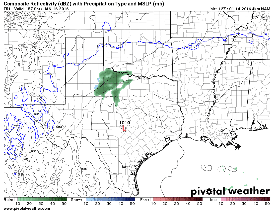
Simulated Radar at 3 PM Saturday
By late Friday Night into the early hours of Saturday the NAM develops an area of light snow across the Texas Panhandle. Surface temperatures in that region will be right around freezing. The precipitation totals will be light but a few folks could pick up half an inch of snow – maybe an inch in one or two places. With surface temperatures hovering around freezing I don’t expect too much in the way of road issues. By 9 AM Saturday this model run has moved the precipitation southeast into Northwest Texas, the BIg Country, and right on the door of western North Texas. Surface temperatures in those locations should be in the middle to upper 30s. Mid-level temperatures will be cooling but it appears that most precipitation will fall in the form of liquid rain. A rain/snow mix isn’t out of the question along the Red River but surface temperatures will be above freezing. A dusting is possible on grassy surfaces but no travel impacts are expected. By Saturday Afternoon the area of light rain has moved east through North Texas and is now in East and Northeast Texas. A few snow flakes may mix in closer to the Red River but by far most precipitation will be liquid rain.
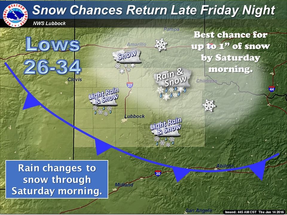
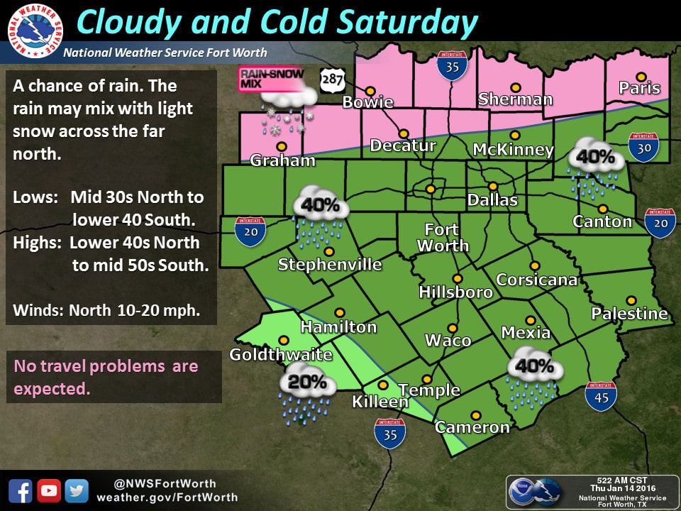
Since we’re still 36 hours out there are a few forecast uncertainties that need to be resolved. One question is how cold will the mid-levels of the atmosphere become while precipitation is falling. A second factor will be the wet-bulb effect which would help the atmospheric column cool more quickly and result in more snow. Finally we’ll have to refine exactly where we expect precipitation on Friday Night into Saturday. Regardless of the above uncertainties this will be a very minor event. If things end up a tad bit cooler than rain may mix with snow in parts of Northwest Texas and North Texas due to the wetbulb effect. Even if that were to occur surface temperatures will remain well above freezing and no travel issues would occur.


0 Comments