
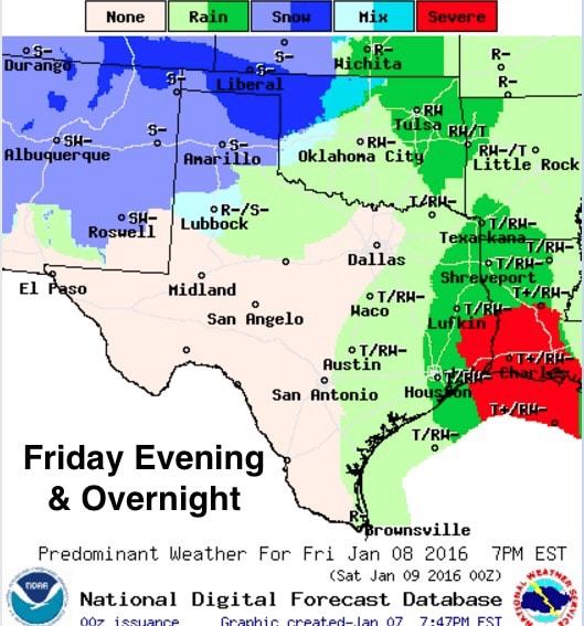
Friday will present a mixed bag of weather conditions across the state. A moderately strong Canadian cold front will begin to move through the panhandle early tomorrow bringing a chance of snow and wintry mix along with it during the day on Friday and through Friday night. Ahead of the front, temps will be quite warm with the chance for afternoon and overnight storms across east and southeast Texas as an upper level system arrives. That’s the Friday forecast in a nutshell. Now for some of the details…
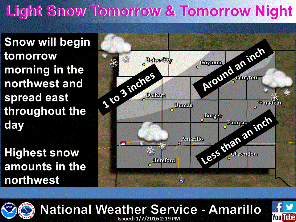
Snow is expected to begin early tomorrow morning across the northwestern portion of the panhandle spreading east during the day and overnight. From Amarillo northward, mostly snow is expected as temps are forecast to be right at about freezing for much of the day. Between Amarillo and Lubbock, the precip will start off as rain, then transition to snow once the temps drop to freezing by late afternoon into the early evening hours. For the rolling plains, mainly rain until after midnight when the temps here will finally dip below freezing. All winter weather issues should be heading east and out of the area by early Saturday morning. Highest accumulations will be across the northwestern Texas panhandle and western OK panhandle where a Winter Weather Advisory is in effect from 6am Friday to 6am Saturday for the counties of Cimarron, Texas, Dallam, Sherman and Hartley. This includes the following cities: Boise City, Keyes, Guymon, Dalhart, Stratford, hartley and Channing.
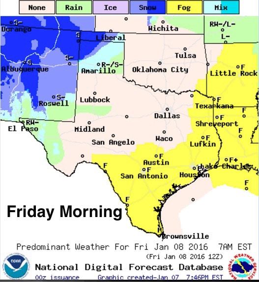
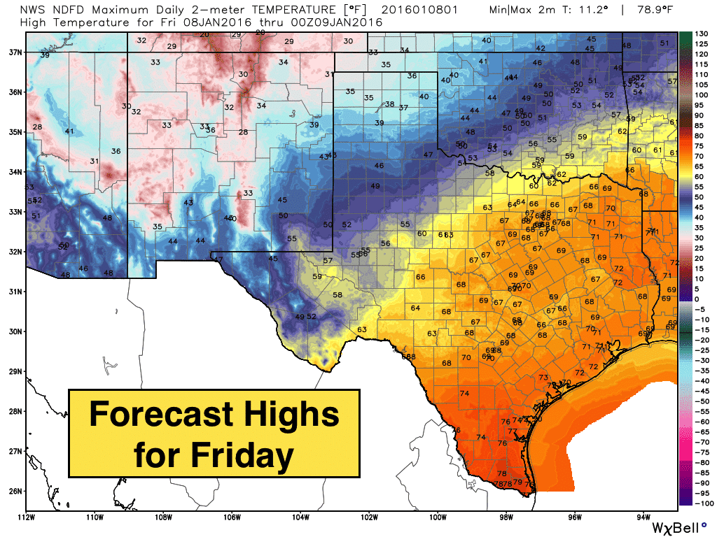
Further south tomorrow morning, widespread patchy dense fog will be likely once again across much of the Hill Country, South Texas, Southeast Texas and east Texas…so be prepared for that as you head out to work or school tomorrow morning. Temps will be quite warm tomorrow afternoon with upper 60s to low 70s expected as far north as western north Texas, north central and northeast Texas. Further south, mid to upper 70s will be likely across south Texas, with low 70s across southeast and up into east Texas.
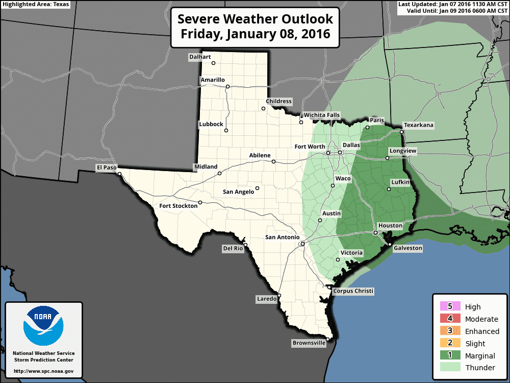
This degree of surface heating in combination with a moderate return of gulf moisture, plus lift from the approaching upper level disturbance, will set the stage for a few strong to severe storms to develop tomorrow afternoon and evening. A moderate amount of instability is expected across southeast up through east central Texas tomorrow afternoon where moisture levels will be highest. Scattered thunderstorm development is expected by tomorrow afternoon across parts of central Texas and southern north Texas, with additional development across southeast and east Texas by late evening and into the overnight hours. There’s still questions about the timing of the best lift from the approaching upper level system coincident with daytime heating, but we could see a couple of marginally severe storms develop with gusty winds and small hail as the main two threats. The threat for tornado development is not likely. We’ll be taking a look at the latest forecast model data starting to roll in as I type, and we’ll have another update out by tomorrow morning, so be sure to check back with us! For those on the warm side of the state tomorrow, enjoy it because we’ll be back to more winter-like conditions by Saturday and into early next week!


0 Comments