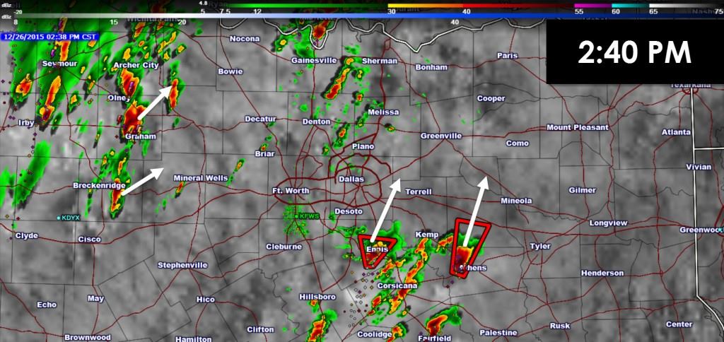
Several supercell thunderstorms are underway southeast of the D/FW Metroplex. These storms are moving north/northeast around 50 MPH. One storm is southwest of Ennis, a second south of Corsicana, and a third just west of Athens. These storms are all showing strong rotation and may produce tornadoes as they move north/northeast. Additional thunderstorms are developing across western North Texas. A ‘lull’ is underway from the D/FW Metroplex into western sections of the metro. I’m watching this area closely since there is a chance storms could start developing shortly. Any storm in North Texas that develops could become severe and potentially tornadic. A Tornado watch is in effect with most storms moving north/northeast around 50 MPH. We’re all out chasing so updates will be infrequent. You can track the storms with our free interactive weather radar, follow updates from the National Weather Service in Fort Worth, and tune in to local media for tornado coverage.
Texas Faces Several Days Of Severe Thunderstorms Ahead
https://youtu.be/zy9FD0hSq28 Daily chances for rowdy thunderstorms and windy conditions will be two weather concerns...


0 Comments