
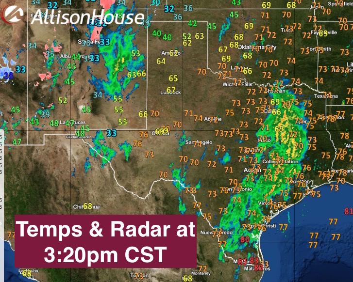
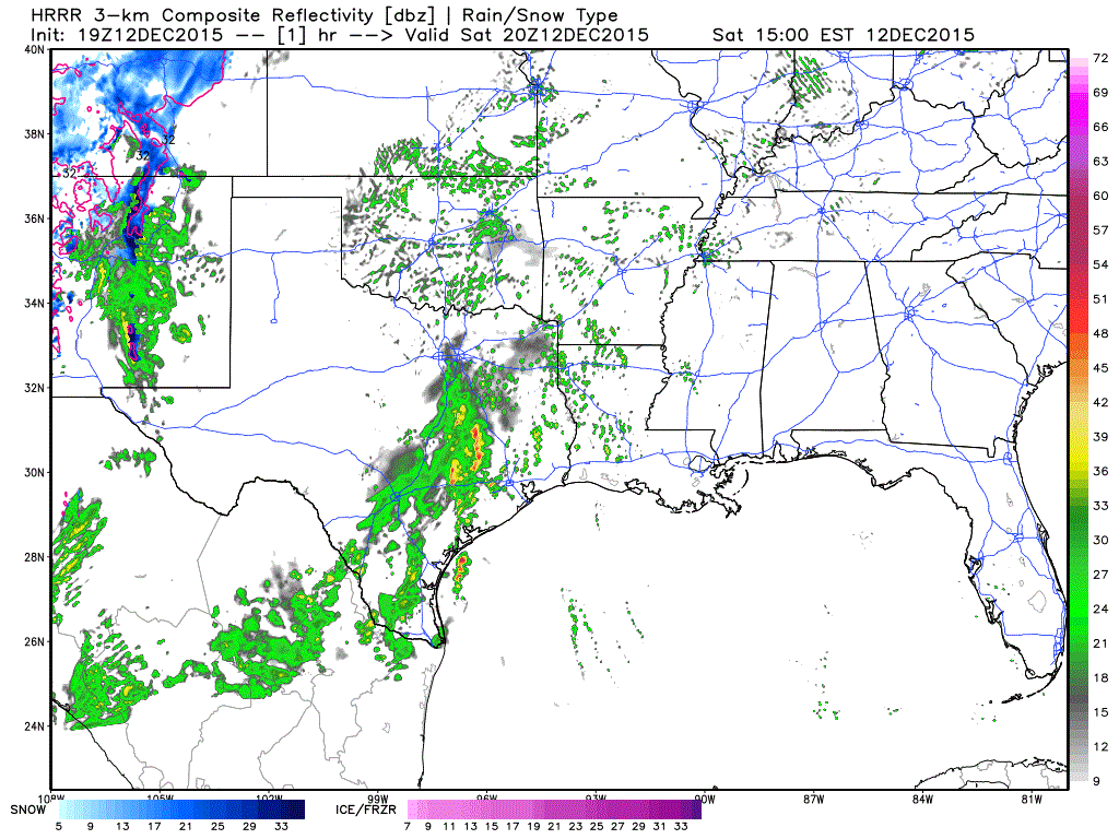
So far, just widespread scattered rain with some embedded thunder mainly along and east of I-35 stretching up from the Hill Country region into eastern north Texas. This area of rain will continue to develop and move to the east/northeast the remainder of the afternoon and evening. A few of the storms in this region could become severe, but that is conditional on surface heating which may or may not be achieved given the amount of cloud cover over the area. The main show is still expected to occur later this afternoon across the eastern panhandle/rolling plains as the front/dryline begins to approach and fires up a line of storms along its leading edge. The initial development along the front/dryline could result in isolated strong to severe thunderstorms with quarter size hail and high winds as the main two threats. The tornado threat is less than what we were seeing this morning, but we’re not going to rule that out completely, especially if storms develop ahead of the front across the eastern panhandle, rolling plains into northwest Texas where instability values will be greatest later this afternoon. After that, we’re expecting the storms to congeal into a squall line which will march east across the state during the overnight hours. Here’s a look at current radar, plus a look at the latest run of the HRRR short-range forecast model which takes us to about 4am tomorrow morning. It’s animated, so give it a few seconds to load. We’ll continue to monitor and keep you updated as mother nature shows her hand this evening!


0 Comments