
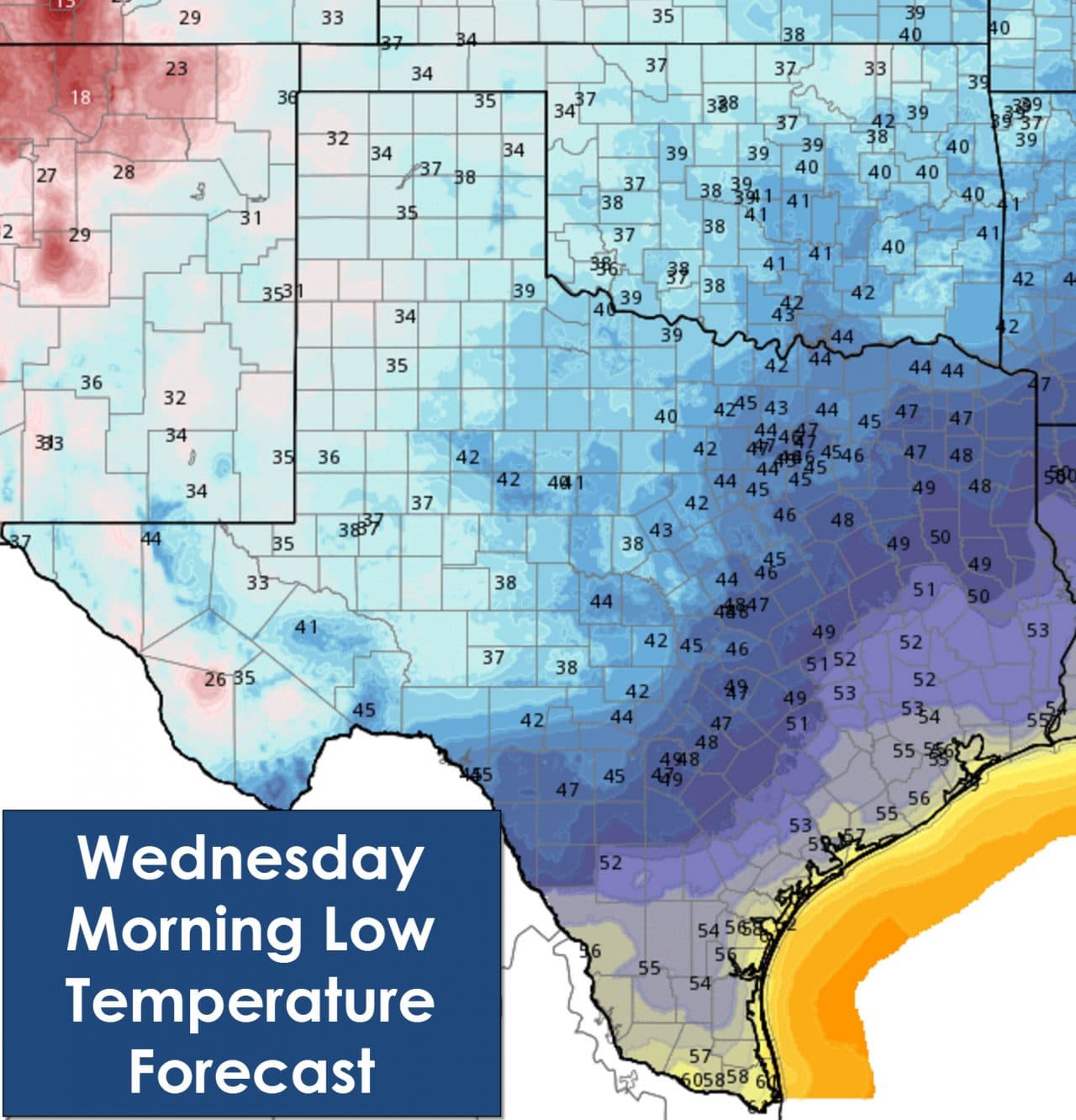
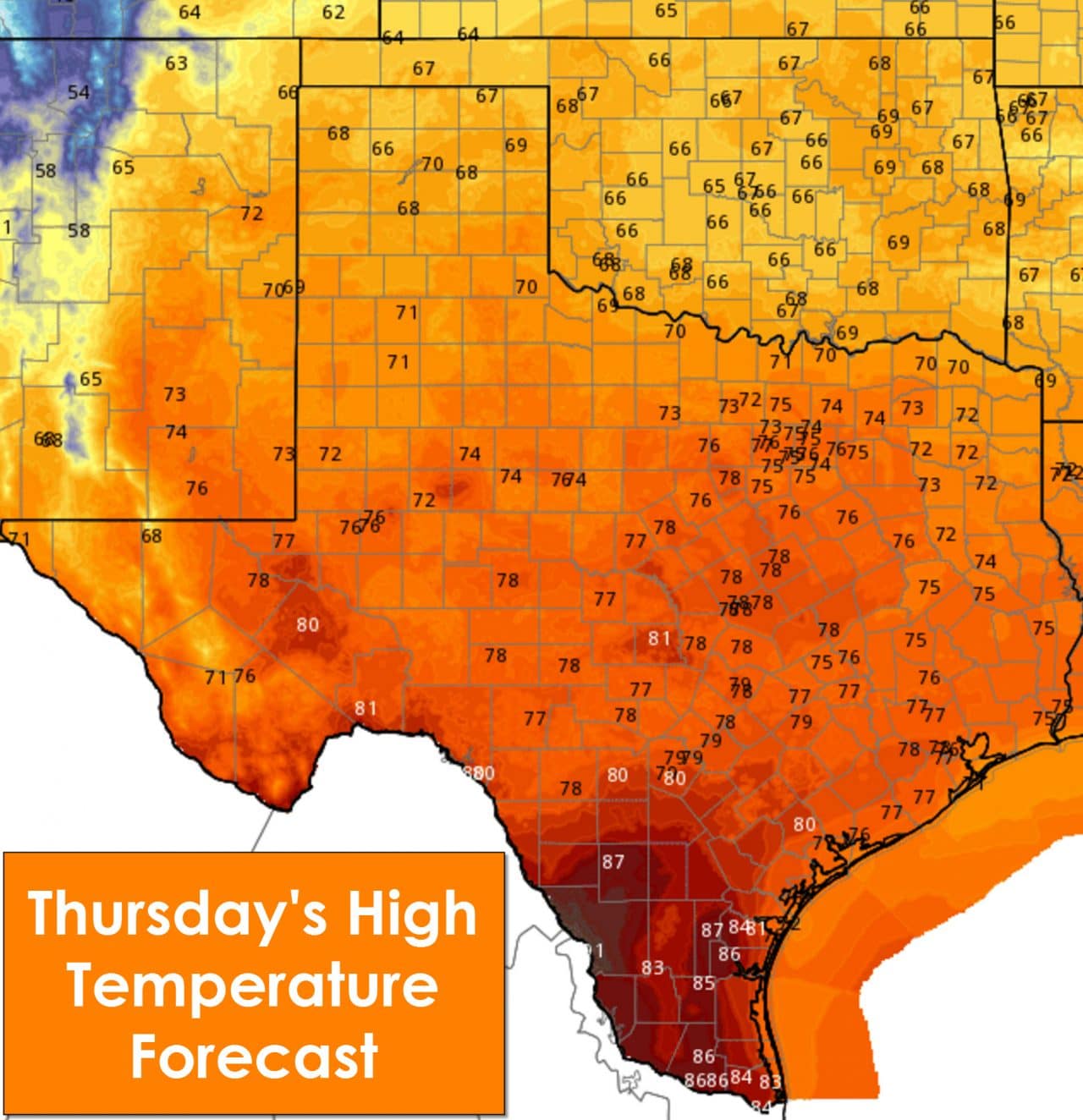
We’re starting out the morning with fog issues across South Texas, the coastal plains, and portions of Southeast Texas. At the time of this writing (shortly after 6 AM) the fog was infringing on the Houston metro. Corpus Christi is socked in with dense fog and will make for a rough morning drive. This morning’s fog will likely be a daily morning issue for the rest of the week as our weather begins to change. Moisture levels will continue to increase this week as we see southeast winds bring richer moisture in from the Caribbean and Gulf of Mexico. South winds will also allow for temperatures to remain well above average for December. Some locations will approach or even set new record high temperatures especially on Friday. Overnight temperatures will generally fall back into the 40s and 50s with 60s along the coast. By Friday night the low temperatures will likely be closer to 50-60 degrees along and east of Interstate 35 as higher dewpoint values spread inland.


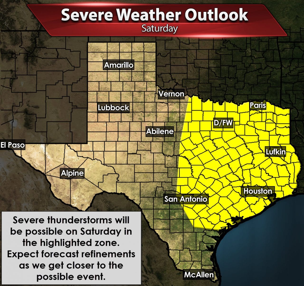
The unseasonably warm weather will come to an end after this weekend. The zonal jet stream flow will amplify out as a storm system makes landfall on the west coast of the United States. That storm system looks to arrive in Texas on Saturday. Timing will likely change somewhat as the storm system is currently located near Japan. Until we get the system in our upper air network in the United States we’ll be relying solely on weather model guidance. Uncertainty remains moderate with several factors still undetermined with the forecast. As of now we expect dry weather to continue through Friday Night if not Saturday morning. Increasing clouds and perhaps fog will occur Saturday morning with the overall feeling similar to an April morning. By Saturday afternoon we should see increasing shower and thunderstorm chances continuing into Saturday night and Sunday. The exact location of highest rain chances and timing will be refined as we get closer to the weekend. Based on the dynamic nature of the incoming storm system along with expected moisture levels there could be a severe weather risk Saturday and Saturday Night across the eastern third of Texas. The Storm Prediction Center has placed that region in a ‘standard’ risk of severe weather. Like the other aspects of this forecast the severe weather threat will also be refined.
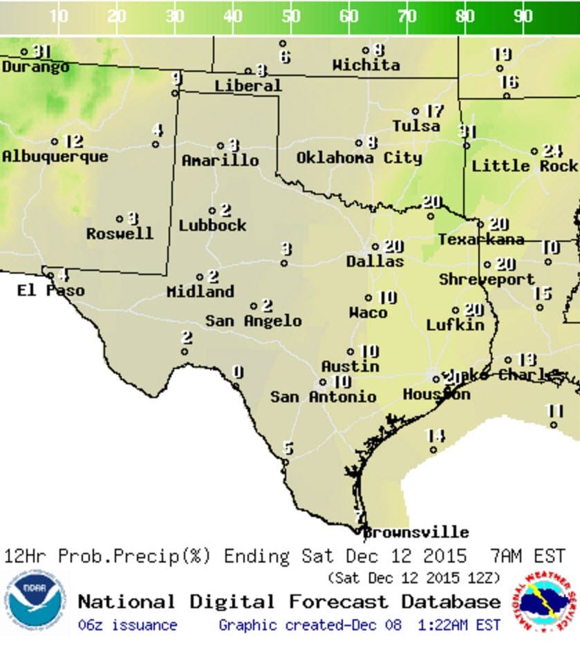
Chance of precipitation Friday Night
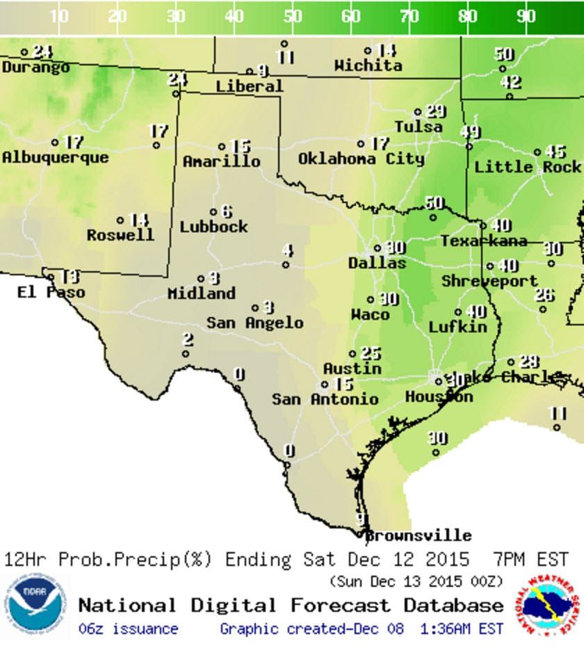
Chance of precipitation Saturday

Chance of precipitation Saturday Night


0 Comments