
Not much has changed since this morning’s blog with regard to the near record highs expected tomorrow and the chance for strong to severe storms Saturday into early Sunday. A pacific cold front is still on track to move east/southeast across the state late Saturday, with scattered rain showers developing early in the day Saturday mainly along and east of I-35. Once we get into peak afternoon heating, we’ll begin to see increased coverage of strong storms along and east of I-35, a few possibly reaching severe limits and carrying a threat for high winds and a couple of fast-moving tornadoes.
We need to be clear that the tornado threat is not very high, but it not completely zero either, thus worth mentioning especially as these storms will be reaching their peak by later afternoon and into the evening hours when people tend to be out and about. Instability still looks quite modest, but there will be sufficient wind shear (winds turning with height) for storms to develop rotation. Limiting factors will be how much heating can be achieved across this area Saturday afternoon with the lower atmosphere already tainted by early morning rain and extensive cloud cover.
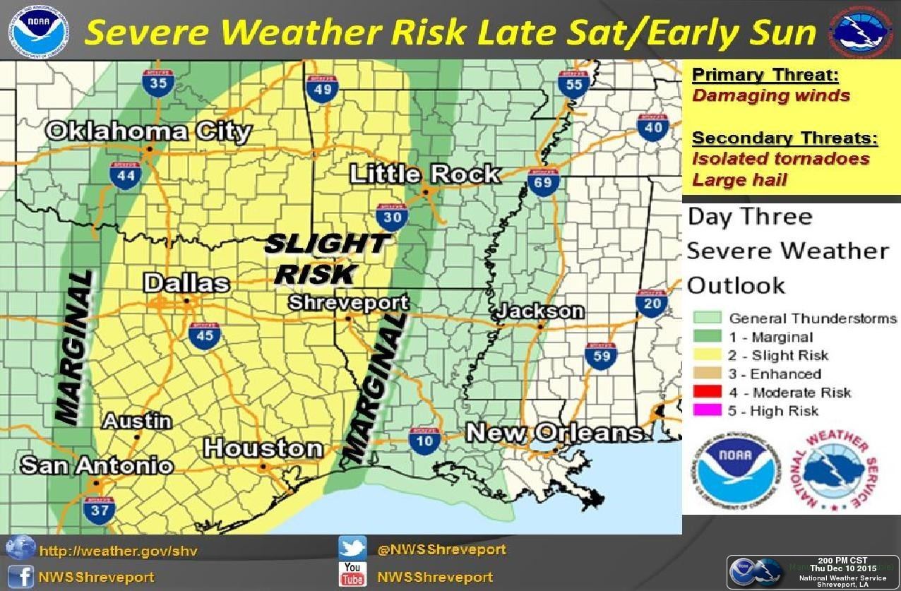
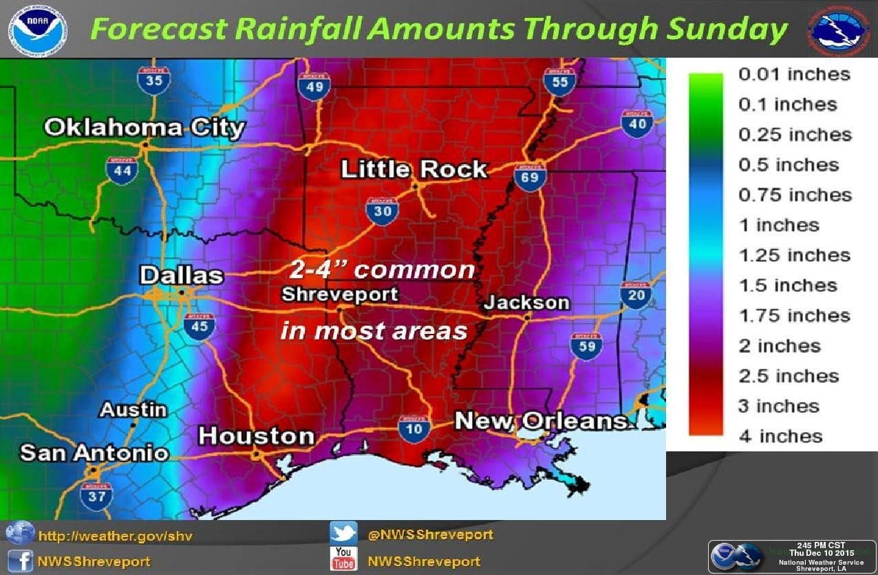
This main area of rain along and east of I-35 is expected to move into east/northeast Texas after midnight. Behind that, the pacific front will be working its way from west to east across the state. A secondary squall line of storms is expected to develop along the leading edge of the front and track across central and northern Texas after dark. Lightning and gusty winds will be the main threat with this secondary line. Eventually, the line of storms looks like it will catch up to and merge with the large area of rain across far eastern Texas and move out of our state and into Louisiana by early Sunday morning. While this system will be rather fast moving, it will dump enough rain across the eastern half of the state to raise concerns about some localized flooding. We won’t see extensive flooding like we saw last month across north and northeast Texas, but folks in flood-prone areas will need to make preparations for this possibility overnight Saturday into early Sunday.
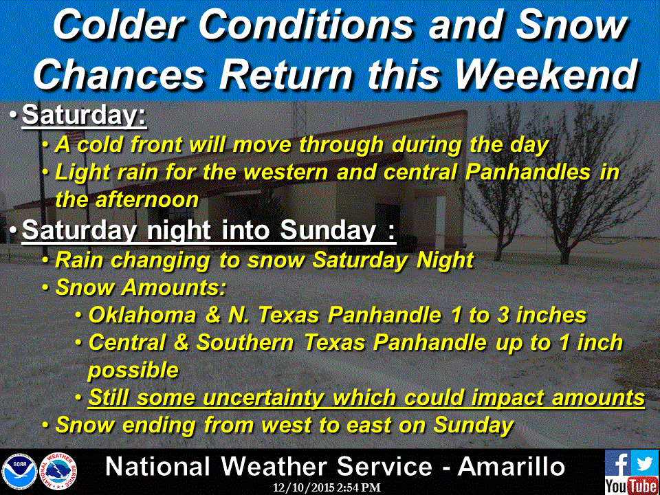
For the panhandle region, light rain is expected to develop by Saturday afternoon and transition over to light snow late Saturday night into Sunday morning. Today’s forecast model runs are backing off on the amount of snow expected and keeping the amounts over 2 inches off to the north across the Oklahoma panhandle and into southwestern Kansas. Across the southern panhandle, amounts between a dusting to 1 inch are possible. Since we’re still seeing a bit of variability between the various forecast models, we will likely see additional adjustments in the location and amount of snowfall expected across this region. Be sure to check back with us for updates as we get into the weekend!


0 Comments