
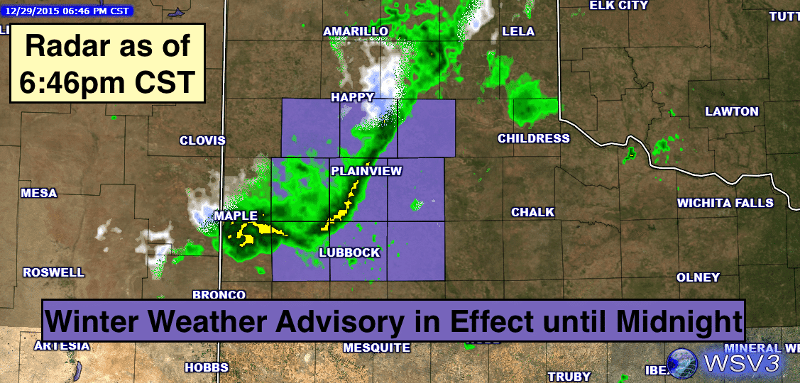
Let me begin by saying that even though the title of this evening’s blog will probably have folks a little concerned once again, this next round of wintry precip is NOT expected to be anywhere near as robust as what we saw this past weekend. We’ll get to that portion of the forecast in just a bit. Before then, conditions across the state will remain generally quiet for tomorrow and through most of Thursday. This evening, we have a band of light precip across parts of the Texas panhandle. So far, it’s resulted in mostly light snow across the central and southern portions of the panhandle, and for areas that have not yet dropped to freezing, reports are that most of the snow is melting once it reaches the ground. That won’t remain the case as temps drop below freezing, so a small section of the panhandle has been placed under a Winter Weather Advisory in effect now through Midnight tonight. Accumulations will generally reach between 1/2 to 1 inch before it moves east by early tomorrow morning. Further south along the coast, moisture has overspread the area and light drizzle and showers are expected on and off overnight into early tomorrow…and remain possible for the remainder of the work week. We could also see some patchy dense fog across parts of the Big Country/Concho valley regions of west central Texas by early tomorrow morning.
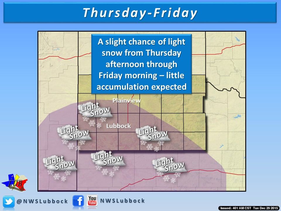
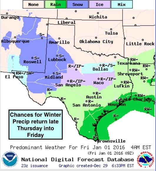
By Thursday, we’ll see a weak-ish upper level system moving in from the west which will begin to spread lift across the region and generate a mix of wintry precip across western Texas by Thursday afternoon, then into central and southern portions of north central Texas by early Friday. A weak cold front arriving by late tomorrow will help keep most of the moisture pushed to the south and to the west which means very little in the way of winter precipitation across north central Texas…but a few areas, mainly south of I-20, could see some flakes Friday morning. The bulk of the winter precip is expected to stay further west across parts of far west Texas, the Permian Basin and into the Big Country region Thursday into early Friday. Most of this will fall as light snow with minimal accumulations, but we could see a mix of freezing rain, sleet and light snow from about San Angelo over towards Waco and areas just south of the Dallas/Ft. Worth metro. This could result is some impacts to early morning driving, but widespread or crippling impacts are not anticipated. As temps rise above freezing on Friday, the wintry weather will come to an end and we’ll just see light rain/drizzle through the day into Saturday. 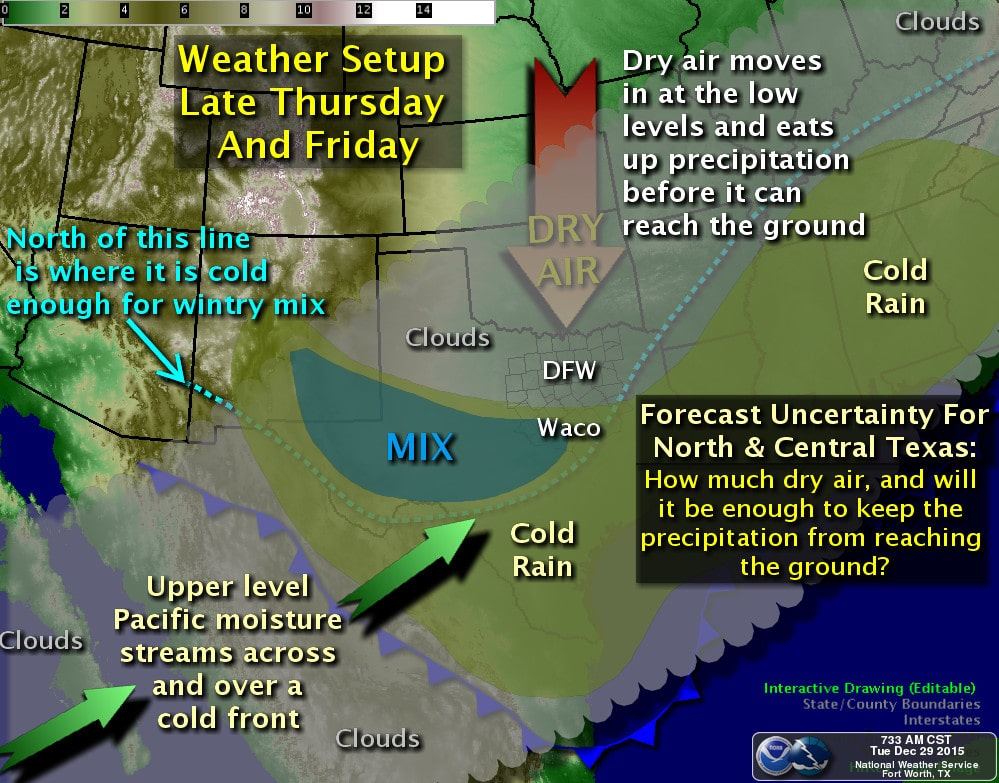
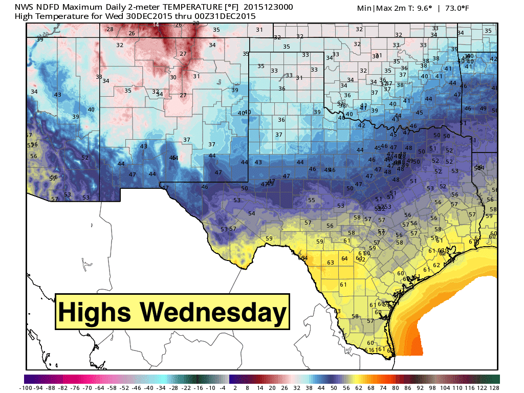
Lows tonight will drop down into the teens across the panhandle and west Texas where residual snowpack from the weekend’s storm remains. Further east and south, lows will generally be in the 30s and 40s, with a few 50s across deep south Texas. Highs tomorrow remain below average across the northern half of the state, with the southern/coastal areas reaching temps about average for this time of the year. 
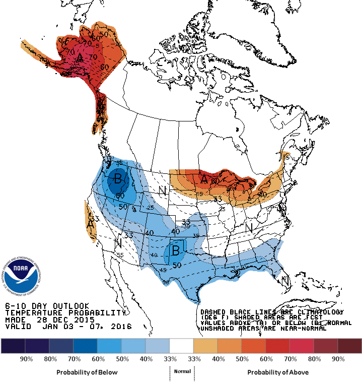
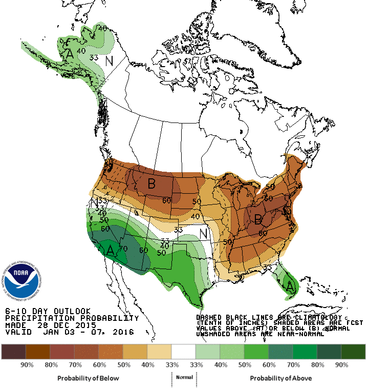
Temperature trends for the rest of this week and into next week are expected to remain a bit cooler than average, although we’ll see a slight warming trend as we head into next week. The latest outlook from the Climate Prediction Center keeps us below average in terms of temps through January 7th, and also keeps us on the wet end of the spectrum as well. As we continue to look ahead into next week, we’re not seeing any really strong signs of another arctic blast or winter event, but we’ll likely see at least a few chances for additional snowfall for western portions of the state, but that’s too far out in the forecast to have any certainty at this time. As always, we’ll keep an eye on it and let you know when we know!


0 Comments