
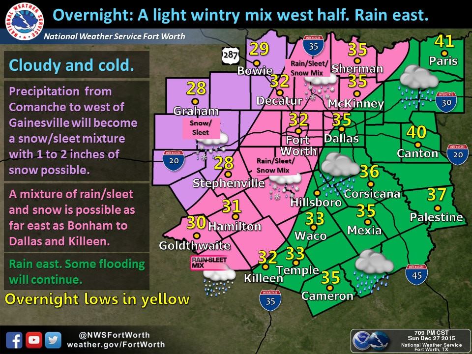
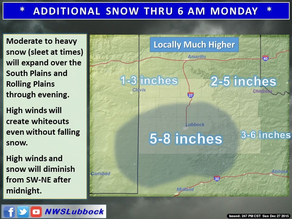
Widespread bands of snow continue to pound the northern portions of west Texas from the northern Permian Basin up into the rolling plains, southern and central panhandle. Sleet and freezing rain has also been reported across a wide swath of western north Texas and also down across the western hill country region with accumulations ranging from light to over 1/4 inches. As the low pressure system continues to move northeast overnight, winter precip will continue to move northeast with it and expand further east across north central Texas by late tonight. Temperatures across western north Texas are currently hovering close to and just above freezing, but once they dip below freezing overnight, we expect to see a changeover to all snow with accumulations ranging 4 to 8 inches for areas west of Wichita Falls, and 1 to 4 inches expected further east. It’s likely that counties immediately west of Dallas Ft. Worth metro will see some accumulating winter precipitation overnight, but it will not be as crippling as what we’ve seen across the southern panhandle. The DFW metroplex itself will likely see some mix of winter precip overnight as well, but with temperatures not expected to drop down below freezing, no significant impacts to roadways tomorrow morning are expected at this time.
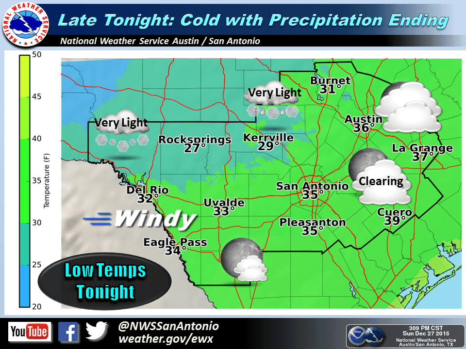
Further south across parts of the Big Country and northern Edwards Plateau region, temps will also drop to the freezing mark but the threat of winter precipitation is expected to remain on the lighter side with just a few inches of slushy accumulation on the roadways by morning. No impacts from winter weather are expected for the Austin or San Antonio metro areas.
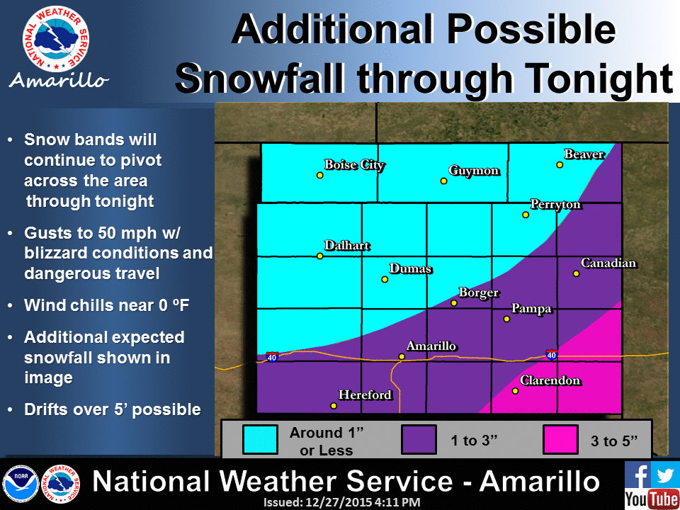
For the panhandle and rolling plains…both the blowing winds and heavy snowfall will begin to decrease by early Monday morning as the low pressure system continues to move northeast overnight. All of the snow should come to an end and be shifting east by mid-morning tomorrow, if not sooner. Clouds will also begin to scatter out and even with temperatures expected to remain below freezing across the area tomorrow, the sun’s radiant energy will begin to help melt the snow. It will still take multiple days for the region to dig out of underneath the feet of drifts, but at least the cleanup can begin.
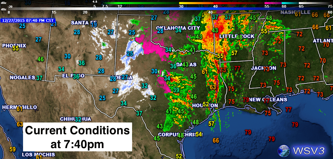
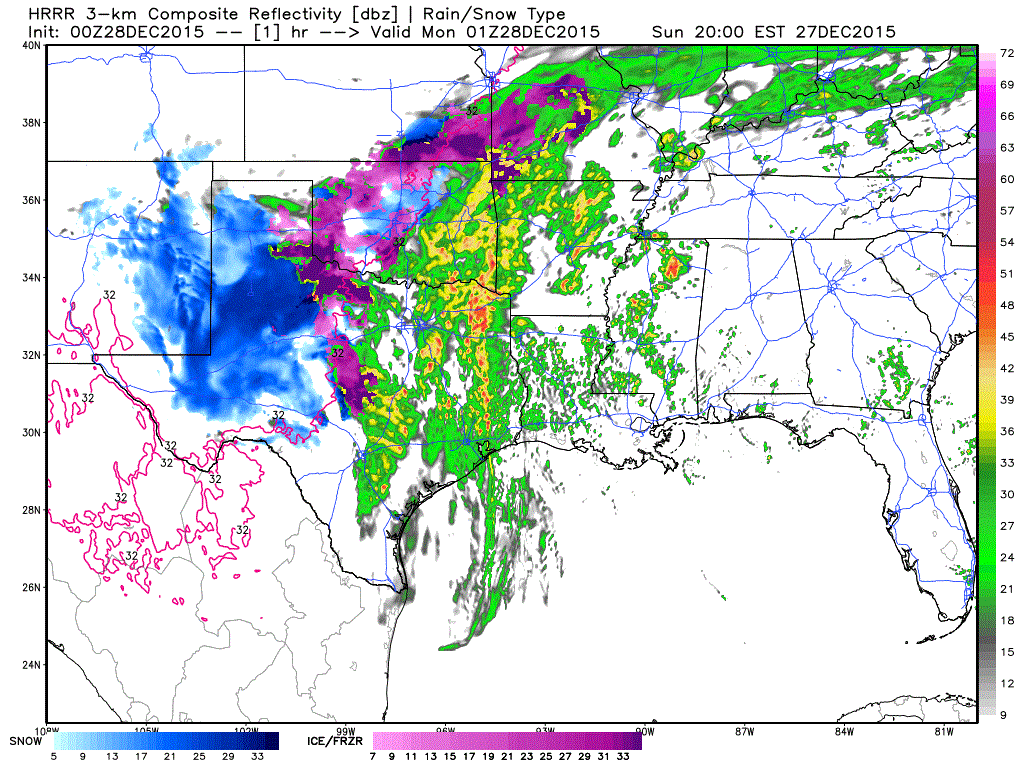
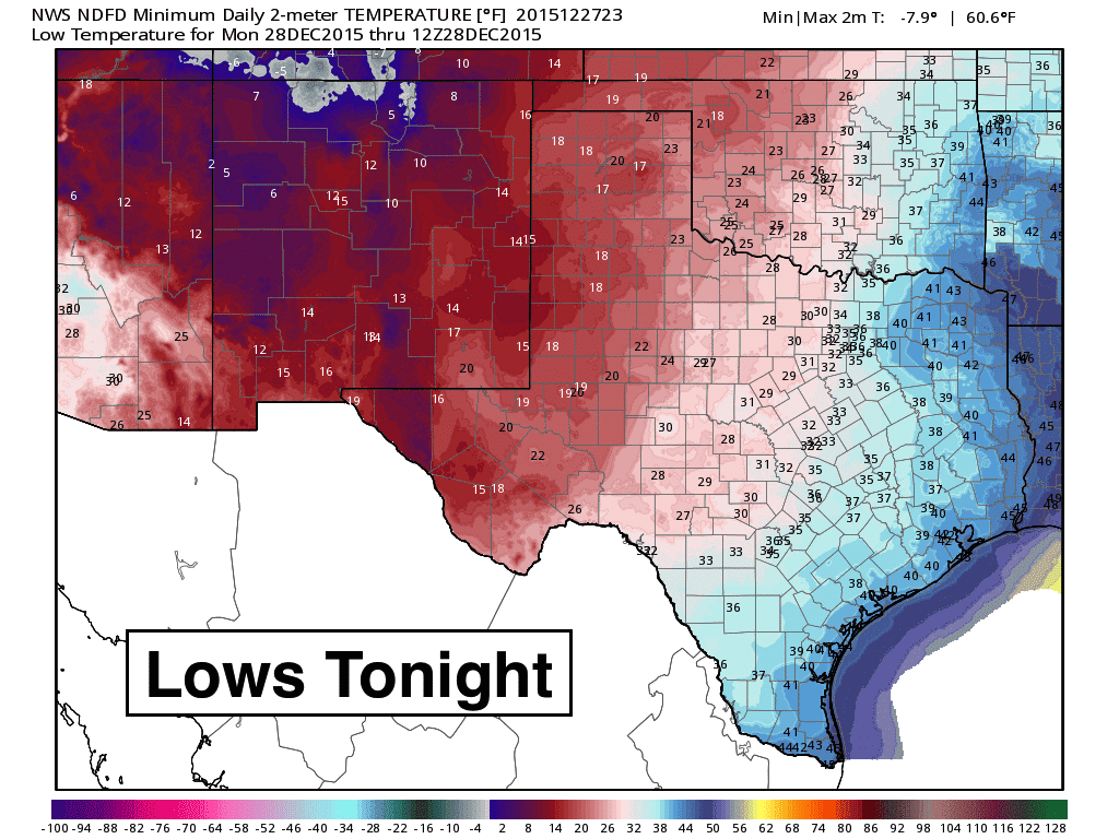
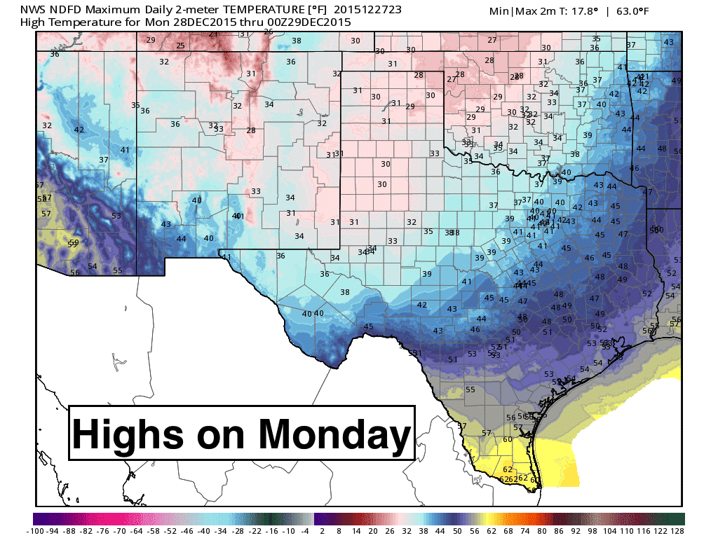
 Lastly, here’s a look at what the radar might look like overnight to about 10am tomorrow…plus our overnight lows for tonight and forecast highs for Monday. Temperature trends this week are expected to remain at or below average for much of the week.


0 Comments