
The gorilla snowstorm expected to impact the panhandle and western half of the state this weekend will not be the only travel hazards we’ll be dealing with this coming holiday weekend. We are also looking at the threat of strong to severe storms on Saturday and Sunday across the southwest, central, eastern and southeastern portions of the state. While details of this upcoming system are still in development mode, we’ll share what we know right now so folks planning to travel this weekend will have an idea of what to expect. (Note: Winter threats will be covered in a separate blog.)
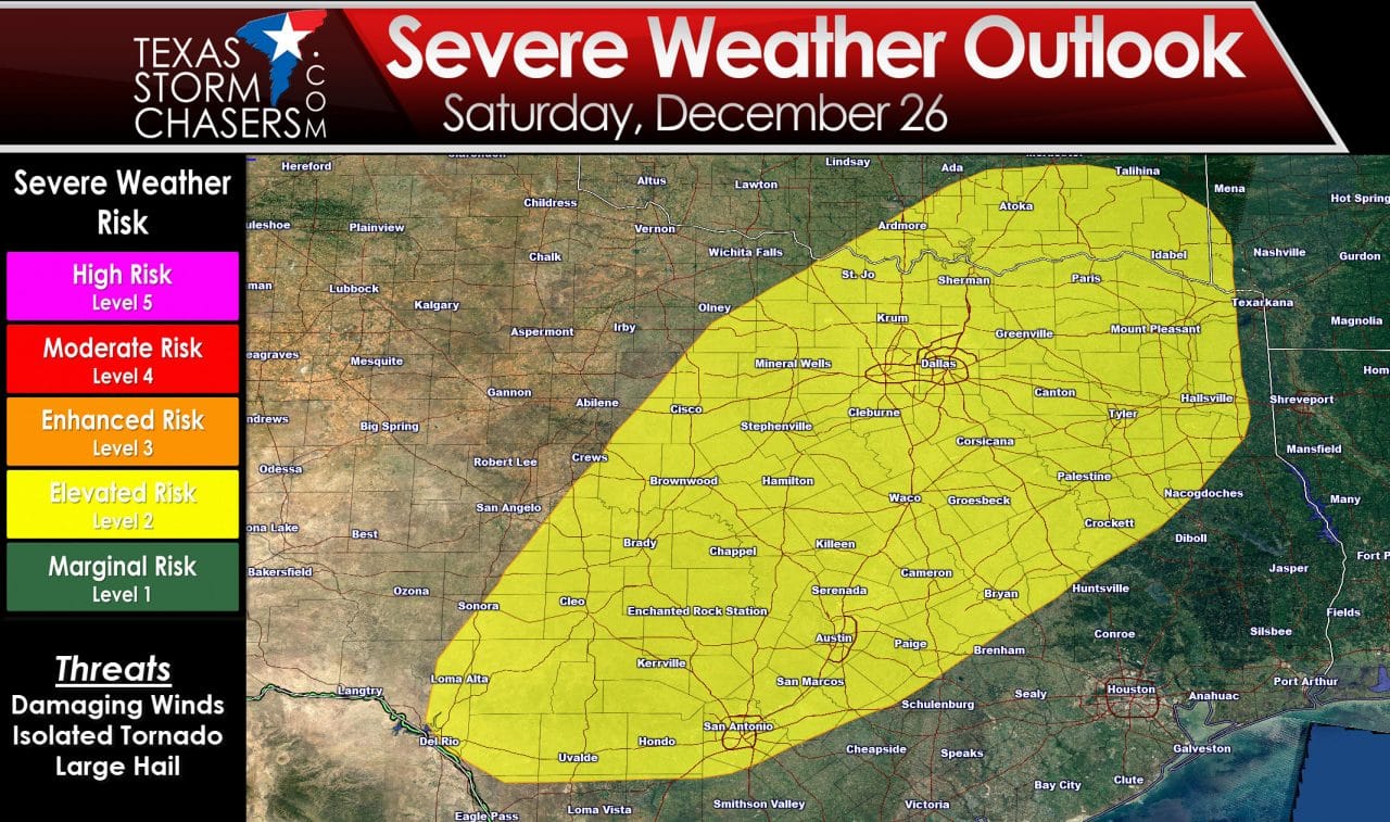
On Saturday, a strong cold front will begin dropping south across the state. Ahead of the front, unusually warm and moist conditions will be present which will generate a good amount of instability across southwest, central, north central and northeast Texas. Lift from an approaching strong upper level system will overspread the region and generate widespread rain and storm development throughout the day on Saturday. Ample wind shear will be present for a few rotating storms (supercells) out ahead of the front, with development of a squall line expected along the frontal boundary by Saturday afternoon as it drops south across north central down into southwest Texas. The most likely threats will be damaging winds and hail, but we will also have a chance at seeing a couple of tornadoes in any isolated development out ahead of the front, and a few spin-up tornadoes along the leading edge of the squall line as it marches southeast across the state Saturday afternoon and overnight into Sunday.
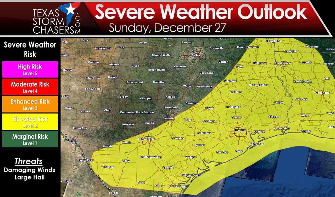 Sunday, the threat for severe weather will shift further south across central and southeast Texas as the squall line continues to move south along the leading edge of the cold front. Again, ample instability and shear will be in place for seeing isolated storm development ahead of the front plus impacts from the squall line as it moves through…both carrying damaging winds, hail and the threat of a few tornadoes.
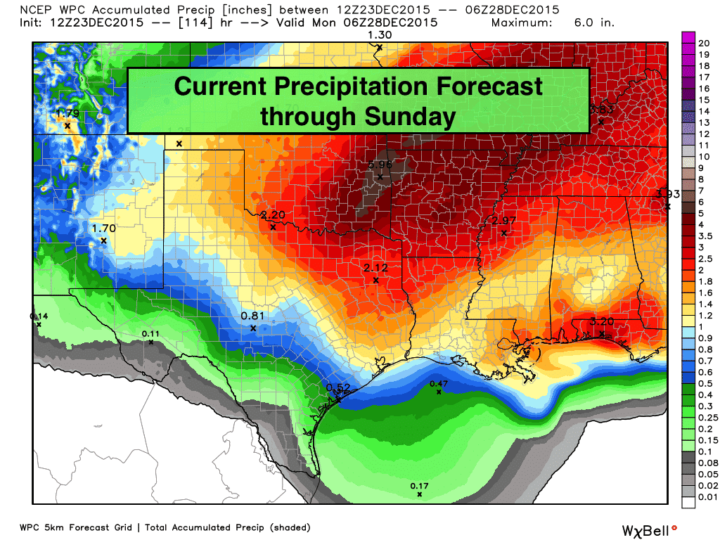
Very heavy rain with the threat of flash flooding will also be likely, especially across north central and northeast Texas Saturday into early Monday morning. Areas north of I-20 and along the Red River could easily pick up a good 2 to 4 inches of rain over the coming weekend. Areas south of I-20 across the eastern half of the state could see a good 1 to 2 inches. Locally higher amounts are also possible if we see storms training over the same area repeatedly. This is all still several days out, so the forecast is expected to change and refine itself over the next several days, so be sure to check back for additional updates as we get closer to the weekend!


0 Comments