
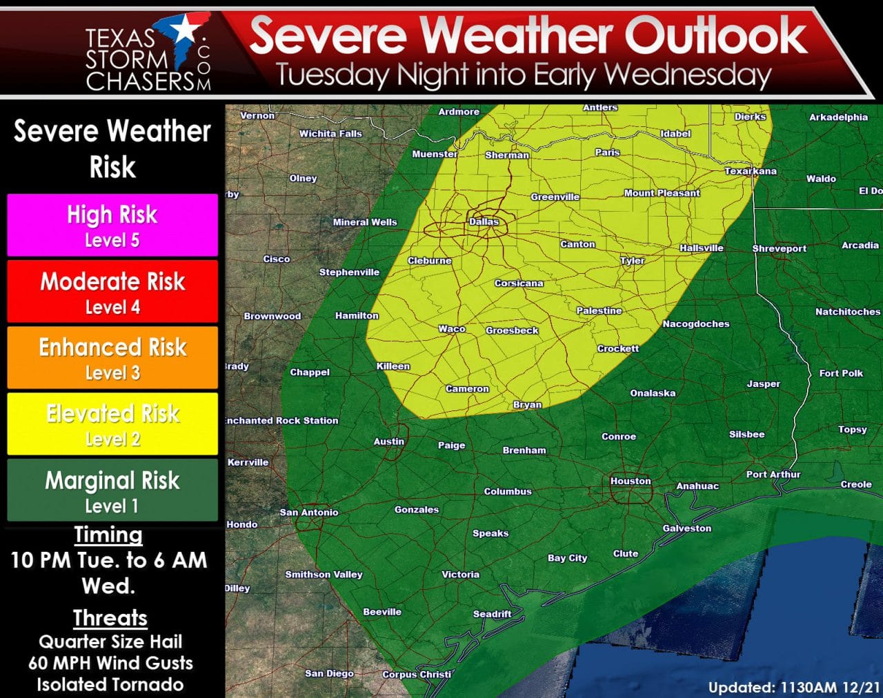
Good Morning! If you’re out traveling today I hope you have a safe journey. Hazardous weather is not expected today, tonight, or for much of Tuesday across Texas. Locally dense fog could be an issue Tuesday morning but no storm-related issues are expected until Tuesday Night. The new severe weather outlook for tomorrow night has trimmed back the area of elevated risk. The elevated risk (level 2) runs from North-Central Texas into Northeast Texas – including Temple, Fort Hood, Waco, the D/FW Metroplex, Sherman, Paris, Texarkana, Tyler, Palestine, and B/CS. A marginal risk does include Southeast Texas where a lower chance for an isolated severe storm will exist. As has been common this fall the timeframe for potential severe weather will be during the nighttime hours. Thunderstorm development should hold off until 10 PM Tuesday and be out of the state by mid-morning Wednesday. Widespread thunderstorms are not expected with coverage remaining scattered. The strongest of these scattered storms may become severe with localized damaging wind gusts, quarter size hail, heavy rain, and an isolated tornado. Storms will be booking it northeast around 40-45 MPH.
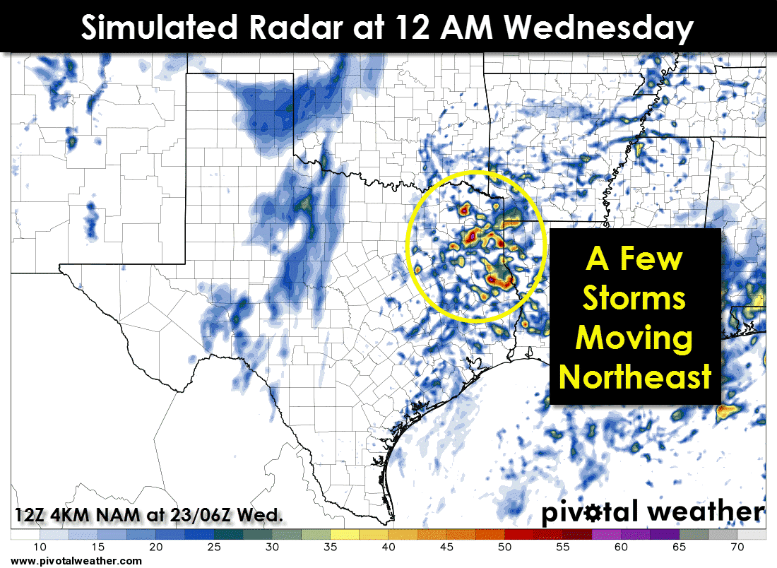
One high-resolution weather model has a few thunderstorms underway across Northeast Texas by midnight Wednesday. This model may be a bit too far east so don’t be surprised if storms actually fire up closer to Interstate 35. Widespread thunderstorm coverage isn’t anticipated but there will be some loud/strong boomers tomorrow night. El Nino Winters are notorious for winter severe weather events in that part of the state so I encourage you to check back for updates and remain vigilant for potential warnings tomorrow night. Jenny will have the latest forecast later tonight and I’ll be around all night tomorrow to keep you updated.


0 Comments