
Good morning and happy weekend everyone! Not much to talk about weather-wise this weekend. Kind of a “calm before the storm” scenario. Only we’ll not be dealing with storms next week…just a couple of surges of Arctic air and possibly some chances for wintry precipitation. That said, this weekend will be your final chance to finish your cold weather preparations if you’ve been putting it off…especially for folks anywhere from south central Texas and northward. But before all that, we have this weekend to get through which will overall not be that bad!
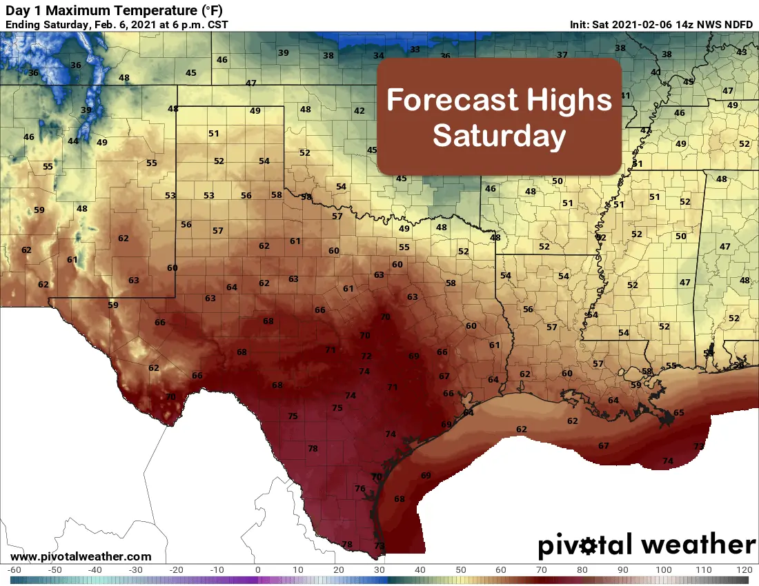
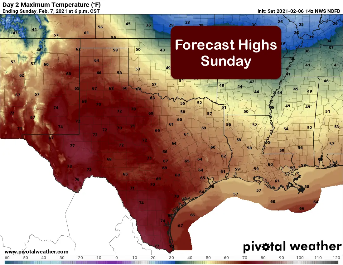
A weak cold front will push through the state today, but will not have that much of an impact on temperatures. Spotty rain chances will continue out ahead of the front today and will be shifted south and east as the front passes through. Behind the front later today….breezy and much drier conditions with plenty of sunshine once the front has passed. Sunday, winds will shift back around from the south again and we’ll see the return of partly cloudy to overcast conditions for the eastern half of the state while the western half continues to see mostly clear skies. Our high temperature forecast for today and tomorrow looks very nice ranging from the 50s and 60s across the northern half of the state with southern half of the state seeing temperatures climb into the 70s and maybe even a few low 80 degree readings across deep south Texas. Areas with lingering cloud cover today and returning cloud cover on Sunday will of course see temps remaining on the cool side.
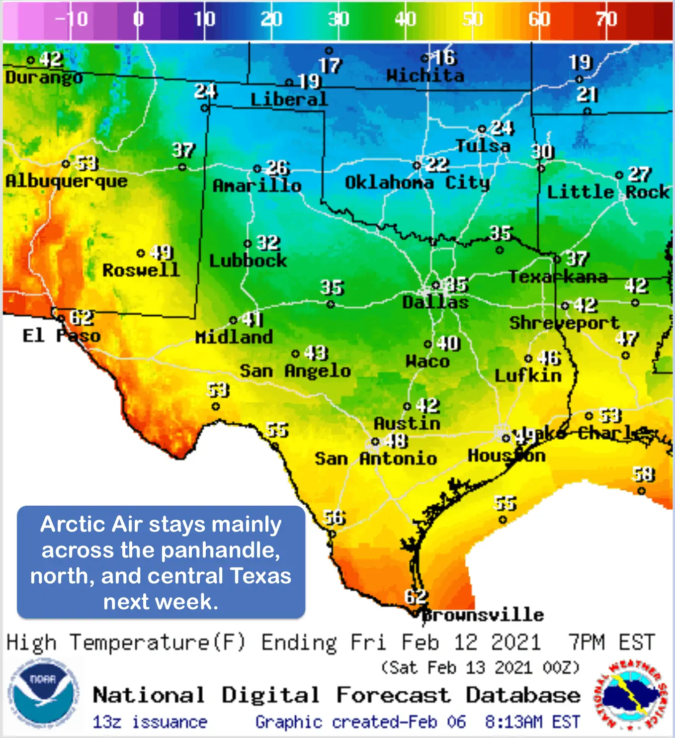
Looking ahead….at this time, we’re expecting to see two surges of arctic air. The first will happen late Monday into Tuesday, the second surge looks to hold off until the end of the workweek into next weekend. The good news on the first surge of Arctic air is that it will not impact the entire state. The coldest air looks to remain across north Texas and parts of the panhandle region and not make it much further south than central Texas. That means southeast, south central, deep south, southwest and even parts of far western Texas will not see any impacts from Arctic air early next week. A good example of that is the current forecast for high temperature next Friday depicted in the graphic below. For next weekend, there’s still much uncertainty in the forecast with regard to how much additional Arctic air will filter further south towards the coast and into deep south Texas, but the current outlook allows for freezing temperatures as far south as the Rio Grande Valley. Wintry precipitation is also possible primarily during the overnight hours next Wednesday into Thursday across parts of the big country, northern central Texas and up into north central Texas. Keep in mind…this forecast is likely to change as it’s still 4-5 days out…bit it’s worth noting now so everyone can be prepared.


0 Comments