
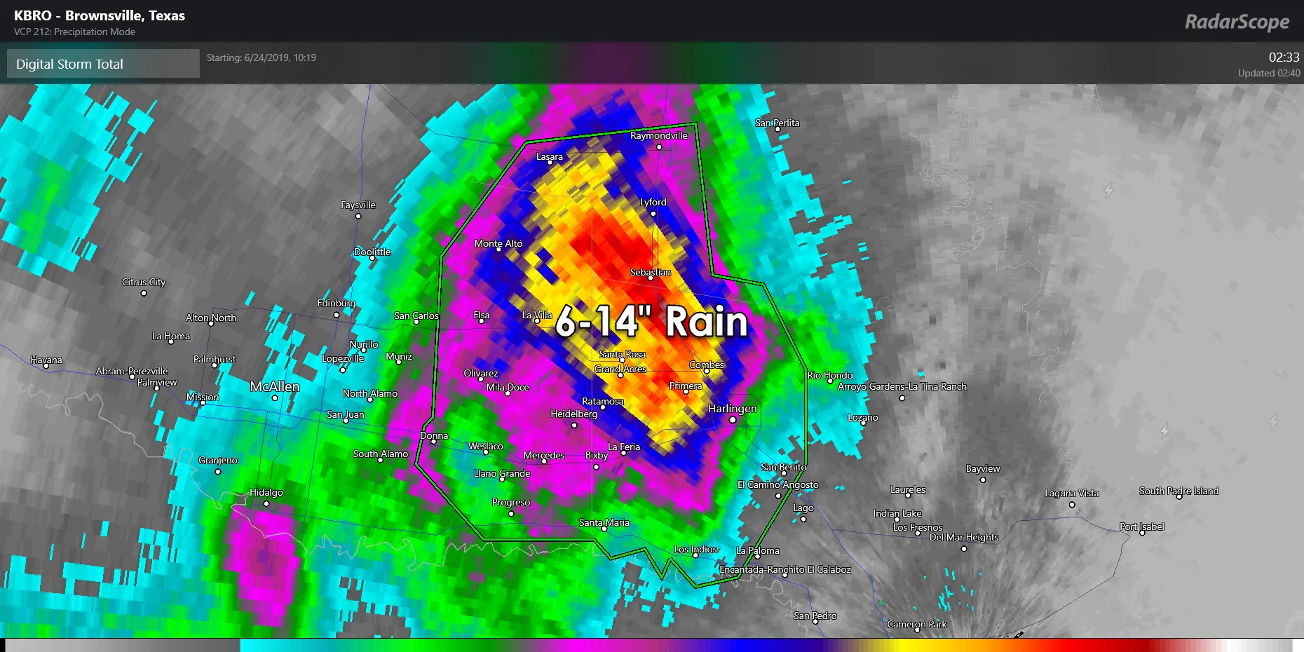
It was not a good night for the Rio Grande Valley. Our monster southward moving supercell yesterday afternoon and yesterday evening interacted with and merged with a cluster of storms. That merger caused storms to essentially stall out and begin ‘training’ over portions of the Rio Grande Valley overnight. The result was six to over twelve inches of rain in about four to five hours. We also had a tornado about 30 miles southwest of Brownsville in northern Mexico (verified with a tornado debris signature). Flash flood emergencies were declared and it sounds like there were numerous issues.
Of course, that doesn’t even get into the monster hailers experienced in West Texas and the Concho Valley yesterday. Wind shear values aloft were a bit stronger than expected (the opposite of Sunday). Combined with extreme instability the strongest storms ended up producing giant hail (larger than the size of a softball) versus the golfball to hen-egg size I expected in my forecast yesterday morning. We may have had a few tornadoes southeast of San Angelo yesterday too. Their National Weather Service office will probably be out conducting damage surveys today to confirm any potential tornado tracks.
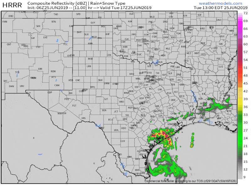
Simulated weather model radar from lunch-time all the way to 1 AM Wednesday.
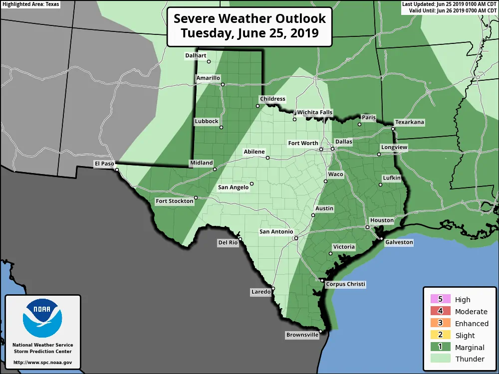
There will be two regimes for thunderstorm activity today. Both regimes will feature relatively weak winds aloft which *should* prevent a widespread repeat of yesterday’s hail extravaganza. This will be much more of a typical ‘summer’ day of thunderstorm chances versus the springtime supercells we experienced yesterday. That being said, I’m sure mother nature will bring along a storm this afternoon in West Texas to prove me wrong.
In all seriousness, we could see a few stronger storms today. Localized damaging wind gusts of 55 to 65 MPH will be the most common hazard with the stronger storms (also known as microbursts). Nickel to golfball size hail may occur with some of the storms in the Texas Panhandle, West Texas, and the Permian Basin late this afternoon. Isolated flash flooding cannot be ruled out where we see any heavier storm lolly-gag along, especially if that occurs over an urban area.
Scattered showers and thunderstorms are expected by the late morning and afternoon hours across the Coastal Plains, Southeast Texas, the Brazos Valley, and East Texas. We could see some higher thunderstorm coverage thanks to an outflow boundary produced by the storms in the Rio Grande Valley overnight. The activity would tend to move northeast – with all storms producing dangerous cloud to ground lightning and some heavier rains. Dangerous lightning and locally gusty winds will be hazards to those outdoors. All of that mess should generally decrease in coverage around or shortly after dinner. Isolated thunderstorms could continue into the evening across Southeast Texas.
Back into western portions of Texas. Wind shear values will be weaker than what we experienced yesterday – and hopefully, that’ll prevent any repeat of the giant hail. Isolated to scattered thunderstorms could develop after 4 PM along remnant outflow boundaries and east of the dryline in the Texas Panhandle, West Texas, the Permian Basin, and into the Trans-Pecos. Like yesterday, we could see erratic storm motions with ‘splitting’ storms.
Generally, though, we should see a slow eastward movement. Storm coverage will decrease after 9 PM as we start losing daytime heating and have the cap start to strengthen. By the late evening, we should be thunderstorm free across western Texas. Again, the strongest storms could produce hail up to the size of golfballs (perhaps a bit bigger if we get a more intense supercell), localized damaging winds over 65 MPH, and isolated flash flooding.
You can keep tabs of any thunderstorm activity today with our free HD interactive weather radar here on our website and in our free mobile app. Today looks like it’ll be our last day of ‘organized severe weather’ for a bit as we enter a more typical summer-time pattern. In that regard, we also are not seeing any signs of tropical mischief headed our way for the next week. That’s good because I want to actually get a chance to do some website design and modifications – but Mother Nature hasn’t given me a chance!


0 Comments