
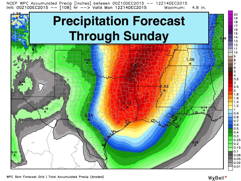
We have a wee bit of a wild forecast coming up over the next couple of days! Near record warmth is expected across much of the state Thursday and Friday. By Saturday, a strong upper level system will be approaching from the west bringing the threat of storms and flooding back into the forecast. Accompanying the upper level system, a rather unimpressive cold front will arrive and we’ll see the threat for some snow across parts of the Texas panhandle. I say unimpressive because it won’t have much of an impact on temps and we’ll be warming up again by Monday. Let’s start with a look at the near record highs for Thursday, Friday and for Saturday across parts of Texas ahead of the cold front.
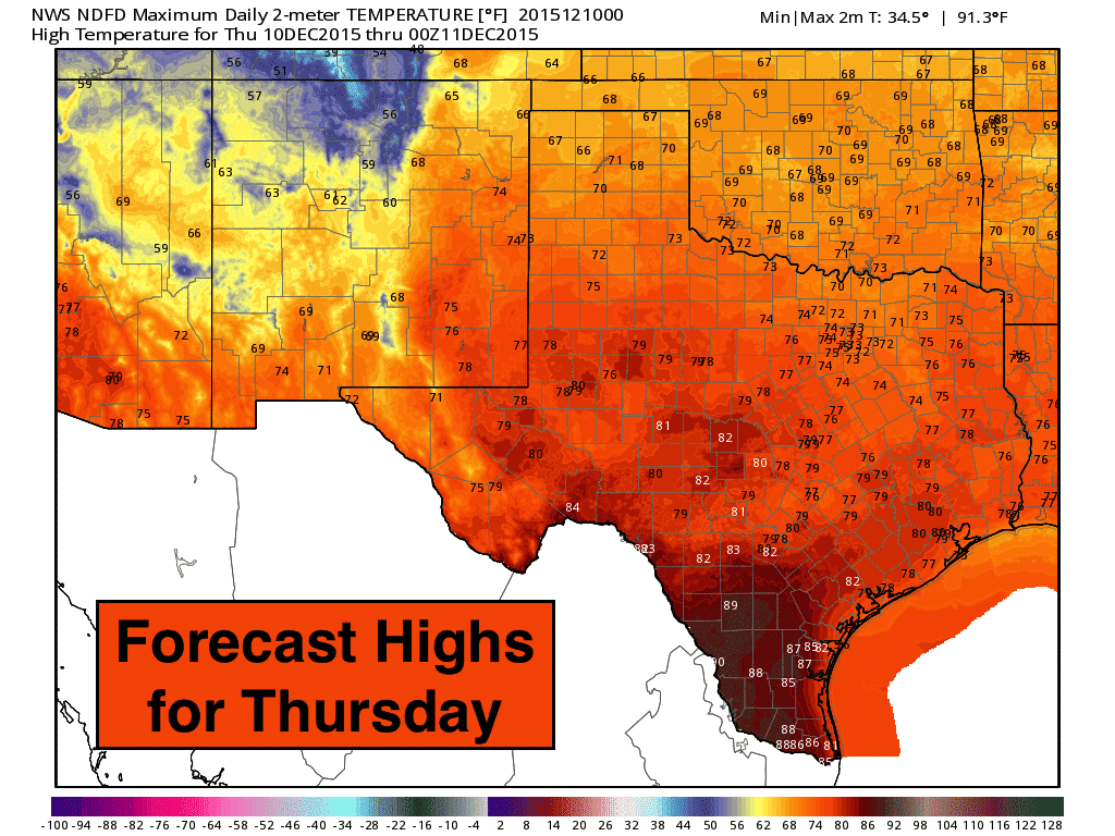
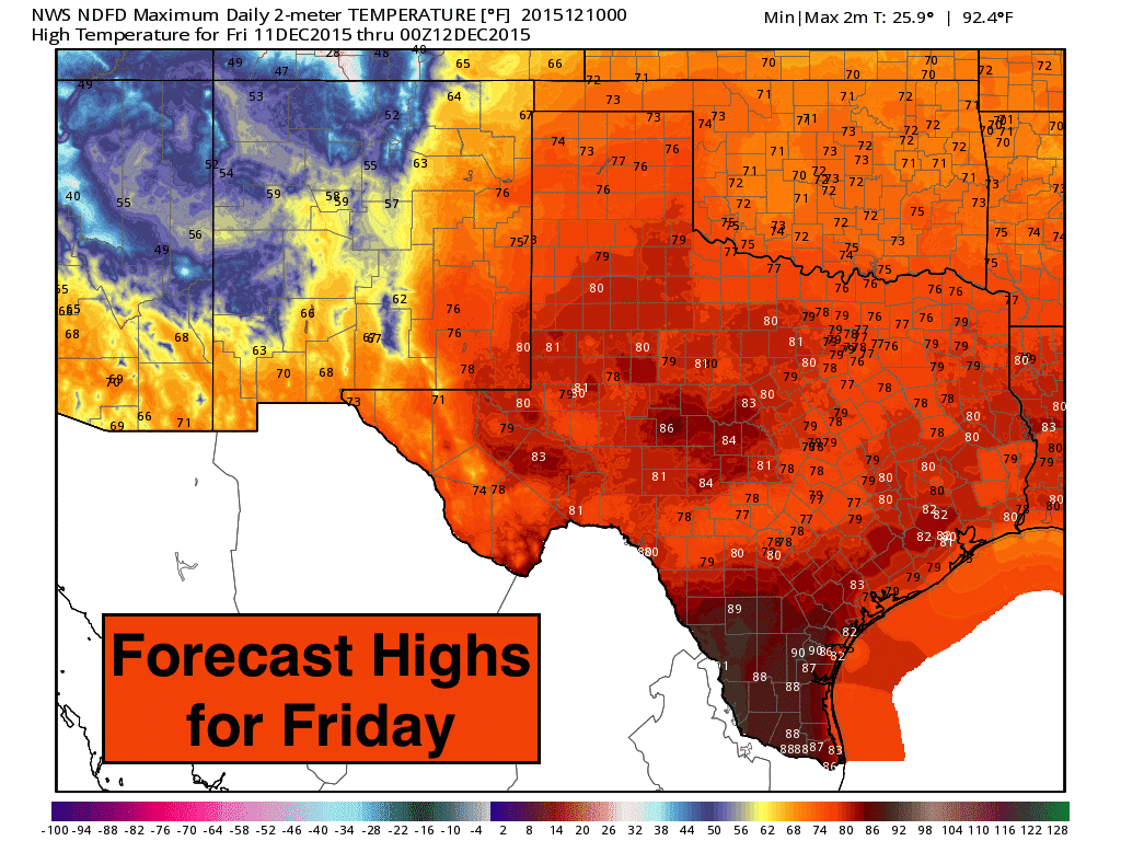
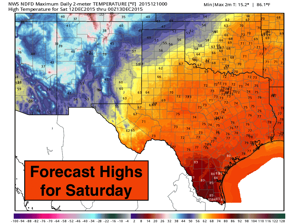
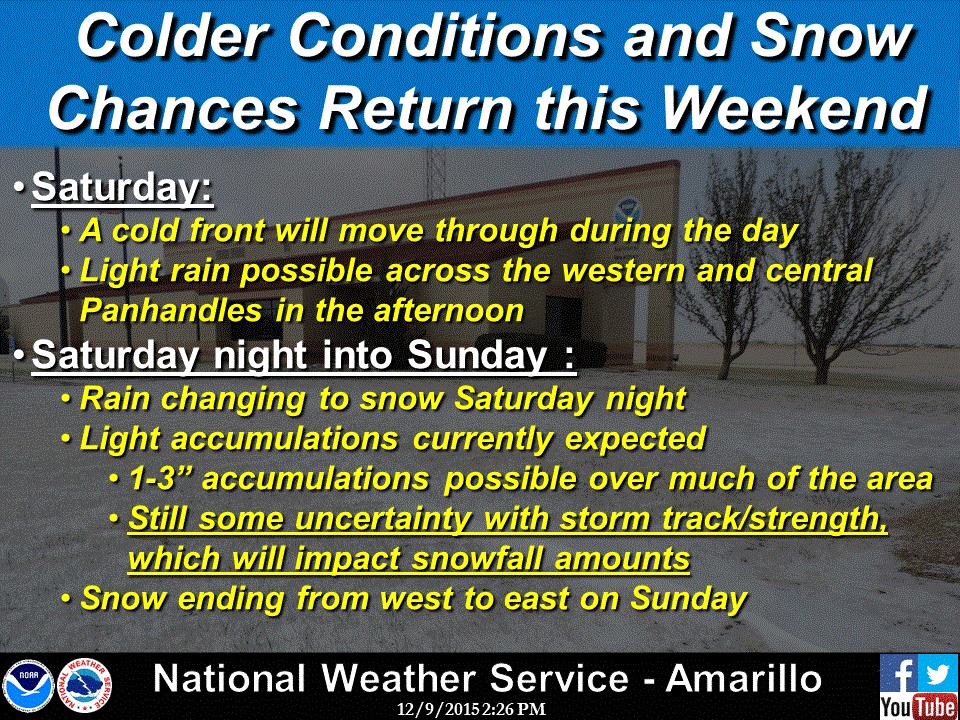
Friday will be the warmest day with highs near 80 across northern Texas and pushing close to the 90s in some locations across south Texas. Did somebody say t-shirt and flip flop weather for December???Saturday we’ll begin to slowly cool off from west to east as the front arrives, but it will not have a lasting effect as temps will begin to warm back up again by early next week. Not quite as warm, but still a little above average for this time of year. The chance for snow will be possible Saturday night into Sunday across the panhandle. There’s still some uncertainty in where and how much with only one of the medium-range forecast models (the European model) bringing anything over an inch into the region. Given the historical forecast accuracy the European model has exhibited with past winter events, local forecasters are going with a blend of model solutions settling on 1 to 3 inches likely across the region by early Sunday morning. This system will not reach the US to be ingested into our weather balloon network until late Thursday, so we’ll likely see a few updates between now and Saturday.
 Along with the arrival of the cold front on Saturday, we’ll see the chance for heavy rain and storms across the central and eastern 1/2 of the state Saturday afternoon and into the evening hours. Right now, instability levels are not looking all that impressive, but there will be abundant moisture and sufficient wind shear in place to generate a squall line of strong storms out ahead of the front as it moves east across the state…especially into the late afternoon and evening hours. High winds look to be the main threat with the line of storms, but a few embedded spin-up tornadoes are possible along with heavy rain and lightning. Training bands of storms will likely lead to flooding concerns overnight for areas east of the I-45 corridor. We will continue to monitor this and bring you the latest forecast developments as it gets closer!
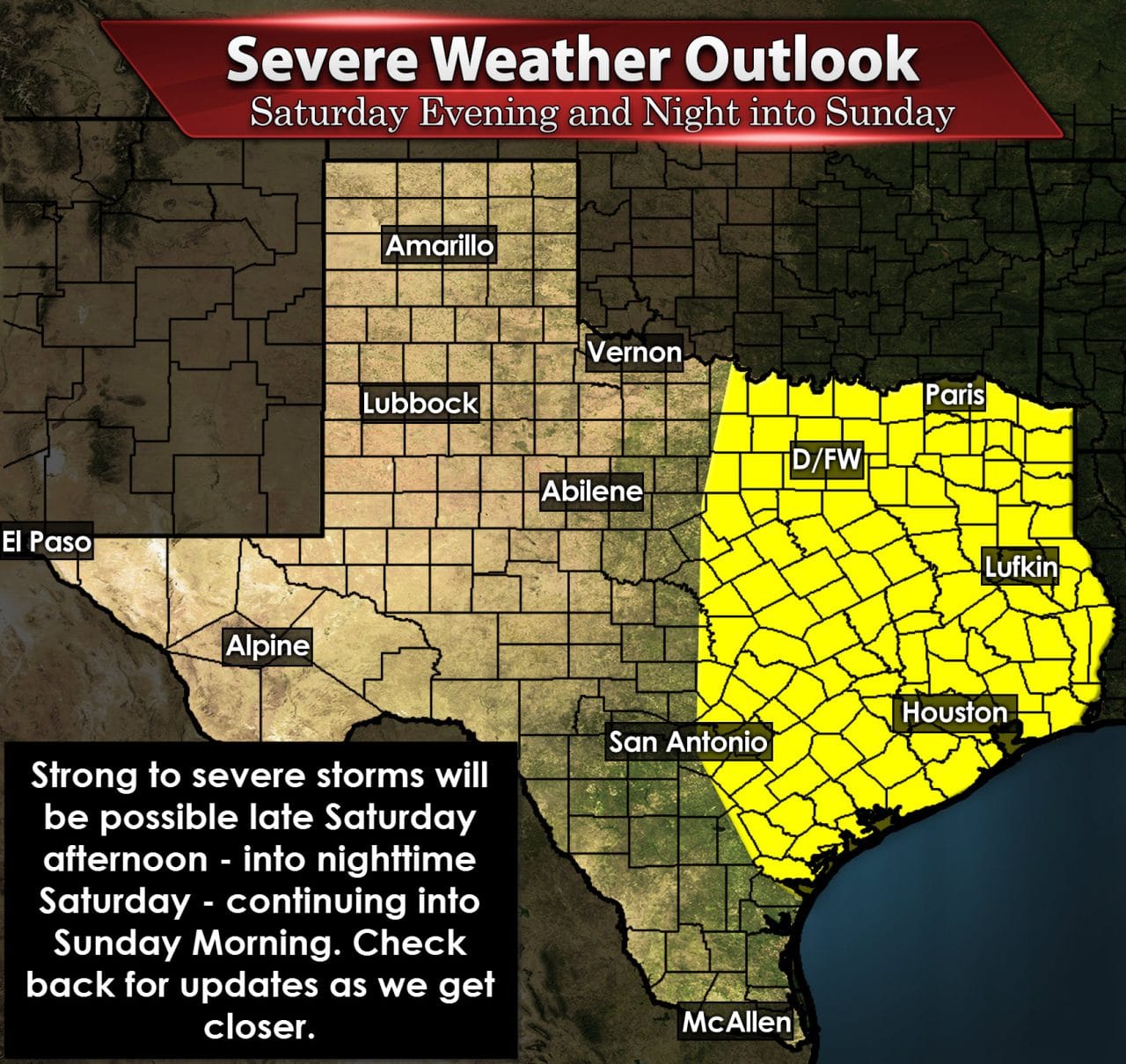


0 Comments