
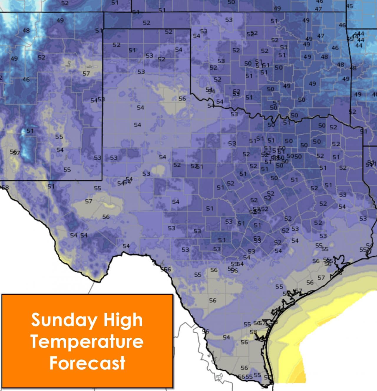
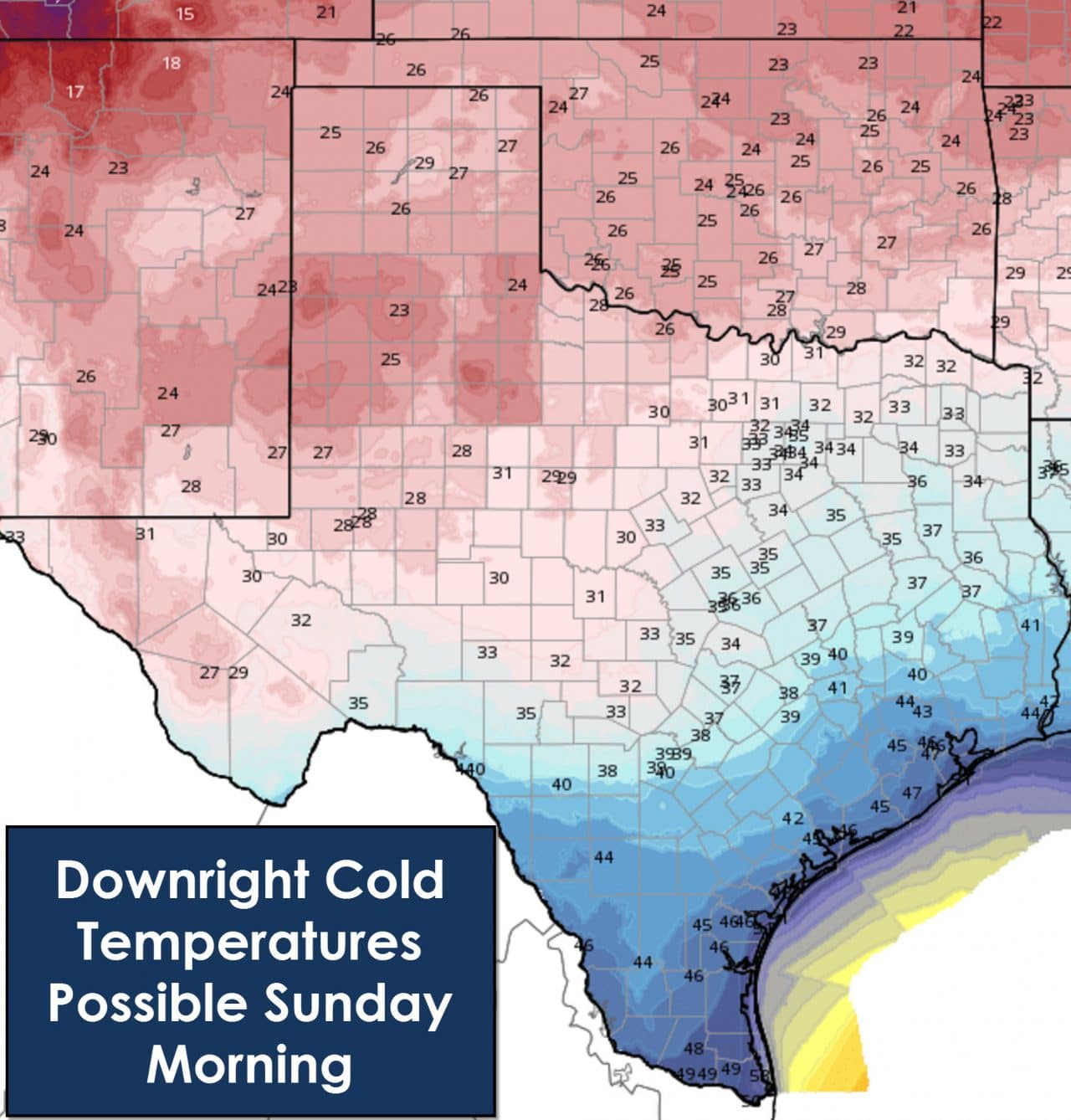
A strong cold front will push south through Texas beginning tomorrow and continuing into early Saturday. Winds behind the front will become gusty out of the north. Thanks to an established snowpack to our north/northwest the airmass won’t have as much time to moderate. We’re in for the coldest days so far this fall. We’re not talking about brutally cold arctic air but its going to be cold regardless. High temperatures this weekend across Texas will remain in the 40s to low/mid 50s. Low temperatures by Sunday morning will be quite cold across the state. Temperatures will drop into the low and mid 20s across the Texas Panhandle, South Plains/Rolling Plains. Mid to upper 20s are expected across the Permain Basin, Concho Valley, Big Country, Northwest Texas, and western North Texas. Low 30s are expected across the remainder of North Texas, Northeast Texas, and the Hill Country into Central Texas. Upper 30s to low 40s are forecast for Southeast Texas and South-Central Texas. Even in the Rio Grande Valley temperatures will drop into the 40s by Sunday morning. Obviously several areas will experience their first freeze of the fall. Be sure to protect those plants if you still have them outside. We are not expecting any winter weather precipitation with this system – although I may not be able to say the same in about ten days ;).
Most of Texas will remain dry with this system. However there is a chance of rain across Southeast Texas into Deep South Texas. We’ll refine the rain forecast tomorrow and have that in your daily Texas Weather Roundup blog. Have a good night and be sure to check out our 2016 weather calendar – just click on the store link up top!


0 Comments