
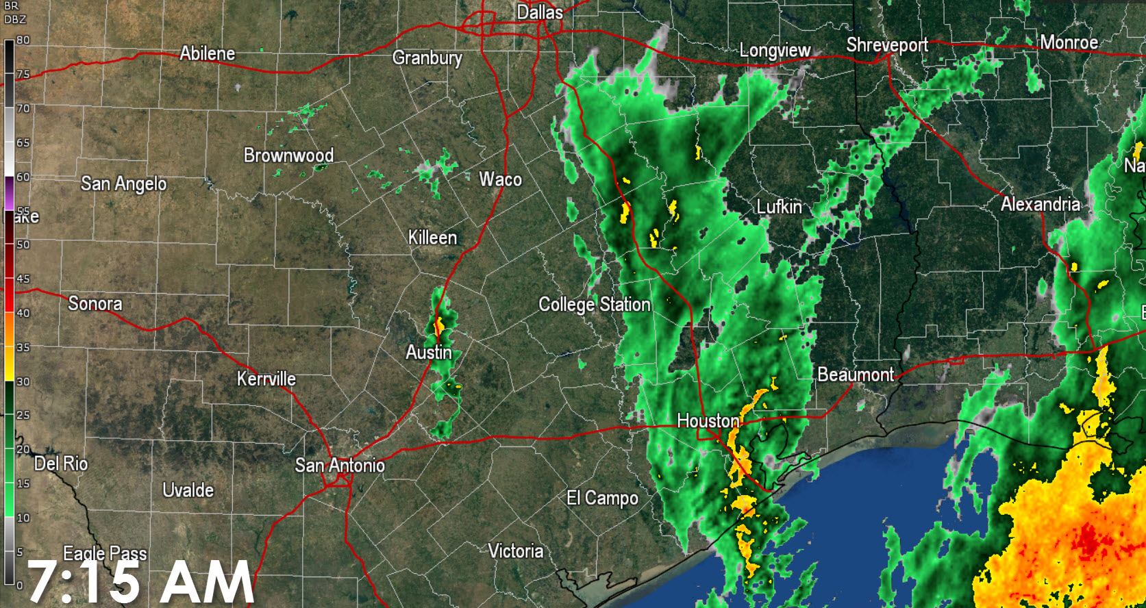
It’s already a wet morning across Southeast and East Texas. A fetch of moisture is helping to sustain a nearly solid band of light to moderate rain. Just after 7 AM this band was located from Galveston and Houston north right along Interstate 45 to Corsicana. It isn’t actually moving all that much but we should see an expansion off to the east today. Another small area of showers are impacting Travis and Williamson counties in Central Texas.
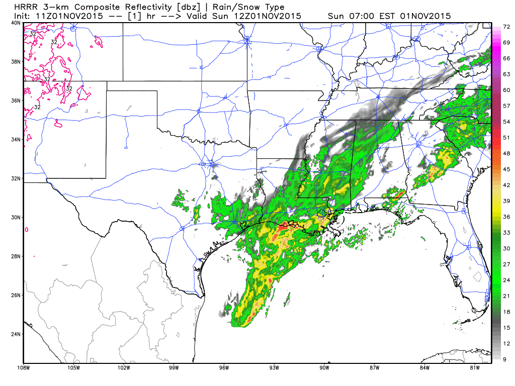
Simulated radar forecast through the afternoon hours

Chance of rain through this afternoon

Chance of rain tonight into early Monday morning
Scattered to numerous showers and a couple of storms are expected to continue throughout the day along and east of Interstate 35. The best chance of rain will continue to be across East Texas. We’re not anticipating any severe weather issues. Average rainfall amounts through this evening will range from a tenth of an inch up to half an inch of rain. Far East Texas near the Louisiana border could see a couple spots approach one inch of rain by Monday morning.
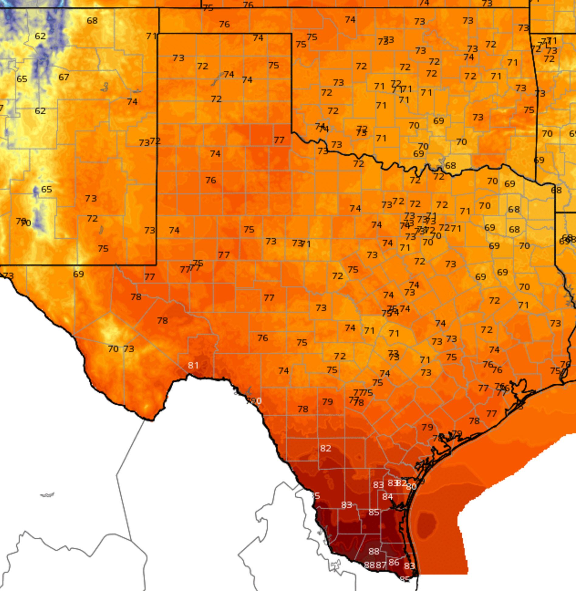
Sunday, November 1, High Temperature Forecast
Temperatures for the first of November will be seasonaly pleasant except for the Rio Grande Valley. The RGV will be hot (again) with temperatures topping out in the upper 80s. The remainder of Texas will enjoy temperatures in the 70s this afternoon with the western two-thirds of Texas enjoying a nice Sunday weather-wise.
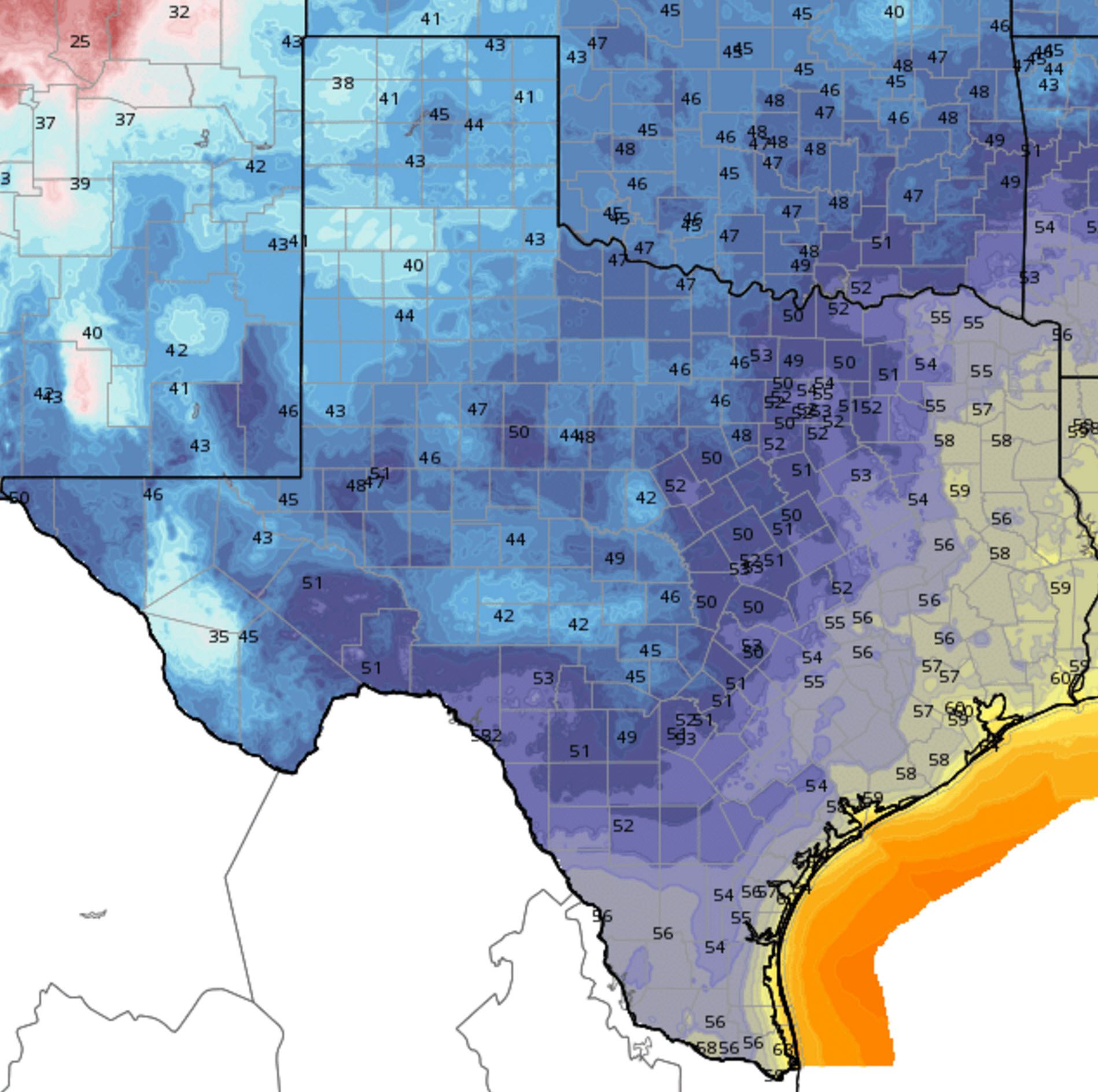
Tonight’s Low Temperature Forecast into the morning hours of Monday, November 2
Drier air across the western half of Texas will allow temperatures to fall back into the 40s tonight into Monday morning. A few of the cooler spots in the Panhandle, West Texas, and higher elevations in Southwest Texas may get into the upper 30s. East Texas, Southeast Texas, South Texas, and the Rio Grande Valley will fall into the 50s tonight.


0 Comments