
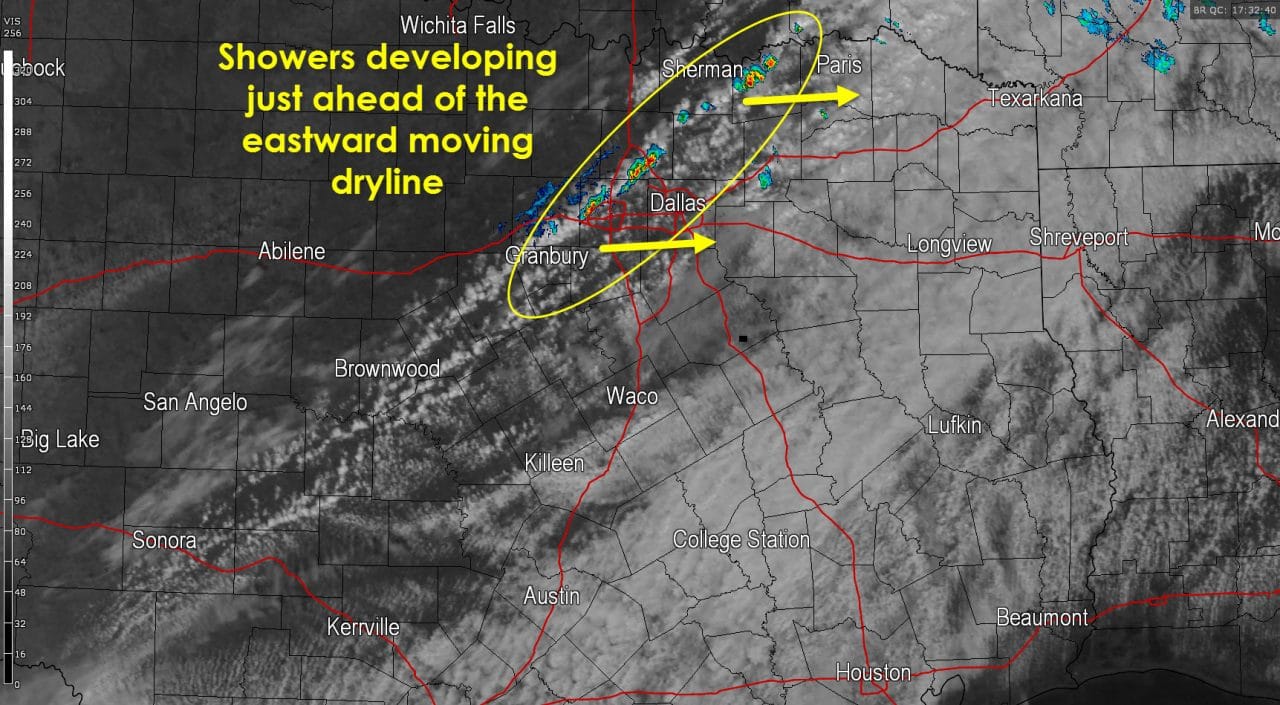
Isolated showers are developing just ahead of the dryline in North Texas. Two particular showers are impacting Bonham and Lewisville at the time of this writing. The dryline will continue to steadily move east into the afternoon hours. West of the dryline moisture levels quickly drop, clouds clear out, and west to southwest winds increase with gusts up to 40 MPH. Fire danger will ramp up quickly west of the dryline this afternoon so no outdoor burning is advised.
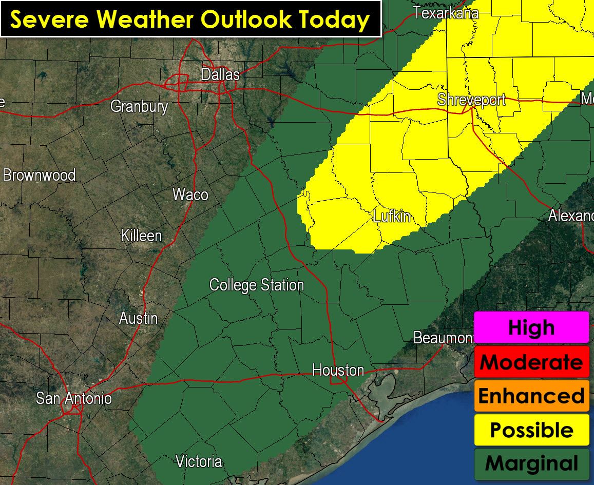
After 2 PM we may see a few stronger storms fire up in East Texas. Wind shear and instablity values will support the possibility of localized damaging wind gusts over 60 MPH and the possibility of quarter size hail. A very low tornado threat does exist but I don’t anticipate much of a tornado issue due to veered low level winds. A marginal/category one risk includes the Brazos Valley and Southeast Texas where an isolated severe storm may occur. A possible severe risk, known as a category two risk, includes East Texas where the risk for a few severe storms is slightly more likely. Individual thunderstorms will move northeast around 40-45 MPH with the line itself moving east. Thunderstorms may form a broken line this afternoon just east of the dryline/cold front. I expect most activity to be east of Texas by 7 PM this evening. Much drier and cooler air will filter in behind the cold front in time for your Thursday morning.
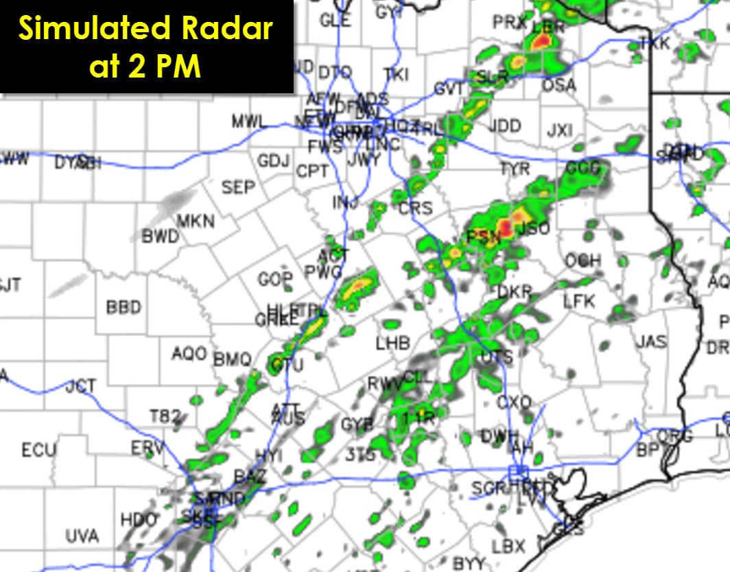
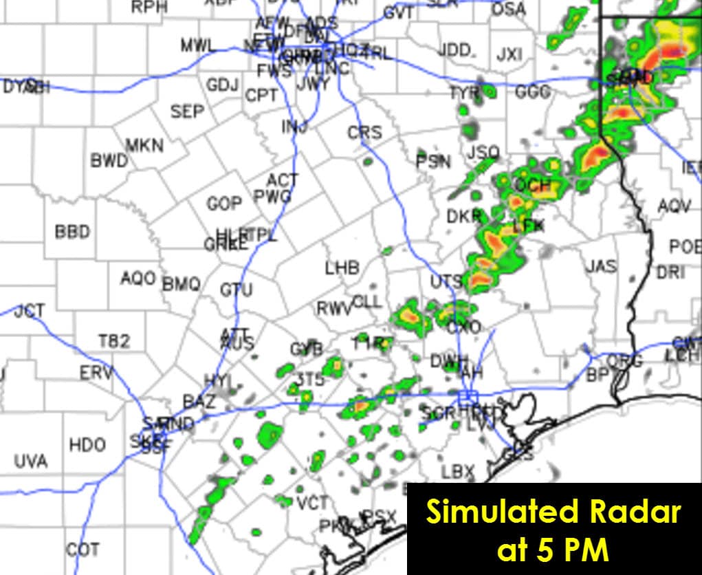
The High Resolution Rapid Refresh (HRRR) hourly model run continues to indicate a few stronger storms this afternoon. This particular run of the model has some storms ongoing by 2 PM in East Texas. Those individual storms would move northeast and would be the ones to watch for some severe weather potential. By 5 PM the HRRR has the strongest activity moving into Louisiana where low-level wind shear values are a tad more enhanced. The strongest storms this afternoon may produce some hail, localized damaging winds, and brief heavy rain. A very low tornado threat cannot be ruled out. We’ll be around keeping an eye on things along with the fire/wind issues west of the dryline this afternoon.


0 Comments