
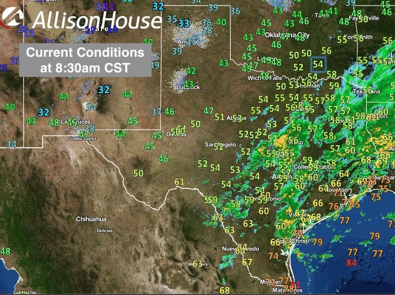
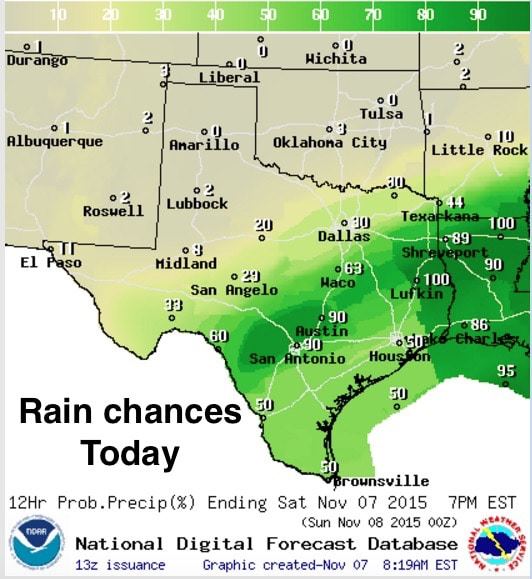
Good morning and happy Saturday! An upper level disturbance will continue to bring chances of rain today mainly south of the I-20 corridor. As the upper level disturbance lifts off to the northeast today, we’ll see surface high pressure building in the central and southern plains today and tonight which will send a secondary push of cooler and drier air into the region nudging the rain chances further south and eventually offshore by late this evening into early Sunday. Within this broad area of rain, a few embedded thunderstorms and pockets of heavier rainfall will develop this morning and during the afternoon hours. Additional rainfall ranging from 1/2 to 1 inch is likely with some of the stronger cells producing pockets of 1-2 inch accumulations. Normally that wouldn’t be an issue except for the fact that we have many areas south of I-20 in central Texas where soils remain saturated and any amount of additional rainfall could cause flooding issues. A Flash Flood Watch remains in effect until 4pm today for numerous counties just south of the DFW metro which have been most heavily impacted by rain over the past two weeks.

Here’s an animated look at how the radar might shape up over the next 15 hours…
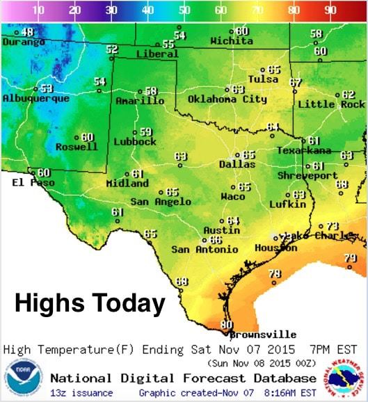
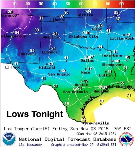
 Highs today…50s and 60s across a large swath of the state with some low 70s and a few 80s holding on along the coast where yesterday’s front has stalled out. Today’s push of cooler air…basically a secondary front…will push the first front offshore by tomorrow. Lows tonight across the northern half of the state will be dropping down into the 30s and 40s…some areas seeing the coldest temps since last April. A bit late in the season to finally see a cold snap like this, but for the warmer weather lovers, this cold snap won’t last for long.
Dry and pleasant conditions are expected until next Tuesday – Wednesday when our next storm system and cold front are expected to arrive. We could once again see an eruption of strong to severe storms along the leading edge of the cold front. Details on that will need to be worked out over the coming days, but for now, this next system looks to impact areas mainly along and east of the I-35 corridor. Stay tuned for updates on that as we get into next week!


0 Comments