
The strong cold front we’ve been talking about for a few days has arrived and is currently barreling through central Texas. Behind the front, winds have been gusting into the 30 to 40mph range, so hopefully everyone has tied down the patio umbrellas and lightweight outdoor furniture! We’ve seen reports this morning across north Texas of some tree limb damage as the front came through early this morning, so it’s likely we’ll continue to see spotty reports of some minor wind gust damage throughout the day. The front is expected to make quick progress today…and with its northeast to southwest orientation, should be clearing the south Texas coastal areas after noon and clearing the central and upper coast by around 3pm. Winds will stay brisk during the afternoon but will begin to calm this evening and into the overnight hours.
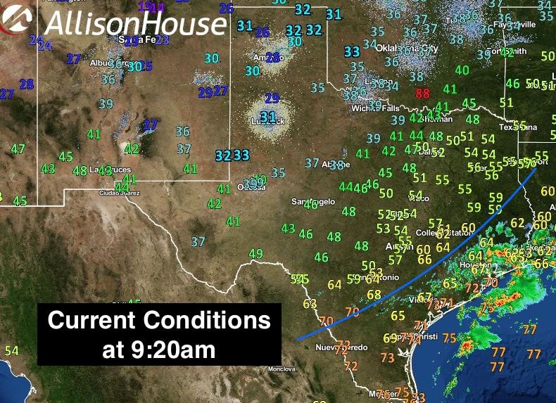
Highs today will have been met early on for most with temperatures steadily dropping behind the front. Current temps in the panhandle rolling plains have already dropped into the 20s and 30s and will likely not budge much the rest of the morning and afternoon. Folks in northern and central Texas have already reached your daily high and will see temps really dropping off over the next several hours. For folks along the coast, enjoy the warmth now as the front will be knocking on your doors in a few hours!

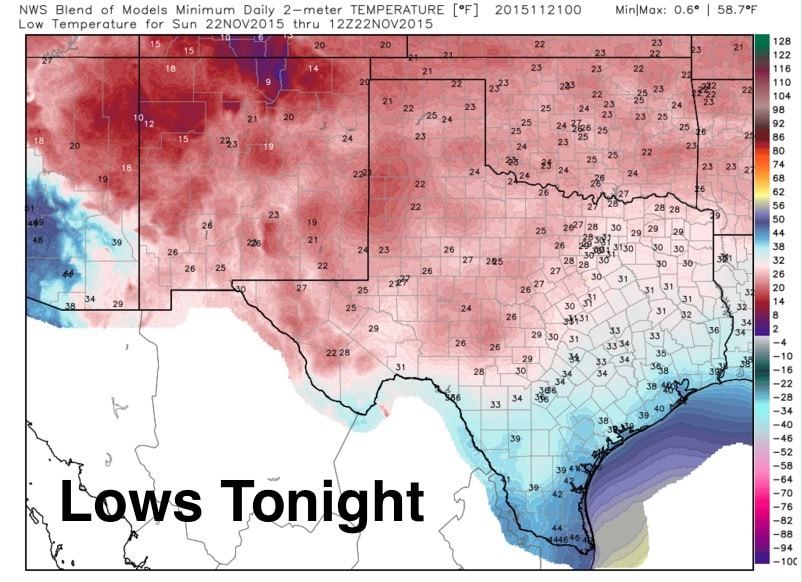
For tonight, clearing skies and much drier air behind the front will allow for significant radiational cooling, setting the stage for temps at or below freezing across a large portion of northern and western Texas. Much of this area has not yet seen much in the way of freezing weather this year…a bit late in the season for a freeze, but nevertheless, you’ll want to cover any sensitive plants or bring them indoors overnight.

Rain chances today stay primarily across the middle to upper coastal and inland areas and will be quickly shunted out of the area with the passage of the front. Tomorrow, expect sunny and chilly temps with a gradual warming trend by the middle of next week. Be sure to check back later this evening for an update on rain and storm chances expected by mid-week!


0 Comments