
Good Tuesday Morning! We’re entering another period of active weather with the first in a series of storm systems arriving tomorrow. The second will arrive this weekend with another next week. This first system that will bring impacts on Wednesday will actually mainly miss out on Texas. Our neighbors well to our northeast in the Midwest could be dealing with a severe weather outbreak by this time tomorrow morning. Meanwhile we’ll likely have to deal with a few stronger storms before our rain chances shut down. In interest of readability I’ll divide this blog post up into bullet points.
Today
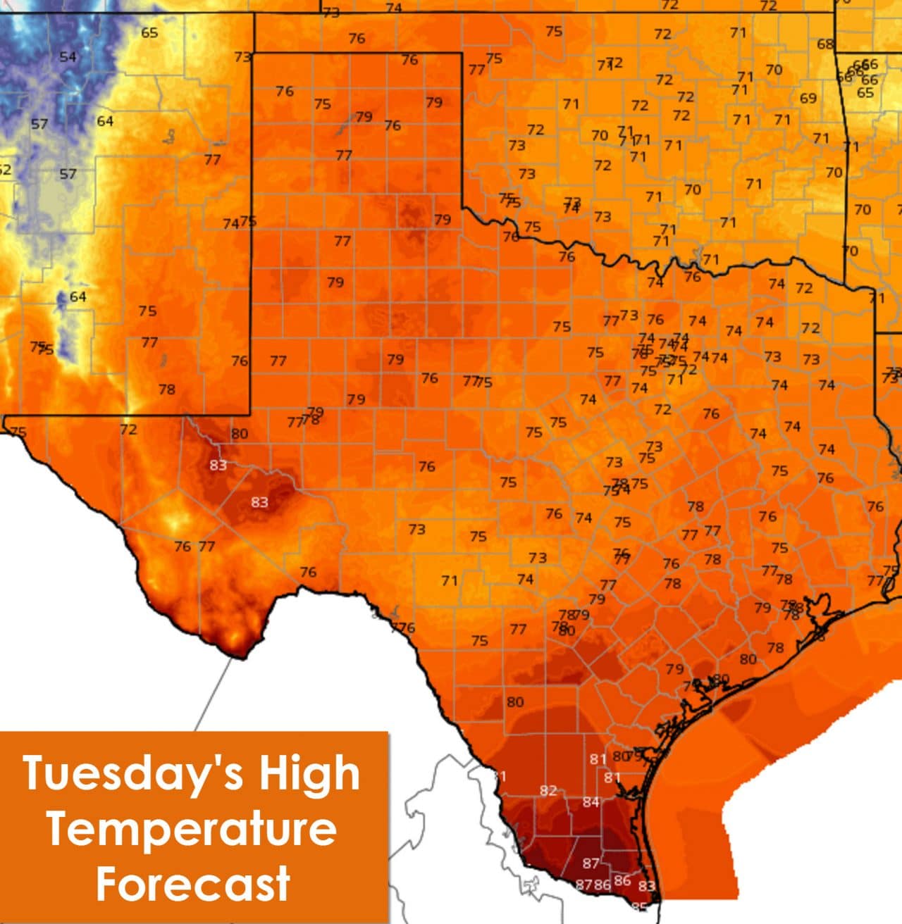
Dry conditions with south winds are forecast today. Winds could become gusty this afternoon ahead of the approaching storm system. High temperatures will be at or a few degrees above average with 70s to low 80s across Texas except the Rio Grande Valley. The RGV will ‘enjoy’ hot temperatures in the upper 80s this afternoon. This will be the warmest day we see for a while.
Tonight

A few very light showers are possible overnight across the eastern half of Texas. A strong low level jet and abundant moisture may try and squeeze out some mist. Low temperatures will be quite warm for November across the eastern two-thirds of Texas with upper 60s to low 70s. South winds will be gusty overnight. After midnight and in the predawn hours Wednesday a dryline and cold front will move east across West Texas into Northwest Texas and the Big Country. Temperatures and moisture levels west of the dryline will fall off along a wind shift to the west.
Wednesday
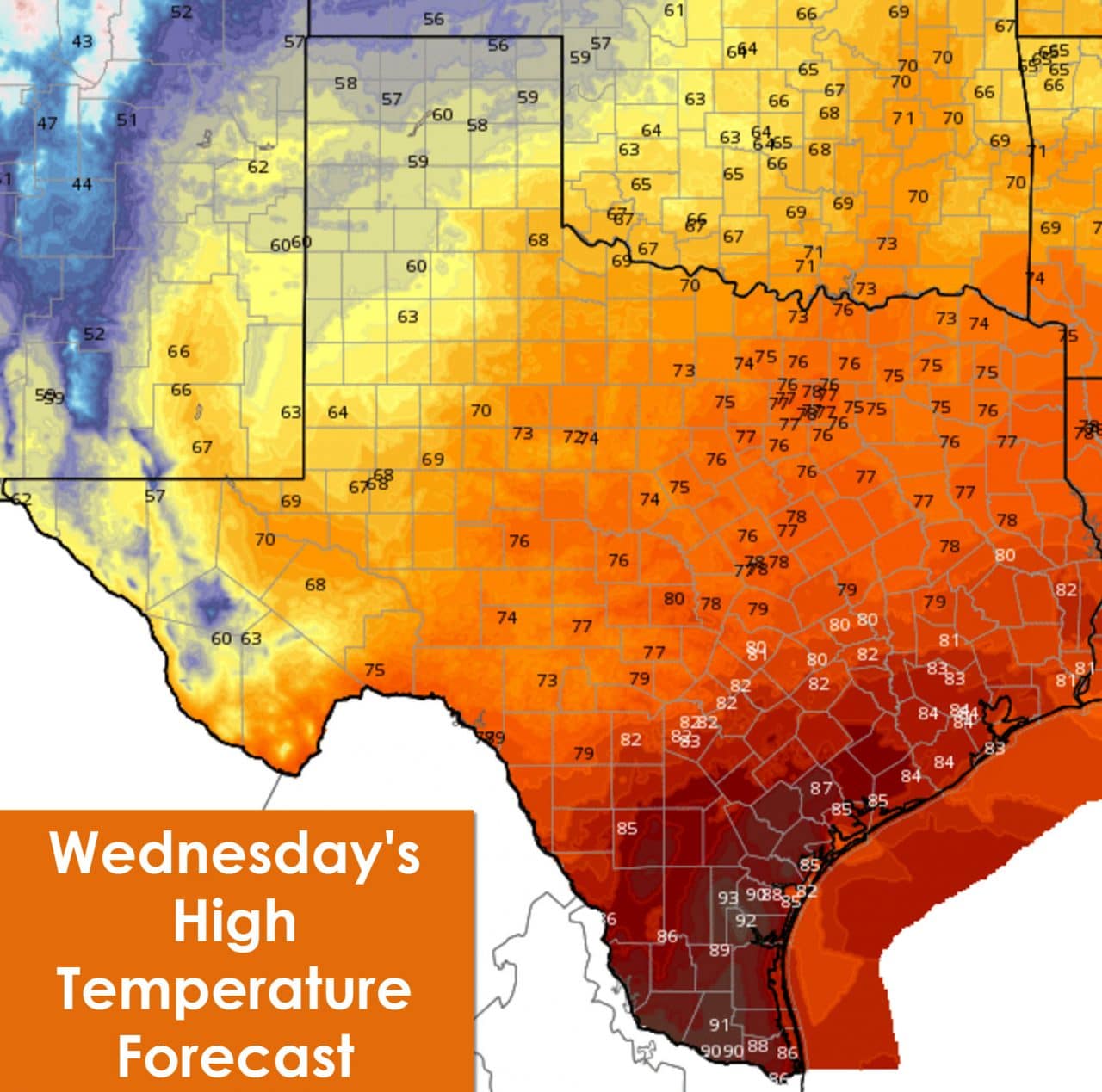
Veterans Day will feature several weather hazards across Texas as an intense negative-tilt trough flies by to our north. Scattered thunderstorms are expected Wednesday Morning into the early afternoon hours along and east of Interstate 35 from the Red River south to Temple. Northeast Texas and East Texas are included and will have the relative best chance for a few severe storms. The strongest storms may produce damaging straight-line wind gusts over 60 MPH. With very strong winds not too far above the surface it won’t take much to mix those winds down – even with a shower or garden storm. The dryline will quickly fly east on Wednesday bringing an end of storm chances in Northeast Texas by mid-afternoon. .
Strong wind gusts expected during the morning and afternoon hours Wednesday
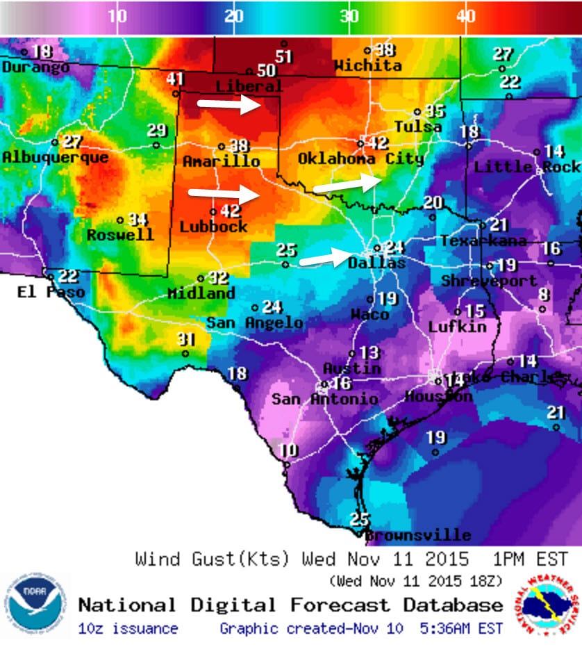
West of the dryline strong to very strong west winds are expected. A high wind event is forecast across the Texas Panhandle and West Texas where wind gusts will approach 50 MPH. A few locations may get closer to 60 MPH. This will make traveling on north/south highways difficult. Some blowing dust is a good bet along with extreme fire danger. Wednesday is definitely a BAD day to do any burning. Winds will be gusty along I-35 by the afternoon but no where nearly as strong compared to further west. Wind speeds will quickly die down around sunset.
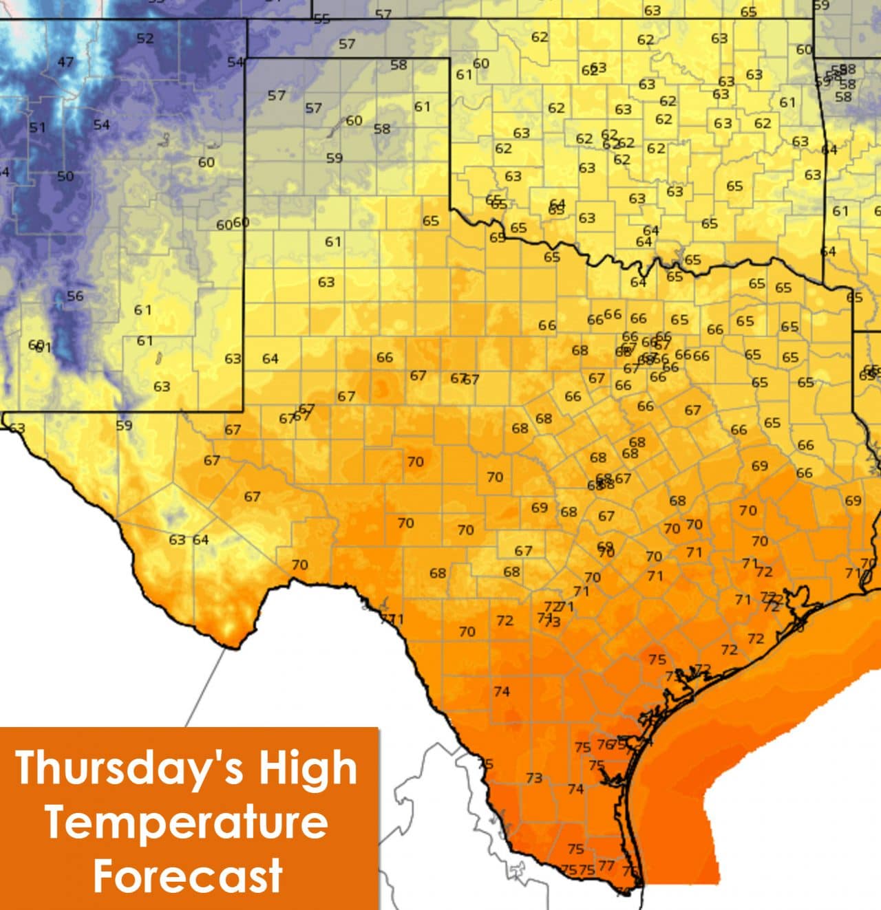
Thursday Morning Low Temperatures
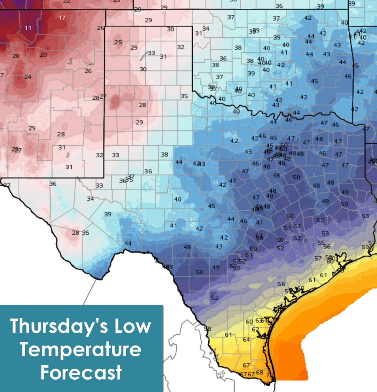
Temperatures by Thursday Morning will be some of the coldest we’ve seen so far this fall. Freezing temperatures are expected in the Texas Panhandle and South Plains. Frost is a good bet in the Permian Basin and parts of Northwest Texas into Far West Texas. It’ll be a chilly morning across the Hill Country, North Texas, Northeast Texas, East Texas, Central Texas, and the Brazos Valley with 40s. Thursday afternoon high temperatures will be relatively pleasant for fall.


0 Comments