
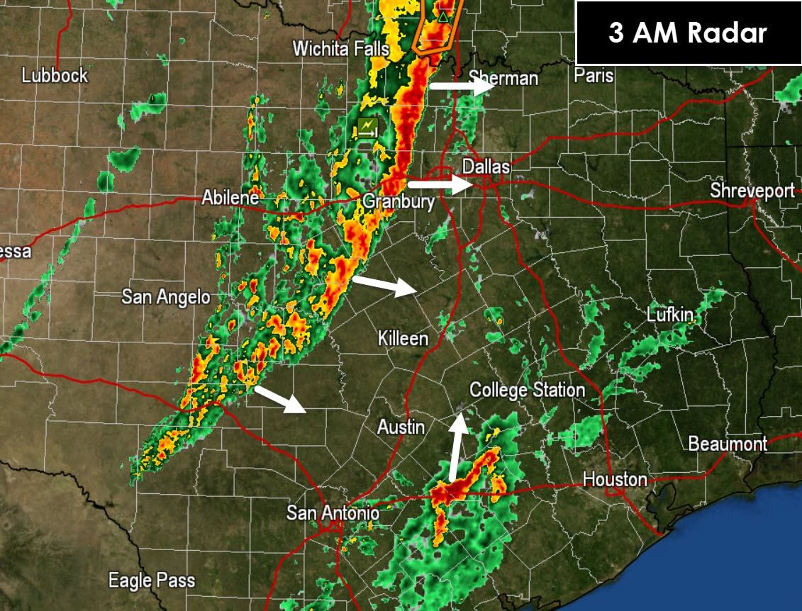
Things have been a tad more quiet than anticipated this morning. After a significant tornado outbreak in the eastern Texas Panhandle last evening I doubt many are complaining. A line of strong thunderstorms extends from just west of Interstate 35 back southwest into the Hill Country at the time of this writing. This line of storms is moving east around 30 MPH. It has struggled to intensify this morning and in fact seems to be less organized than it was a few hours ago. There are a couple exceptions with one being a severe storm moving into Tarrant county. Strong wind gusts of 40 to 60 MPH will be possible on the leading edge of the line over the next few hours. Even though the atmosphere is quite favorable for severe weather the line isn’t having it. It may have something to do with cold outflow being generated and pushed out just ahead of the line. That cold outflow cuts off the warm and unstable airmass thus rendering it inert. That can happen sometimes and we should be thankful. Otherwise we could have been dealing with a major wind event with embedded tornadoes. The severe weather threat is not eliminated by any means as some damaging wind gusts and a low-end tornado threat will remain through the morning hours as the squall line moves east.
A separate cluster of thunderstorms has developed in the warm-air regime from near Gonzales to La Grange. These storms are moving northeast and unlike the squall line are potentially surface-based. We’ll need to monitor them closely for signs of organization as conditions are quite supportive of rotating thunderstorms. As of now they’re producing frequent cloud to ground lightning and heavy rain.


0 Comments