
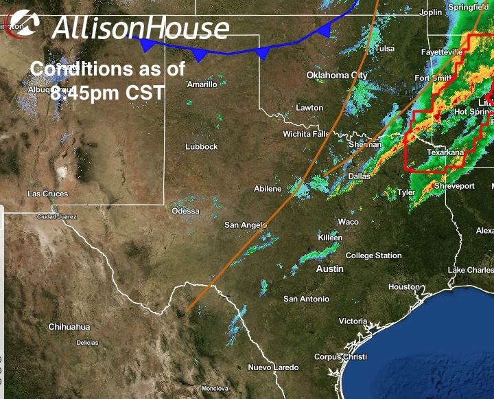
Well, that was fun! Not! Numerous reports of damage are coming in across north Texas this evening after a squall line of severe storms moved through. Most noteable so far was damage to the roof of a building near Meacham Field with what certainly looks like a brief tornado based on video footage posted by WFAA Channel 8. Other reports of large hail…golf ball to tennis ball size…in Denton, plus numerous flash flooding/high water reports. Thankfully, this line moved through quickly at speeds near 50mph which greatly lessened the flooding risk. Now the storms have moved east of the DFW metroplex and into northeast Texas where a Tornado Watch remains in effect for about 15 more minutes…until 9pm.
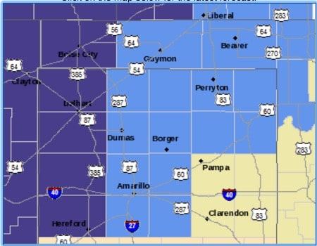
For the rest of tonight, rain chances will continue to move south and east as the upper level disturbances moves over. A cold front, currently entering the panhandle, will slowly make its way south across the state and should be approaching the coast by mid-day Saturday. Behind it…temperatures MUCH cooler than we’ve seen in quite awhile! Freeze Warnings and Frost Advisories are in place from midnight to 9am tomorrow morning across the northern panhandle where temps as low as 27 degrees may be seen by daybreak tomorrow. The front will also bring much drier air with it making for a very pleasant fall weekend ahead!

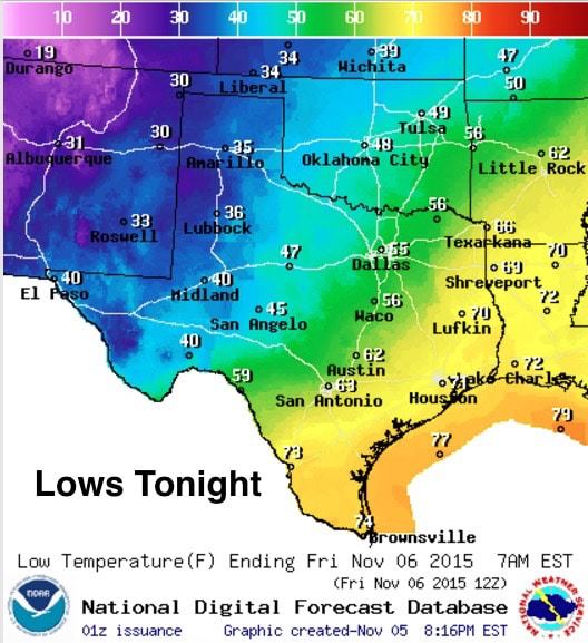
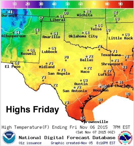
Lows tonight…20s and 30s across the panhandle after the front moves through, 40s across far west Texas, mid to upper 40s across west central Texas, mid 50s along the I-35 corridor with warmer and still muggy conditions further east and south well ahead of the front and dryline. By tomorrow, we’ll see the front moving into central Texas with highs struggling to get into the 50s across the panhandle and very pleasant low to mid 70s for north and parts of central Texas. Sunday and Monday look to be the coolest days of all with highs only in the 60s and lows dropping down into the 40s across a large portion of the state! By Tuesday, we’ll start warming up again and we’ll be watching for our next rain event Tuesday into Wednesday. We’ll have more on that over the weekend, so check back!


0 Comments