

We’ll have to deal with one last elevated fire weather day before that threat calms down for the remainder of the week. Temperatures will be a few degrees above average this afternoon with high temperatures in the upper 70s to upper 80s. South winds will become quite gusty this afternoon across the Texas Panhandle, Northwest Texas, and western North Texas. South winds around 10 MPH are expected across the remainder of Texas. Relative humidity values will drop into the teens to low 20s across North Texas, Northeast Texas, East Texas, Central Texas, and Southeast Texas later today resulting in another day of high fire danger.

Higher dewpoint values and associated moisture will begin a rapid influx back into Texas tonight. The result will be slightly warmer overnight low temperatures.
Our weather undergoes a huge change this week as we finally switch from hot and dry to cool and wet. An upper level low currently located over California will slowly move east this week. There remains some uncertainty regarding the path of this low since cutoff upper level lows tend to play tricky. Rain chances this week look to be the best we’ve seen in months with all of Texas expected to get rain by the time the event concludes this upcoming weekend. We’ll see rain chances increase on Tuesday and Tuesday Night across the western parts of our state. Those rain chances will spread east through the work week. By the weekend we should see rain moving out and a cool front moving in.
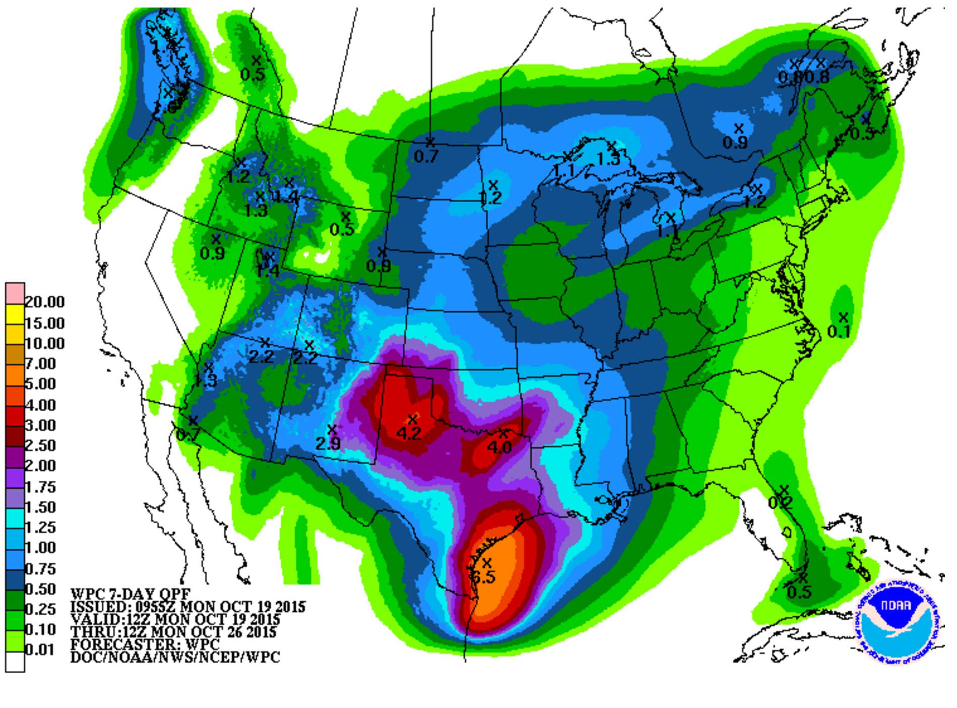
Forecast general rain totals through the next week
The latest seven day rain total forecast from the Weather Prediction Center is a sight for sore eyes. This forecast has widespread rain amounts of 1 to 2 inches falling across nearly all of Texas. Locally heavier amounts of 3 to 4 inches are possible across the Texas Panhandle, West Texas, Big Country, North Texas, Northeast Texas, and Southeast Texas. Widespread flooding is not anticipated at this time due to our recent dry weather. Localized flooding is certainly a possibility and we’ll watch for that threat as we continue into the work week. There may be a marginal severe weather risk on Friday along the Texas coast and into Southeast Texas that we’ll also have to watch for. I’m stepping out the door on my way back to day 2 of the National Weather Association meeting in Oklahoma City. If you’re interested in following along and learning about all the great talks follow the hashtag #nwas15 on Twitter.


0 Comments