
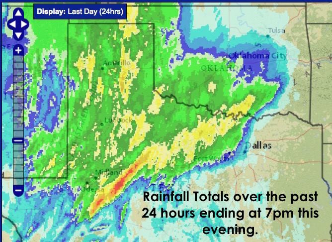
Widespread rain with embedded thunder will continue to impact parts of north central Texas over the next several hours. A few locations in Montague county northwest of the DFW metroplex picked up a quick 3+ inches earlier this afternoon as the system was advancing towards the metroplex. Further southwest between Midland and San Angelo, folks there have picked up between 6 to 8 inches within the past 24 hours. The map below details what has been received since 7pm yesterday.
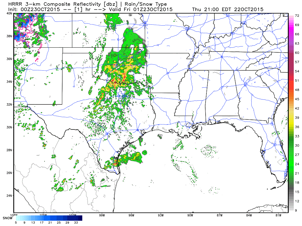
Rain, heavy at times, is expected to continue on and off across north central and down into west central Texas during the overnight hours. We may have somewhat of a lull in activity around midnight before the next round takes over after midnight as another wave of upper level energy is expected to arrive coincident with a surge in mid to low level energy. Tomorrow morning for the DFW metroplex and surrounding areas could be quite stormy with a heavy rain band setting up just west of the metro area and moving east during the early morning hours. Flash flooding is likely, especially in notoriously flood-prone areas which will make for a messy Friday morning commute to work or school. Plan on leaving early and give yourself plenty of time to reach your destination. The simulated radar graphic below will take you through tonight and into the morning hours on Friday. While no model has been 100% accurate with this system, it will give you a general idea of what to expect over the next 12 to 15 hours.
Tomorrow afternoon, overnight and into Saturday, we get to do this all over again as a second wave of upper level energy approaches with the chance for additional heavy rain and embedded thunderstorms. A cold front will also be moving into the state Saturday which will only enhance rain chances Saturday afternoon and evening across north Texas before pushing most of the rain south by early Sunday. In addition to the cold front, moisture streaming up from Hurricane Patricia in the eastern Pacific will also enhance rain chances, especially across the Hill Country and areas south/southwest of the DFW metro Saturday into Sunday.
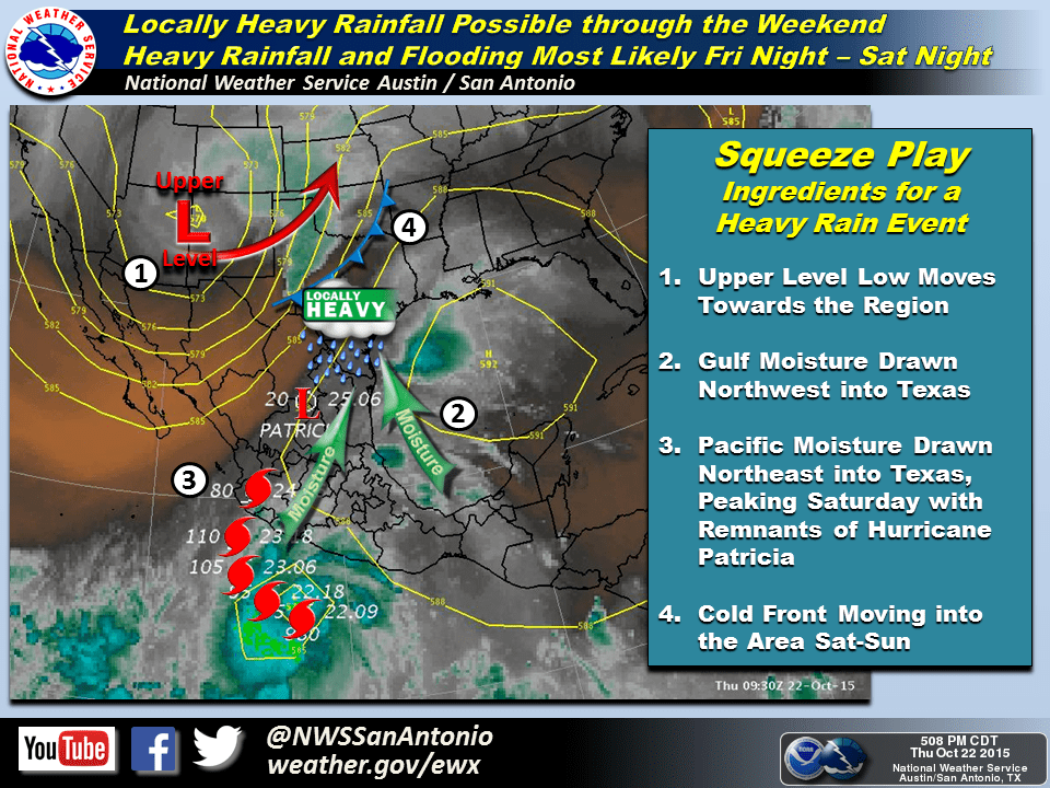
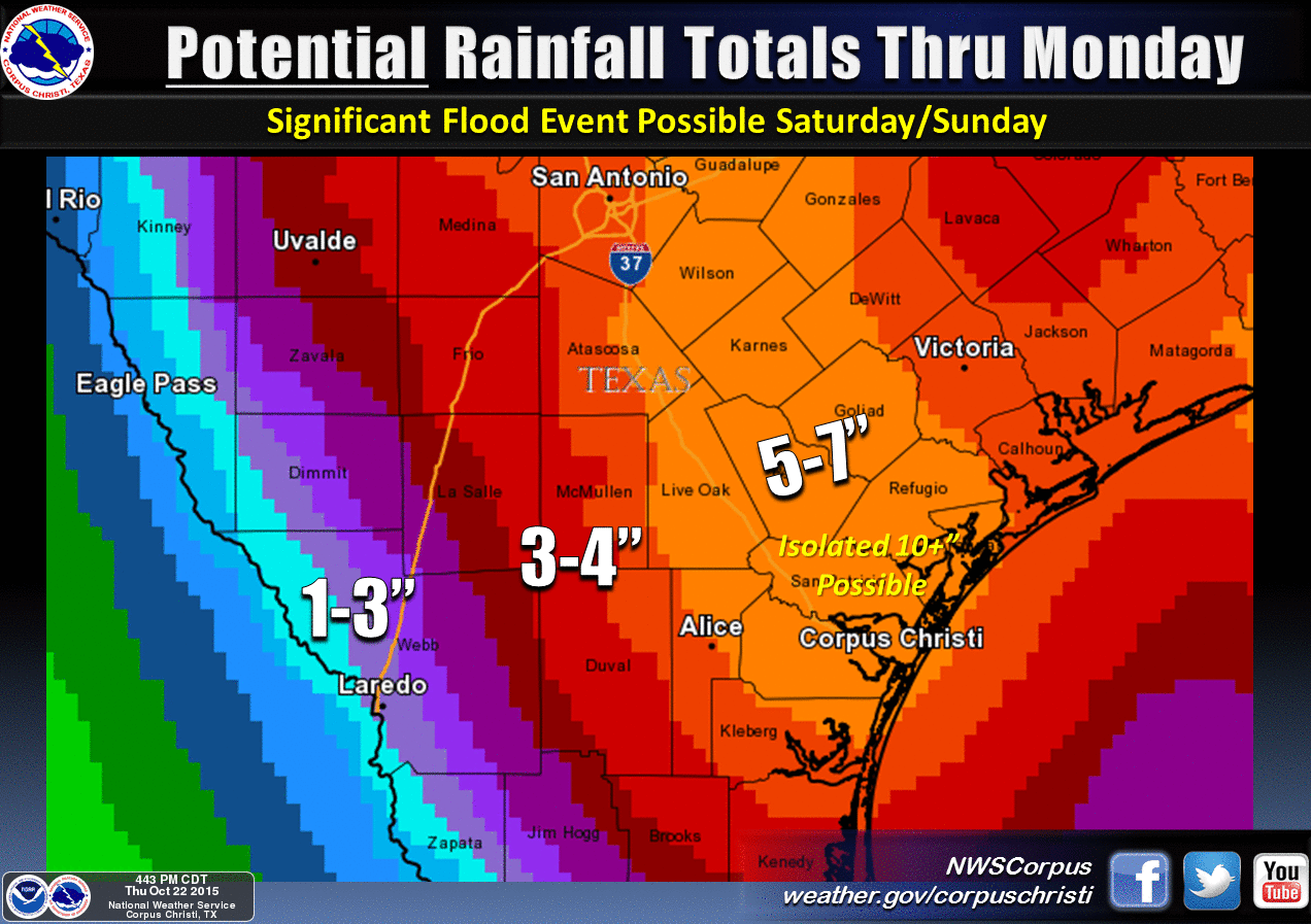
Heavy rain will also impact coastal bend region Saturday into Sunday as a coastal low develops and also taps into some of the moisture streaming up from Hurricane Patricia. We’ll have more details out on chances here and the Hill Country after the latest data rolls in tomorrow.


0 Comments