
Showers with a couple of isolated embedded thunderstorms are moving across the Texas Panhandle and Permian Basin this morning. The showers over the Panhandle are moving almost due north while activity over the Permian Basin is moving northeast. I don’t expect much, if any, additional eastward progress this morning since the rain is already pretty far east of the upper level low pressure.
Speaking of the upper low let’s take a look at the pesky system. This low has been a pain in the behind to forecast because rain chances are closely connected to where the low sets up shop. Somewhat unusual is the low pressure system is actually going to start moving south and eventually southwest/west by the end of the week. Initial forecasts placed the low further east closer to Texas resulting in decent rain chances along and west of Interstate 35. It now appears the low isn’t going to make it as far east and thus the best rain chances will remained confined to the Texas Panhandle, West Texas, the Permian Basin, Eduard Plateau, and Far West Texas over the next few days.
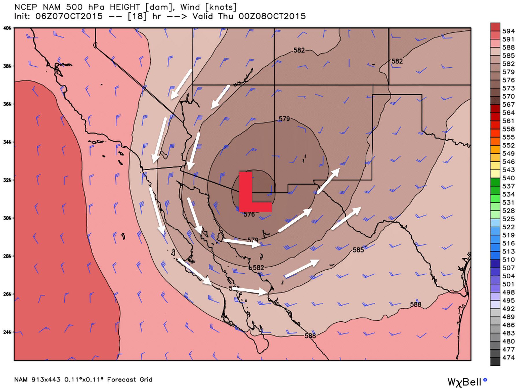
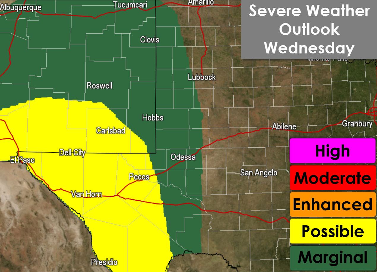
The placement of the upper level low and associated mid/upper level winds place Far West Texas in a favorable quadrant for organized thunderstorms. Winds at 500 millibars (about 18,500 feet above sea level) are cranking out of the southwest around 45 to 50 MPH. Winds in the lower levels of the atmosphere are weak around 10 to 20 MPH but are out of the east gradually veering to the south and southwest with height. That veering with height and noticeable speed shear increase with height means there is certainly enough wind shear in place to support organized thunderstorms. A limiting factor for a more significant severe weather threat is the weak low-level winds and widespread clouds helping to keep the atmosphere from becoming too unstable. Regardless enough instability should develop in conjunction with the mid-level jetstream to support a severe weather threat this afternoon and this evening. The Storm Prediction Center highlights the threat of strong to severe storms with a Category 2 risk across Far West Texas into parts of the Permian Basin. Large hail up to the size of half-dollars (1.25″ in diameter) will be the primary concern with the stronger storms today. A Flash Flood Watch is in effect for Far West Texas and the Permian Basin through Thursday evening where 1 to 3 inches of rain is possible with locally higher amounts.
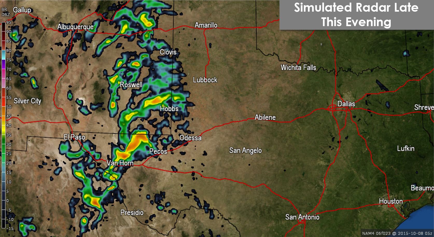
Moving on to the high resolution North American Model (NAM) model run from this morning. It shows scattered thunderstorms underway across Far West Texas and the Permian Basin this afternoon. Weaker activity is noted across the Texas Panhandle south through West Texas and the eastern Permian Basin around Odessa and Midland. I think this is a pretty good representation of what we should see today although don’t expect the radar to turn out exactly like the model depicts.

Stronger thunderstorms along with heavy rain will continue into the late evening hours across Far West Texas into parts of the Permain Basin and West Texas. This is the timeframe where we may have some localized flooding issues as the NAM does indicate fairly decent rain totals. Some of the storms over Far West Texas may continue to produce hail overnight.
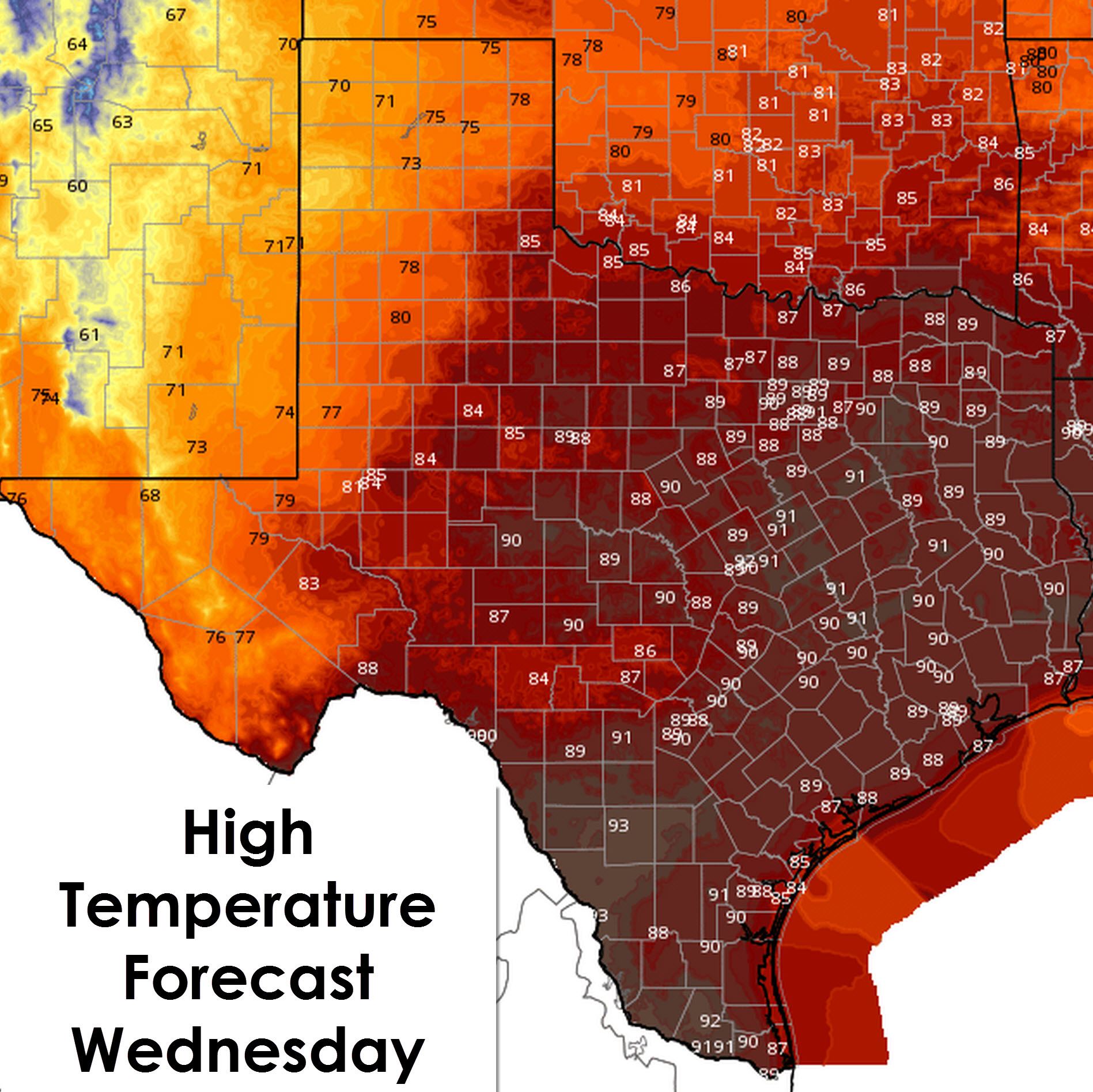
High temperatures today will be in the 70s across the Panhandle, West Texas, into Far West Texas thanks to the rain chances and cloud cover. Once you get into the Big Country, Concho Valley, and Northwest Texas temperatures are noticeably warmer with 80s to lower 90s expected this afternoon. The rest of Texas, including all the Interstate 35/45 cities, are expected to approach or get into the lower 90s today. The fall preview has ended (for now) and we’re back to summertime weather. Trends are not looking good for the next week with temperatures possibly even warming up into the mid/upper 90s. Hopefully we don’t get that warm but alas don’t expect to wear any of your fall clothing for the next few days.


0 Comments