
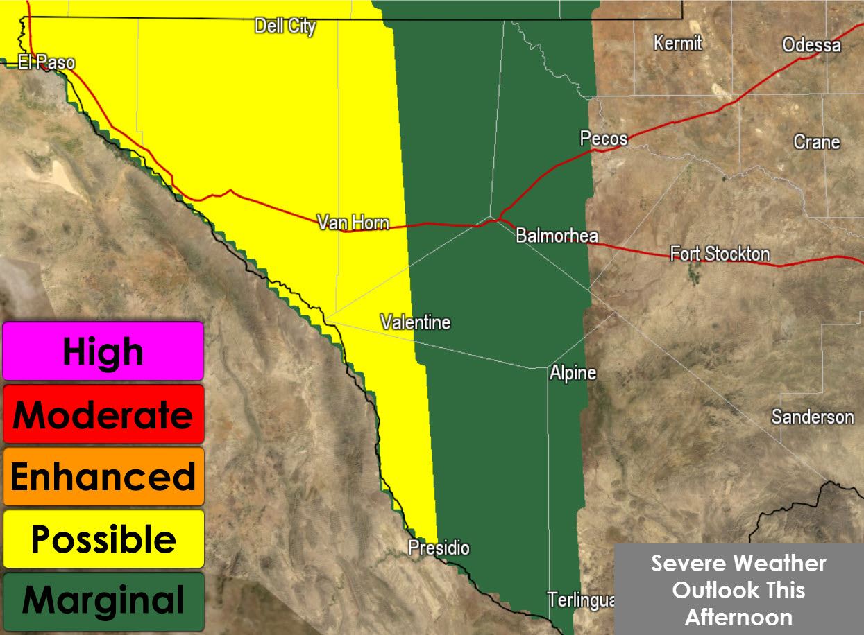
A fairly uncommon severe weather setup for October is setting up today and for the next couple of days across Far West Texas. A slow-moving upper level low will meander around the Southwest United States over the next few days. For today the position of the upper level low places Far West Texas in a favorable quadrant for wind shear. Low-level wind shear will be weak with about 40 knots of west/southwest flow at 500 millibars. Directional wind shear in the low levels does show some curvature meaning changing wind direction with height.
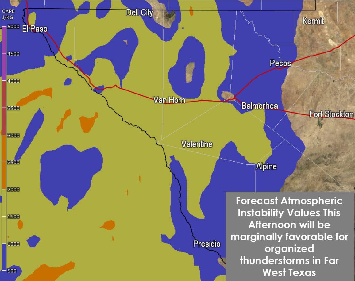
One limiting factor for a more organized severe weather event is marginal instability values. Widespread clouds and continued shower/storm development will only allow the atmosphere to become marginally unstable. The North American Model shows 750 to 1500 joules per kilogram of CAPE this afternoon in Far West Texas. CAPE (Convective Available Potential Energy) is a measurement of how much energy is available to an updraft, or thunderstorm. Those values are not particularly impressive but assuming a bit of sun can get through the clouds it may be just enough to support a few severe storms.
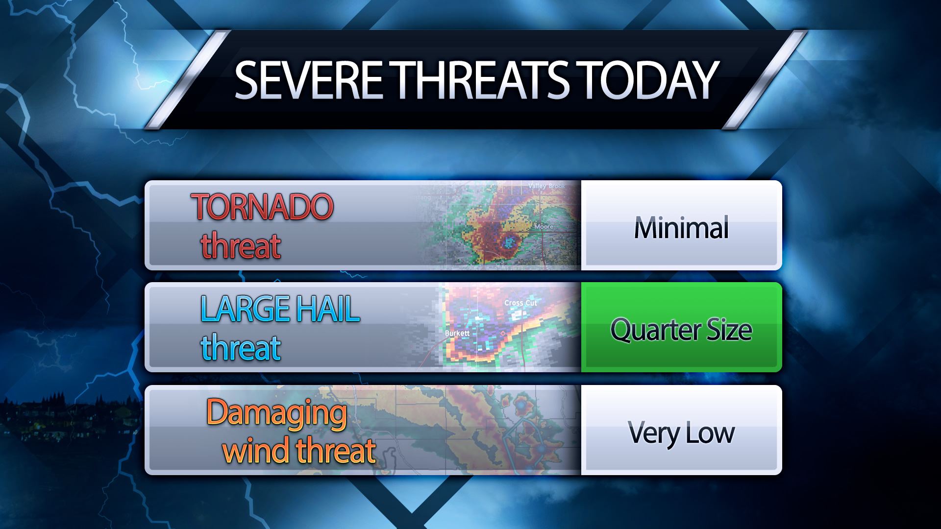
The strongest storms could produce hail today up to the size of quarters. Gusty winds up to 45 MPH are also a possibility along with a non-zero tornado risk. If there was more instablity the severe weather threat would increase. While low-level winds are weak the mid-level winds are actually decent and supportive of organized thunderstorms.


0 Comments