
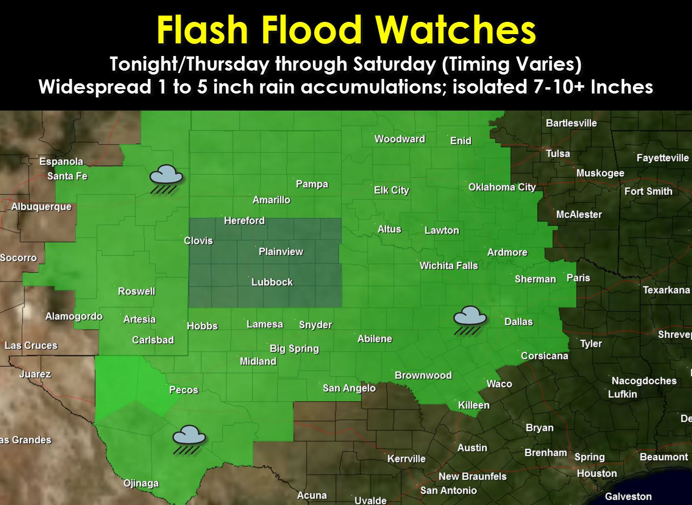
Flash Flood Watches are now in effect for the Texas Panhandle, South Plains, Rolling Plains, Permian Basin, Northwest Texas, Big Country, parts of the Concho Valley, North Texas, and parts of Central Texas. The flash flood watch is in effect now for western parts of Texas while it takes hold on Thursday across Northwest Texas, the Big Country, North Texas, and Central Texas. These watches have been issued due to increasing confience in widespread heavy rain. Widespread rain totals of 1 to 5 inches are expected including in Central, South-Central, and Southeast Texas where watches are not yet in effect (they may be issued later). Weather models are hinting at one or two localized, but very significant band of accumulations. Neither I or anyone else can tell you accurately where exactly that band will set up. However it will be capable of producing prolific rainfall rates late Thursday Night into Friday and Friday Night. It is not out of the question that one or two spots pick up over a foot of rain.
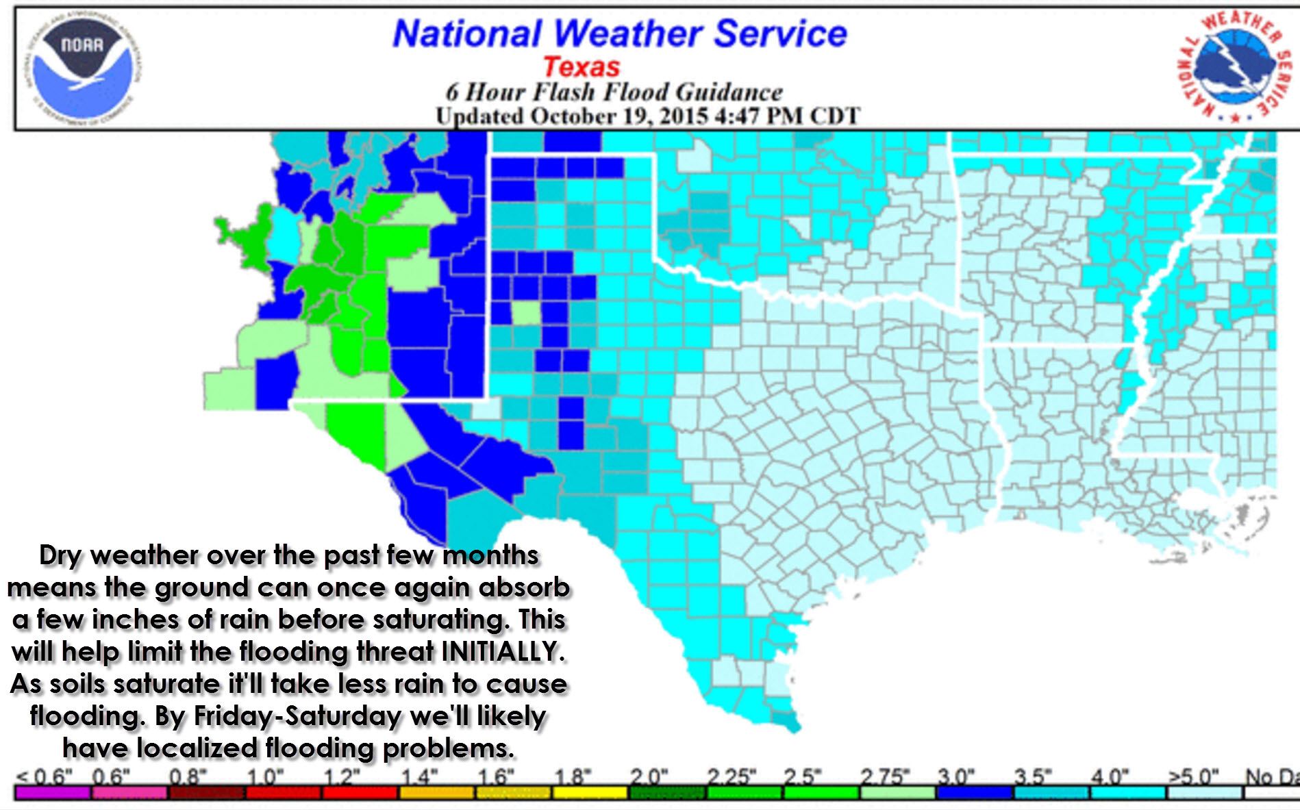
As stated earlier soils are dry and can absorb several inches of rain without much of an issue. However some locations will receive enough rain to cause flooding. Widespread flash flooding is not likely based on the current forecast. Minor nuisance flooding is expected during the heavy rain and in urban areas. Where we see the enhanced band of 7-10+ inch rains set up that is where significant flash flooding may occur. Once again those impacts will be very localized, but significant where they occur. We won’t be able to accurately tell you an idea of where the band will set up until we’re within 24 hours of the event. Stay tuned!


0 Comments