
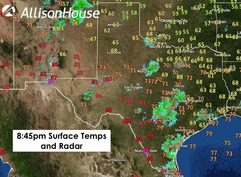
Just a quick forecast update for everyone this evening! Cool and fall-like temperatures have settled in over most of the state this evening. Yesterday’s cold front has pushed beyond south Texas and is currently located south of the border stretching up into central New Mexico with cool air continuing to slowly filter in behind it. Unfortunately for south/southwest Texas, the front washed out quite a bit before its arrival and won’t do much to drop daytime temps, but considerably drier air moving in will make it feel much less muggy overnight and through tomorrow. Further north across the panhandle, temperatures have dropped into the upper 50’s. Temps across north Texas have dropped down into the mid 60’s, and we’re seeing a mixture of 60 and 70 degree readings from central Texas all the way over to far southeast Texas near the Louisiana border. A fine evening to be attending Friday night high school football games or enjoying your favorite beverage on the patio.
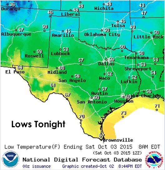
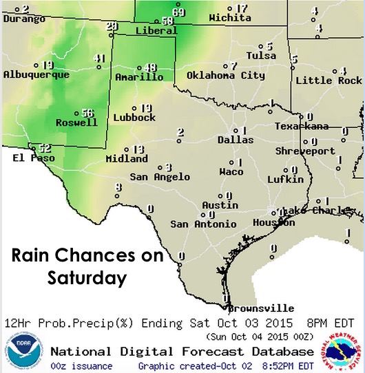
Lows tonight will be dropping down into the 40s across most of the panhandle with readings in the 50s and low 60s as far south as San Antonio. Areas along the Rio Grade will see upper 60s to low 70s overnight and we’ll have lots of dry and less humid air across most of the state. For tomorrow, highs in the panhandle will struggle to get out of the 50s with cloud cover and rain expected on and off throughout the day. Further east across north Texas, we’ll be in the 70s most of the day and finally top out around 80 degrees by mid-afternoon. Central and south Texas will see pleasant highs in the mid 80s…and we’ll see a few low 90s along the coast.

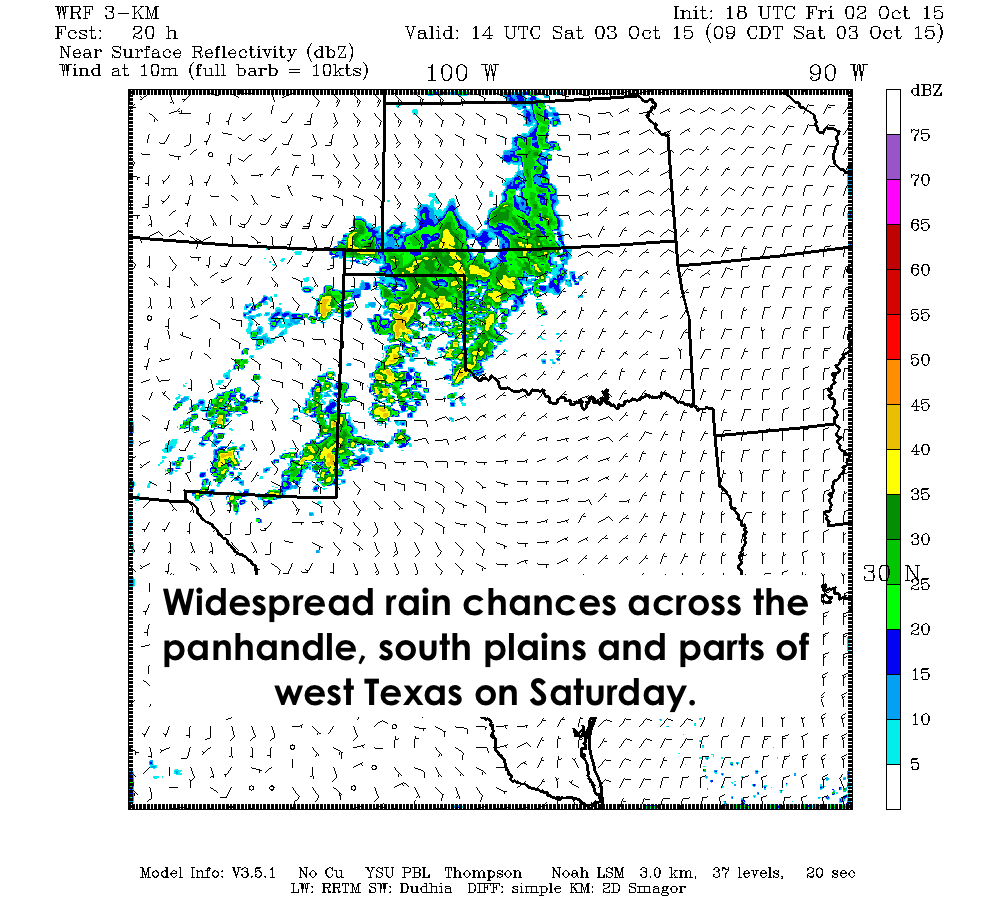
Rain chances tonight and tomorrow will be confined to the panhandle and west Texas as an upper level low builds over the desert southwest. This will bring continued rain chances to the western half of the state over the next few days as the low becomes cutoff from the main upper level flow and slowly drifts east. Forecast models for the upcoming week are starting to point to a rather rainy pattern for the week ahead. We’ll dig more into that data tomorrow and prepare a comprehensive forecast for everyone by Sunday evening!


0 Comments