
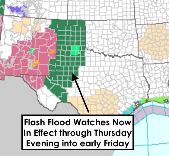
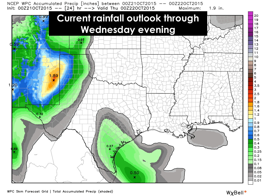
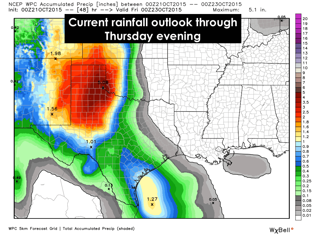
Our multi-day widespread rain event is on our doorsteps tonight. Strong to severe storms currently pounding parts of New Mexico will continue moving northeast and into the panhandle and far west Texas overnight through tomorrow morning. It looks like we’ll be seeing several rounds of weather across these regions tomorrow and through Thursday with the bulk of the heaviest rainfall across the panhandle occurring Wednesday into Thursday. After that, the heaviest rain will move east towards central and north central Texas with the heaviest rains expected to impact these regions Friday and through Saturday. Rain amounts across the panhandle are expected to range between 1 to 4 inches, with some locally higher amounts. Far west Texas will see lighter amounts, generally around 1/2 to 1 inch before the system moves out. The potential for flooding is strong with this one with Flash Flood Watches already in place for all of the panhandle, parts of the trans pecos and western Permian Basin region through Thursday.

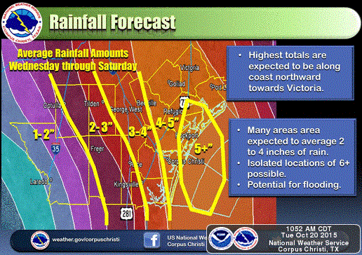
For coastal and south central Texas, the bulk of your rainfall is expected Wednesday through Thursday with highest amounts closer to the coast between Corpus, Victoria and Port Lavaca. Rainfall estimates at this time range from 1 to 5 inches with some locally higher amounts possible as well. Coastal flood advisories are already in place between Port O’Connor and Corpus…and we’ll likely see Flash Flood Watches posted tomorrow for areas inland as well.
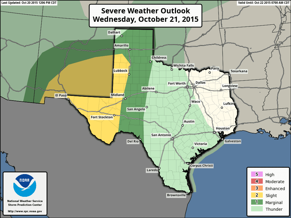
The threat of strong to severe storms on Wednesday will be across west Texas and up into the southwestern Texas panhandle closer to the main forcing provided by the approaching upper level disturbance. Ongoing storms early tomorrow morning across the region should move out quickly enough to allow a decent amount of heating tomorrow which will enhance the chances of seeing several strong to severe storms develop by tomorrow afternoon across far west Texas, the trans pecos region and up into southeastern new Mexico and the southwestern Texas panhandle. Hail, damaging winds, heavy rain and frequent lightning will be the main threats. There is also a threat of an isolated tornado or two to develop as well, though that threat pales in comparison to the hail, gusty winds and heavy rainfall threats.
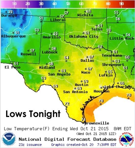
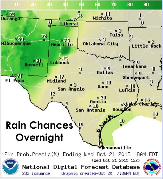
The rest of the forecast for tonight and tomorrow, plus a look at rainfall patterns between now and Sunday! Lows tonight, mild and in the upper 60s to low 70s for coastal up into central Texas as moisture is pulled up into the area. Ongoing rainfall overnight will keep the panhandle and west Texas cooler and in the 50s. Rain chances overnight into tomorrow morning will be confined to parts of the panhandle and western Texas.
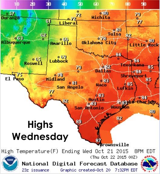
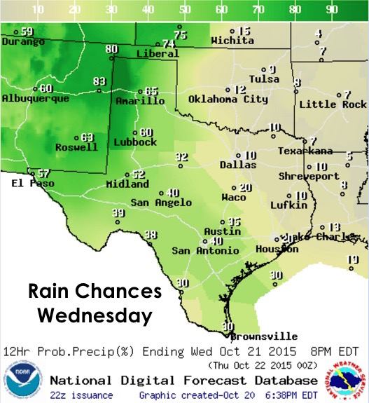
Highs tomorrow, mild and above normal for this time across southern, central and north Texas with highs expected to jump into the 80s by early afternoon. Continued rain and storm chances along with residual cloud cover will keep temps across the western half of the state in check and a tad below normal values for this time of the year. Rain chances will increase across south Texas up into the Hill Country region tomorrow and these areas could see a few strong storms develop during peak heating…though not expected storms as strong as what’s anticipated for western Texas tomorrow afternoon.
And last but not least…here’s the updated outlook for the week through Sunday, plus a breakdown of rainfall amounts expected each day west to east across the state. Keep in mind when viewing these graphics that each day builds on the previous days’ rainfall accumulation forecast so you see the grand total by the end of this week…which basically ends up being a real frog strangler!


0 Comments