
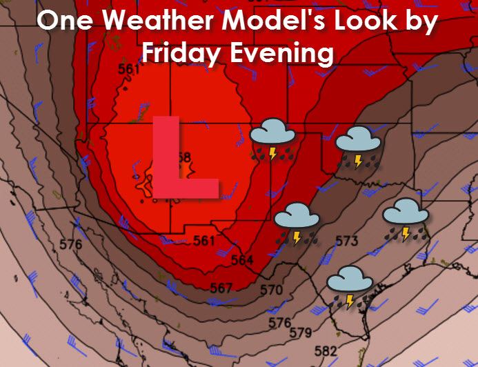
The weather across Texas is going to be much calmer tonight and for the first half of this work week. However the calm weather isn’t going to last for more than a few days. It now appears likely that an upper level low pressure will move into the Southwest United States this week. By Friday its possible this cutoff upper low could be sitting on the Arizona/New Mexico border. A cutoff low means its disconnected from the jetstream and not being influenced by the strong steering currents. These pesky upper level lows can be a pain to forecast due to their unpredictable nature. All of that is a fancy way of saying we’re still several days out from the event and you can most definitely expect forecast changes. Nothing is written in stone yet.
While confidence is low in the eventual placement of the low it does look likely that we’ll see a return of rain and storms across parts of Texas by Friday. At this time those rain/storm chances look to continue into Saturday which just so happens to be Halloween. We’re six days away and I won’t even waste your time by trying to give you more specific rain/timing chances. Just know that it looks like another multi-day potentially heavy rain event is possible beginning Thursday Friday and continuing into Saturday, possibly Sunday. The timing aspect of the forecast is expected to change as we get closer to the event and forecast confidence increases.

One of the main reasons I’m talking to you about a potential precipitation event five days out is the chance of another significant rain event. Moisture levels look to be quite high again and both the American and European weather models are showing some locations receiving several inches of rain. At this time the Weather Prediction Center is indicating the potential for 3-5+ inches of new rain on Friday through Sunday across North Texas, Central Texas, and Southeast Texas. That kind of rain on already saturated soil would result in another episode of flooding. Rivers are running high but should at least be on the decline by the end of the work week.
The forecast will certainly change between now and later this week. Strength of the upper level low along with its location will determine where the heaviest rains set up and how much rain those locations may see. Based on the latest weather model data there is the possibility of another flash flood/heavy rain event in the Friday-Sunday timeframe. Check back for forecast updates this week.


0 Comments