
Another day in mid-October with record highs…Childress reached 96, Wichita Falls reached 97, Dallas/Ft. Worth (airport) reached 95, Austin (Camp Mabry) reached 95, Texarkana and Tyler both reached 95, Longview reached 96 and Lufkin reached 94. The cold front we’ve been discussing for several days is currently moving into the Texas panhandle and will continue oozing southward overnight and through tomorrow. While it won’t bring blustery cold conditions with it into central and southern parts of the state, we will be seeing temperatures much closer to where they should be at in mid-October through the weekend. It’s interesting to note that, while we’re baking in the heat down here, the northern and central plains states have widespread frost and freeze warnings in place for tonight. Gotta love Mother Nature!
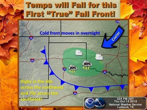
Rain chances overnight will be confined along and behind the frontal boundary as it drifts slowly south into the southern panhandle and west central Texas. Rainfall amounts will be minimal with our best chances for widespread rainfall arriving next week.

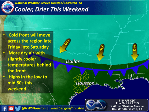
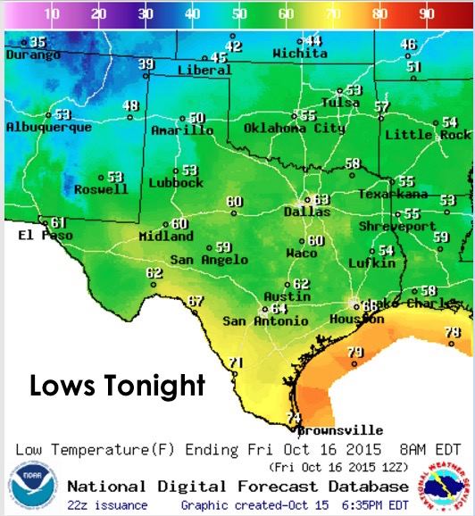
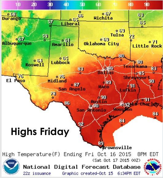
Lows tonight, not remarkably different from last night with the exception of the panhandle which will begin to see much cooler air filtering in behind the cold front. Tomorrow, increasing cloud cover across the panhandle and western Texas combined with cool easterly winds will keep temps in check across the panhandle and western Texas where highs will struggle to get out of the 60s. Further east and south, much warmer with highs reaching near record levels across parts of central and southeastern Texas before the front arrives. By Friday evening and overnight into Saturday, the front should be moving across south central Texas with lows dropping down into the 40s across the panhandle, with 50s and 60s for north and central Texas, and 60s and 70s south along the coast.

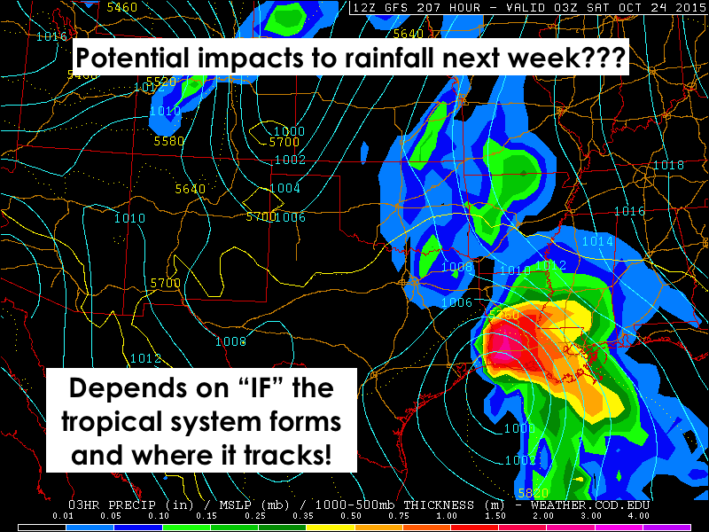
Update on next week’s rain chances…a fly in the ointment has developed which could end up having a significant impact on rain chances …both positive and negative…and may disrupt the passage of a strong cold front we have been monitoring for the following weekend. We were hesitant to bring this up the past couple of days due to model run inconsistencies, but now that local forecasters are mentioning it, and it’s likely to get out on the news and interwebs, we might as well dive in. There is a chance….a CHANCE…that a strong tropical system may develop in the Gulf next week with impacts along central and northeastern coastal areas by next weekend…Victoria to Port Arthur. If this develops, it could work to hog moisture needed to develop rain and storms across the northern half of the state, leaving north and central Texas with much less rainfall than what appeared on the Precip Outlook we posted last night. However, a shift further west in the track of this hypothetical system…say Corpus to Brownsville…we could see a much greater chance of rainfall across central, northern and eastern Texas as the system moves inland. Why? Because of the counter-clockwise flow of the winds in a tropical system. The further west the center axis of the storm is, the more moisture we will see pulled up from the Gulf and over our state. A more eastward track of the system would end up drawing most of the moisture up into Louisiana and the backside of the system would drag down drier air from the northeast. Most of the rain for Texas, in that situation, would likely remain across coastal and southeastern Texas with only lighter chances further north. It’s also likely that tropical storm development across the Gulf will have an effect on the upper level flow which will disrupt the flow of of a strong cold front which we expected to arrive the following weekend. All we can say right now is….wait and watch.


0 Comments