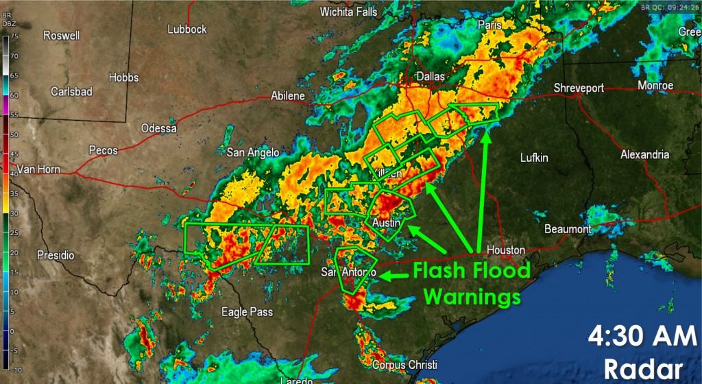
- Precipitation intensity and overall coverage has increased over the past few hours across South-Central Texas, the Hill Country, Central Texas, and North Texas.
- Several flash flood warnings are in effect with a list too numerous to post here. One easy way to check on them is by visiting our weather radar page. You can find that by clicking the banner at the top of our page.
- The heaviest rains through sunrise look to be concentrated from near Del Rio northeast through San Antonio, Austin, Temple, to Athens. Rainfall rates in the heaviest rain bands are near 2 to 2.5 inches per hour. Flash Flooding is a high threat for both San Antonio and Austin this morning.
- Further north in the D/FW Metroplex light to moderate rain continues to fall. A cool front located near the Red River is slowly pushing south. Later this morning the forcing associated with this front may help locally enhance rainfall rates – thus we’ll have to watch for some additional flooding issues along and south of D/FW.
- Moisture from Hurricane Patricia is beginning to enhance moisture and lift across South-Central Texas. By this afternoon an area of low pressure across northern Mexico will move into Deep South Texas and the Rio Grande Valley. As the low organizes we’ll see heavier rain shift south out of North Texas into Central Texas, South-Central Texas, and the Rio Grande Valley. By tonight those rain chances will increase across the Coastal Plains and Southeast Texas. This is when the flooding event for those locations will begin.
- Widespread rain amounts will range from 2 to 6 inches today, tonight, and Sunday. Isolated totals up to 15 inches will be possible. It goes without saying that flooding will be a threat today.
Texas Forecast: Severe Storms Possible After 3 PM
https://youtu.be/f0Z3y4lc-_0 Active weather returns to Texas for the remainder of the week. Today's scattered severe...


0 Comments