
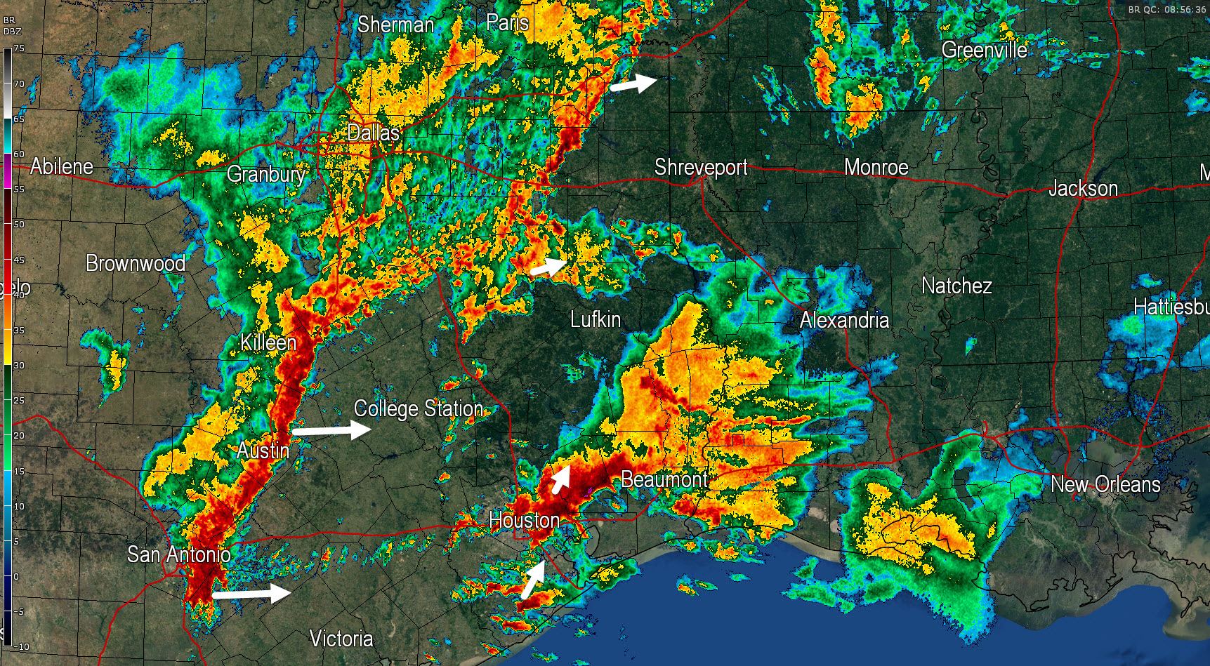
- A band of moderate to heavy rain is impacting Northeast Texas. Locations like Texarkana who are dry will see rain move in over the next hour. 1 to 2 inches of rain will be possible. Severe weather is not expected although lightning is occuring.
- Light to moderate rain continues to fall over the D/FW Metroplex and surrounding locations. This rain will move east after a few hours leaving dry conditions. I doubt we’ll see any additional heavy rain this morning.
- The leading edge of heavy thunderstorms extends from near Temple to Taylor to Seguin. This squall line is moving east at 25 MPH. The good news is that the line is booking it and also fairly thin. A quick half inch to 1.5 inches of rain is possible over a short period of time but the rain won’t last long. Once the line of storms moves east of any given location some light rain may remain possible for a few more hours before the rain ceases entirely.
- Moisture from the Gulf of Mexico along with increasing lift has allowed heavy thunderstorms to develop across Southeast Texas this morning. Significant flooding is underway in Houston where numerous roads are closed and dozens of water resources are being conducted. In addition supercells moving onshore have had strong rotation and at least one tornado indicated by radar. This activity is generally moving northeast but in some cases has noticeably slower movement. Rainfall rates of 1 to 4 inches per hour are occuring and flash flooding is a distinct threat. The line of storms out by I-35 will approach the region by mid-morning which should help start to move the rain along.


0 Comments