
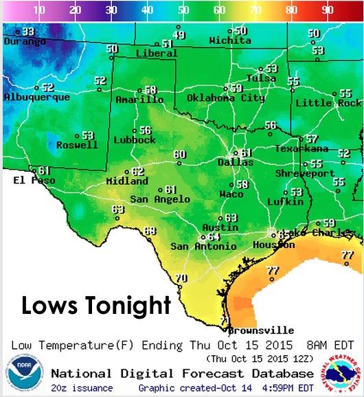
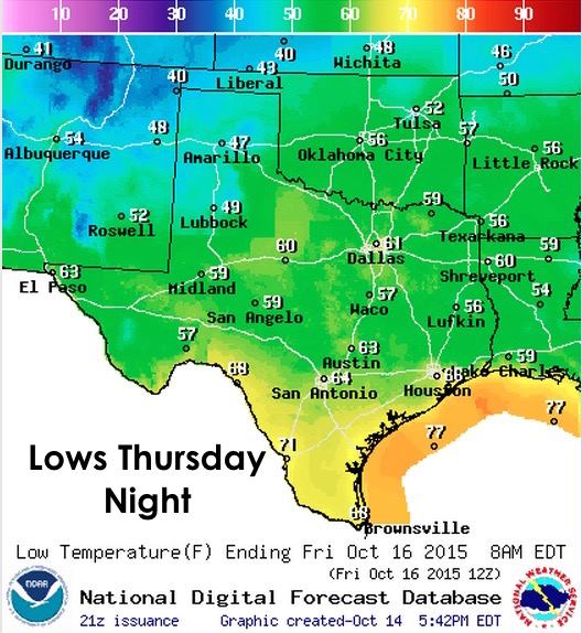
More record highs today….Waco reached 98, Austin (Bergstrom) reached 95, Austin (Camp Mabry) reached 96, San Antonio reached 95, Corpus Christi reached 94, Galveston reached 89, and El Paso reached 92. And guess what! Tomorrow, we get to do it all over again with more record highs expected. But, hang in there…we are getting a cold front for the weekend which will knock temps back down to near seasonal averages across most of the state. And….next week, it looks like we’ll have a chance at seeing rain and a continuation of seasonable or “less hot” temps. AND………..the following weekend, the long range models are hinting at an even stronger cold front. One that could bring a real taste of fall to our state! But for now, here’s a look at the forecast lows for our overnight/early Thursday morning timeframe. Once again, low humidity values will allow temperatures to drop into the 50s to low 60s across most of the state. We’ll see some 70s across deep south Texas and in the Rio Grande Valley region where humidity levels will be highest, but overall quite pleasant conditions.
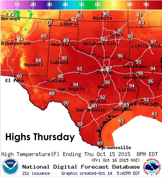
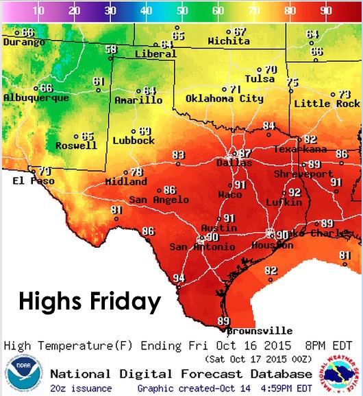
Highs Thursday, once again unseasonably warm with some new record highs possible across central and southeast Texas.
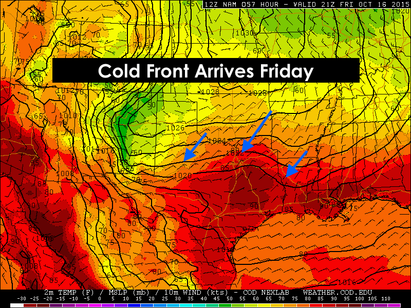
Late Thursday, our next cold front begins to move into the panhandle region and then into and across northern Texas by Friday afternoon. The front will slow down quite a bit as it arrives, but is expected to filter cooler and drier air as far south as I-10 by early Saturday. This front will knock temps down into the 40’s across the panhandle Thursday night, and we will see a pretty sharp temperature gradient Friday afternoon with highs only in the the 60’s to low 70’s across the panhandle, western Texas and the rolling plains…with highs still reaching the 80s to low 90s for the central and southern regions of the state. Saturday and Sunday’s highs look much better…mainly in the 70s up north and 80s across central and southern regions.
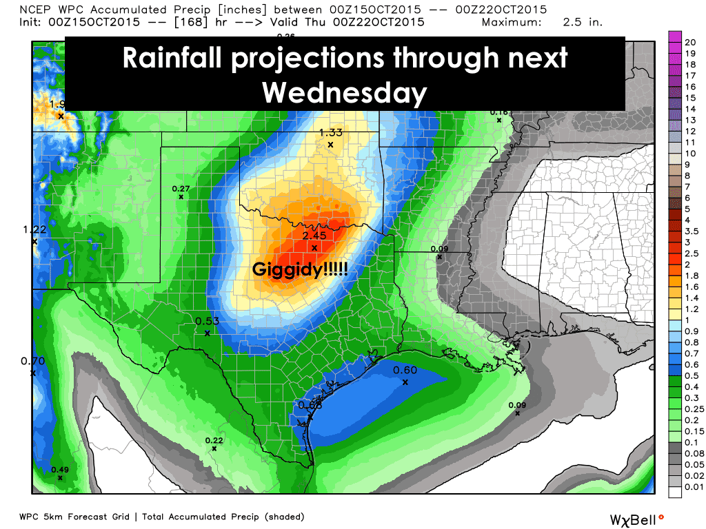
Rain Chances Next Week…this is probably the best thing you’ll see all day. The first thing you need to know is that this forecast only goes out one week. The next thing you need to know, is that most of what you see estimated here will fall Tuesday through Wednesday as an upper level disturbance approaches from the west. There’s also hints in the long range models that rain chances will continue across south Texas and up into central and north central/northeast Texas as we get closer to the following weekend along with a much stronger cold front possibly arriving that weekend. That’s way too far out to reliably forecast, but the overall consensus among the forecast models is for a pattern change swinging us into a much more rainy pattern a week from now. Hang in there!


0 Comments